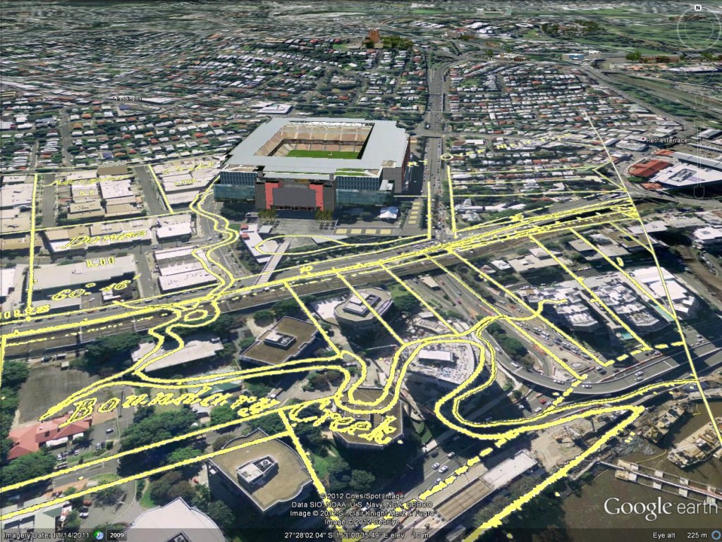
A few weeks back, I posted some images that I put together by combining old maps with recent aerial photographs. Since then, I’ve discovered how to import those same maps into Google Earth. This is really exciting, because it allows you to explore these maps in an interactive way. Instead of being stuck with an orthogonal ‘straight down’ view, you can move around and view things from any angle you choose. A gallery of examples is below. In these images are three different historical maps:
- ‘Plan of the limits of the town of Brisbane’ (1843). You can see the original in the Queensland Historical Atlas.
- ‘Plan of Portions 203 to 257 in the Environs of Brisbane, Parish of Enoggera, County of Stanley, New South Wales’ (1859). This is available at the Queensland State Archives (Item ID620656) and the State Library (Record 727379).
- ‘Plan of Brisbane Water Works’ (1864). This map shows the pipeline route between Enoggera Reservoir and Brisbane City, and is available from the Brisbane City Council Archives.

Boundary Creek as depicted on in 1864. In the foreground is the Coronation Drive Office Park, and behind it is Suncorp Stadium.
Continue reading
