Rainworth gallery
This gallery shows all pictures from the site that relate to what I have called the Rainworth section of Western Creek (from Stuartholme to Fernberg). Unless indicated otherwise, all photos are Copyright Angus Veitch.
-

- Aeiral image of the Rainworth section of Western Creek (Google Maps)

-

- Aerial view of the Western Creek headwaters (Google Maps)

-

- A stream in the Weedy Wonderland after rain in October 2011

-

- A clearing in the Weedy Wonderland, which appears to have been terraformed for recreational purposes

-

- A clearing in the Weedy Wonderland, which appears to have been terraformed for recreational purposes.

-

- A stream in the Stuartholme branch of the Weedy Wonderland after rain in October 2011

-

- A stream in the Weedy Wonderland after rain in October 2011

-

- The Stuartholme branch of the Weedy Wonderland, leading towards the Couldrey Street clearing (October 2011)

-

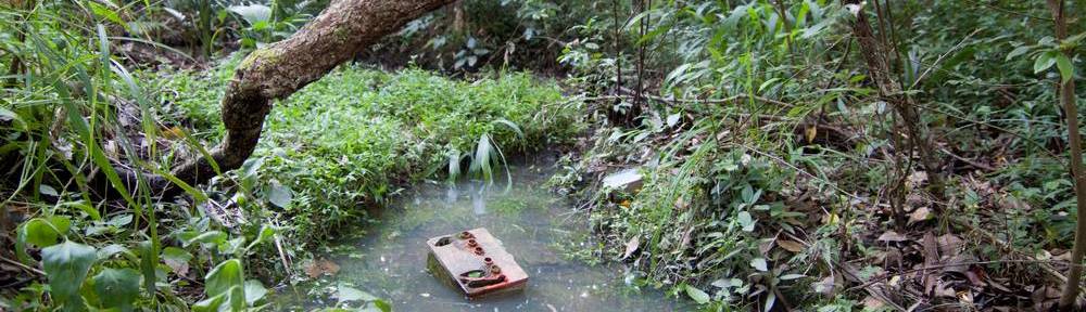
- A pond in the Weedy Wonderland just near the clearing at Couldrey Street, October 2011

-

- A channel in the Birdwood branch of the Weedy Wonderland (October 2011)

-

- A channel in the Birdwood branch of the Weedy Wonderland (October 2011)

-

- A pond in the Birdwood branch of the Weedy Wonderland, approaching Couldrey Street (October 2011)

-

- Aerial view of the creek from the Couldrey Street clearing to the Boundary Road roundabout

-

- A pond at the junction of the Weedy Wonderland and the Couldrey Street clearing (October 2011)

-

- The clearing at the bottom of Couldrey Street (October 2011). This site is often boggy, and ponds form when there is good rain.

-

- A temporary pond on the Couldrey Street clearing. When I visited here after rain in October 2011, Striped marsh frogs were breeding in this pond. I doubt they were successful though, as the pond soon dried up.

-

- The clearing at the bottom of Couldrey Street (October 2011). This site is often boggy, and ponds form when there is good rain.

-

- Aerial view of the creek across Norman Buchan Park and the bottom of the Fernberg property (from Google Maps).

-

- The pond by the culvert under Baroona Road at Norman Buchan Park

-

- Rehabilitated pond on the Fernberg grounds (Governor's House), October 2011

-

- The culvert under Tristania Drive (the 'Stuartholme branch' of the stream)

-

- The sewage pipe crossing through a clearing along the Stuartholme branch of the Weedy Wonderland

-

- View of from a footbridge over the channel in the Birdwood branch of the Weedy Wonderland

-

- Frogspawn in the temporary pond at the Couldrey Street clearing after rain in October 2011. The pond dried up fairly quickly after this, so the eggs or tadpoles would not have survived.

-

- The stream at the bottom of the blocks on Sixth Avenue, flowing towards Haining Street (October 2011)

-

- Rainworth Park, where you can still see the contours of the old stream bed

-

- The sportsfield of Rainworth State Primary School

-

- The footbridge alongside the playing field of Rainworth State School

-

- A drain pit in Norman Buchan Park.

-

- A drain pit in Norman Buchan Park

-

- The subcatchments bounded by Simpsons Road and Boundary Road

-

- Puddles and mud on Norman Buchan Park

-

- The bottom of the Fernberg grounds, where the shape of the ground reveals the path of the original stream.

Last modified: April 25, 2012
awesome, i have been retracing the old creek that ran through the city, this subject is interesting ..
I was brought up at 36 Rainworth Rd Rainworth, NE cnr of Barton St. which is opposite Norman Buchan Park. We spent many hours as kids playing in the creek around 1951-1966. There were many adventures including the tunnel that some kids (not me) dug into the wall of the creek. It went several metres into the bank and would have probably killed someone had it collapsed. You needed a candle to see your way to the back of it. Much later when the council started covering sections of it and put in manholes a friend, who lived on Boundary Rd. decided to open one of the manholes. The covers were very heavy and sure enough he dropped it on his big toe. One less toe after that. I am pretty sure a lot of kids had their first cigarette down there (maybe even me). My one of my friends older brother also introduced us to golf which he had taken up. We would hit balls to each other from one end of the park to the other. My younger brother and I used to time ourselves running right around the park, starting at our house then down Rainworth Rd, Baroona Rd, Boundary Rd and back along Rainworth Rd. Because I went to Rainworth State School the creek played a pretty important role in our after school life. A big holiday adventure would be to walk up the creek to Stuartholme Convent. We even managed to see some boarders (girls) on the verandah, very exciting. Your website has brought back some fond memories. Thank you very much. Regards, Roger Pearce
Thank you so much for sharing those stories, Roger! Some day I will get around to writing a page about Norman Buchan Park. I get the feeling that it has a rich history, even if not much of it has been written down. So many kids must have played in that drain!
Did you find the ‘Guppies and Geysers‘ page? It deals with some similar stories.
I’m curious to know how much of the drain would have been called a ‘creek’ back in the 1950s. In the 1946 aerial photograph (which you can see here) it looks like an open concrete (or very bare earth) drain across the length of the park. But your account suggests that it wasn’t all like this, at least not in the 1950s.
jki66r
8ete3i
ykfb4e
664xqf
un23nn
lulp29
7mnccd
272x8x
3yfvp5
7lsps7
ugdpic
1699vn
3ixwnd
wx5v31
5sepbm
orlzu1