
Plan of Portions 203 to 257 in the Environs of Brisbane, Parish of Enoggera (1859)
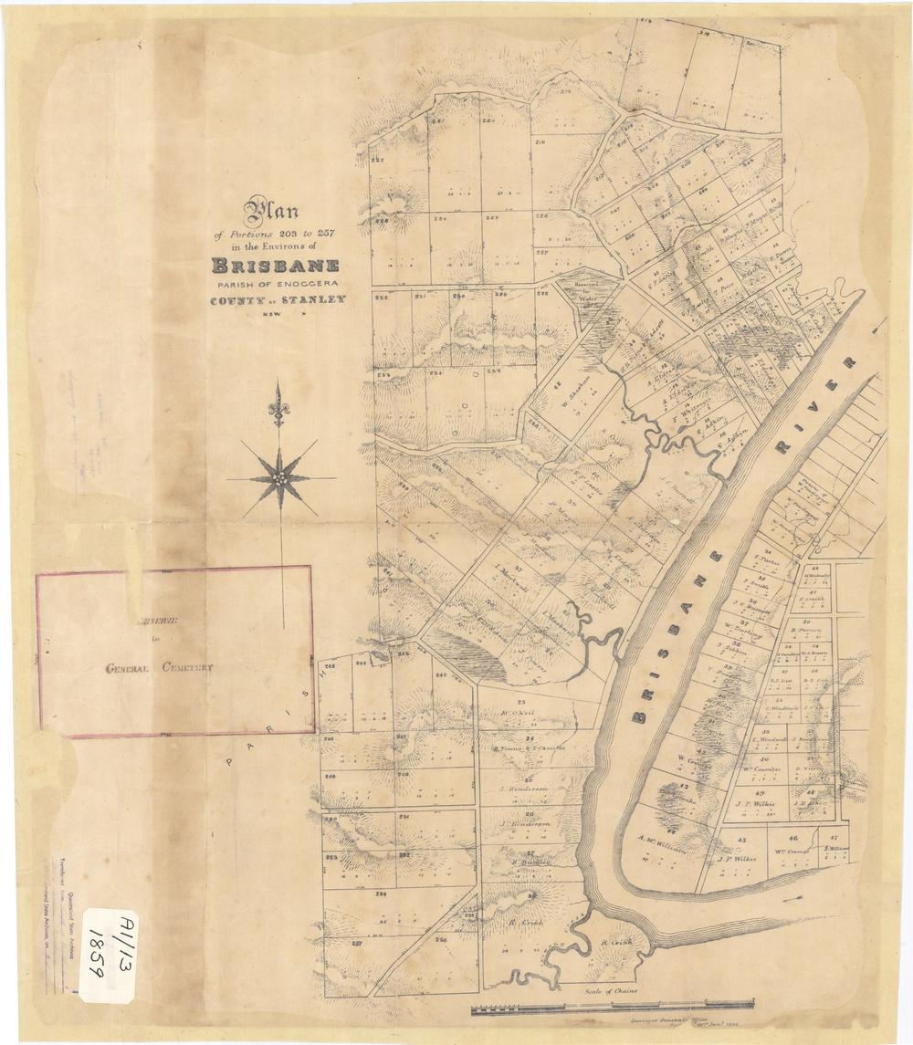
Plan of Portions 203 to 257 in the Environs of Brisbane, 1859. (Queensland State Archives Item ID620656)
This map from 1859 is held by the Queensland State Archives (Item ID620656) and the State Library (Record 727379). It features excellent depictions of Western Creek, Langsville Creek and Toowong Creek, as well as the lagoon between Cribb Street and Park Road. I have featured it in previous posts and articles including Milton – Brisbane’s western frontier and The lost creeks rise again.
Google Earth portal
You can explore a specially prepared version of this map in the Google Earth window below.
Google Earth data
You can explore this map in the standalone version of Google Earth by opening (or downloading and then opening) this file.
Last modified: April 13, 2013
Pingback: The broken lands of Toowong | There once was a creek . . .
Pingback: Map Mania! | There once was a creek . . .
8w4n1m
q5bi2j
8uksoj
nc0uvz
k2luzf
52vmp5