The Rainworth section of Western Creek

Aeiral image of the Rainworth section of Western Creek (Google Maps)
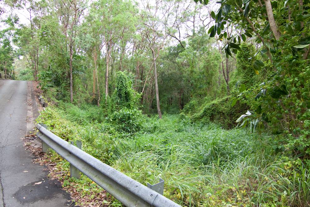
The Rainworth section of Western Creek incorporates the creek’s headwaters, and includes the only remaining natural channels in the catchment (though these are far from pristine). It passes through Rainworth School, Norman Buchan Park, and the bottom of the Governor’s House property (‘Fernberg’). The ridge of Boundary Road divides the area into two major subcatchments – one bounded by Birdwood Terrace and Stewartholme Road, and the other by Simspons Road and Macgregor Terrace.
The headwaters

Aerial view of the Western Creek headwaters (Google Maps)
Like most streams, Western Creek ends at one point but begins at many. It may not be possible to pinpoint ‘the start’ of the creek; the best we can do is to identify the various tributaries that converge into the main stream. The headwaters of Western Creek begin in the slopes rising up to Birdwood Terrace and Stuartholme Road — the area in and around the Tristania Drive housing estate. There are two main branches, one rising up to Birdwood Terrace, and the other to Stuartholme Road. These two branches are roughly equal in terms of the size of the area that they drain. Both have intact natural channels, and both flow through a small reserve of bush — an area that I call the Weedy Wonderland.
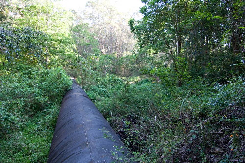
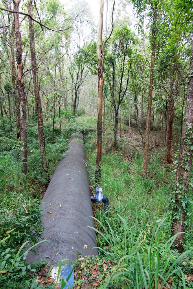
I don’t yet know the history of this reserve, or of the estate that surrounds it (this is something I plan to explore on another page). The only treasure that it seems to be protecting is the large sewage main running from Taringa to Enoggera. Certainly, the reserve itself is far from a treasure of biodiversity: in most parts it is a thicket of Chinese Elms, Ochna, Singapore Daisy and other environmental weeds. Still, if you visit after good rain and filter out the fact that much of the vegetation is exotic and invasive, you can imagine yourself in a little urban rainforest oasis.

A stream in the Weedy Wonderland after rain in October 2011
The Stuartholme branch

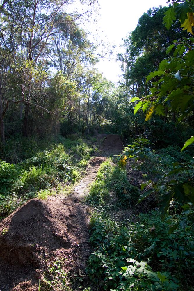
A clearing in the Weedy Wonderland, which appears to have been terraformed for recreational purposes.
The picture above shows a stream in the Stuartholme branch after a brief wet period in October 2011. The Stuartholme branch is generally narrower than the Birdwood Terrace branch, and drains more slowly, hence you are more likely to see it flowing if you are visiting after rain has ceased. It becomes clearly discernible as a stream just above Tristania Drive, though it is difficult to access here except via the houses that back onto it.
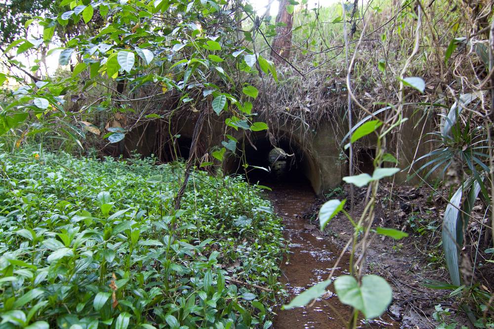
The stream then passes under Tristania Drive through a culvert drain and emerges into a small clearing carpeted in Singapore Daisy. After passing through a small grove including palms and tree ferns, the stream then reaches a larger clearing that is crossed by the large sewage pipe. This area appears to have been ‘terraformed’ recently into what looks like a BMX track.
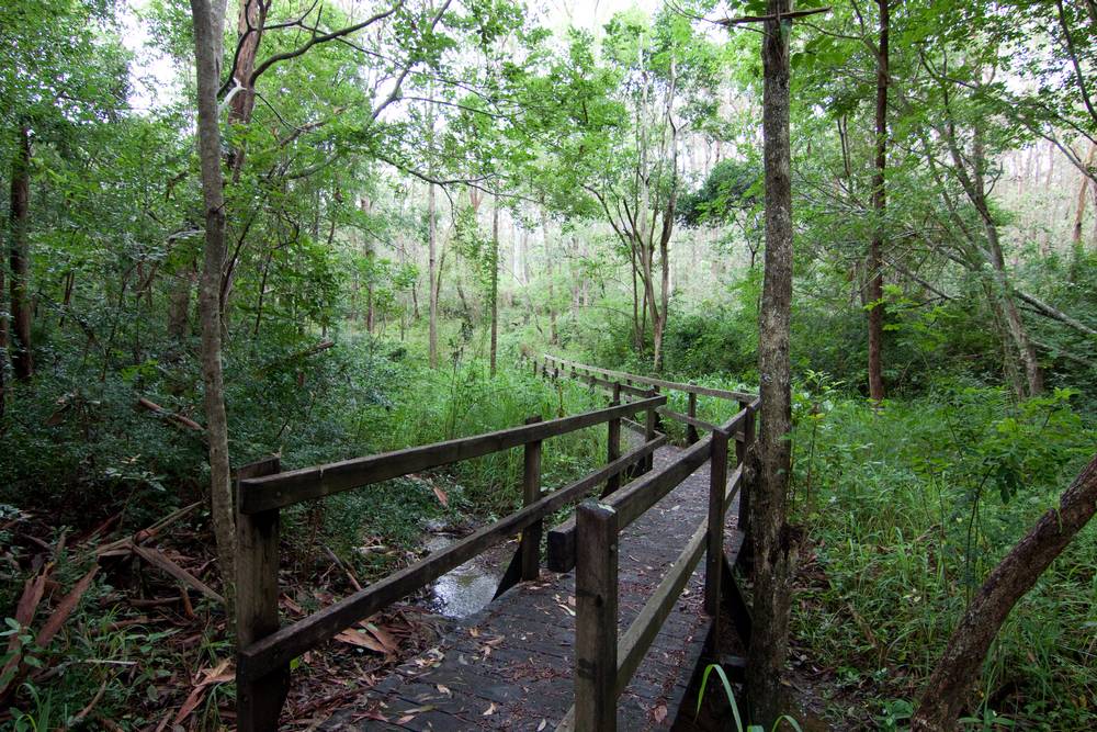
If you fight your way through some more vegetation you’ll come across a small footbridge which forms part of a walking track through the reserve. The vegetation then takes on something of a rainforest character. The channel of the creek here is narrow and straight, and quite picturesque when it is flowing. After only a short distance the stream reaches the clearing at the bottom of Couldrey Street, where it joins the Birdwood Terrace branch.

A stream in the Stuartholme branch of the Weedy Wonderland after rain in October 2011

A stream in the Weedy Wonderland after rain in October 2011

The Stuartholme branch of the Weedy Wonderland, leading towards the Couldrey Street clearing (October 2011)
The Birdwood branch
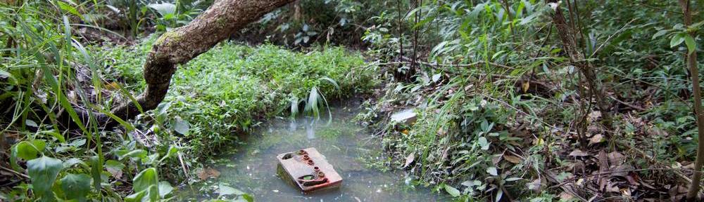
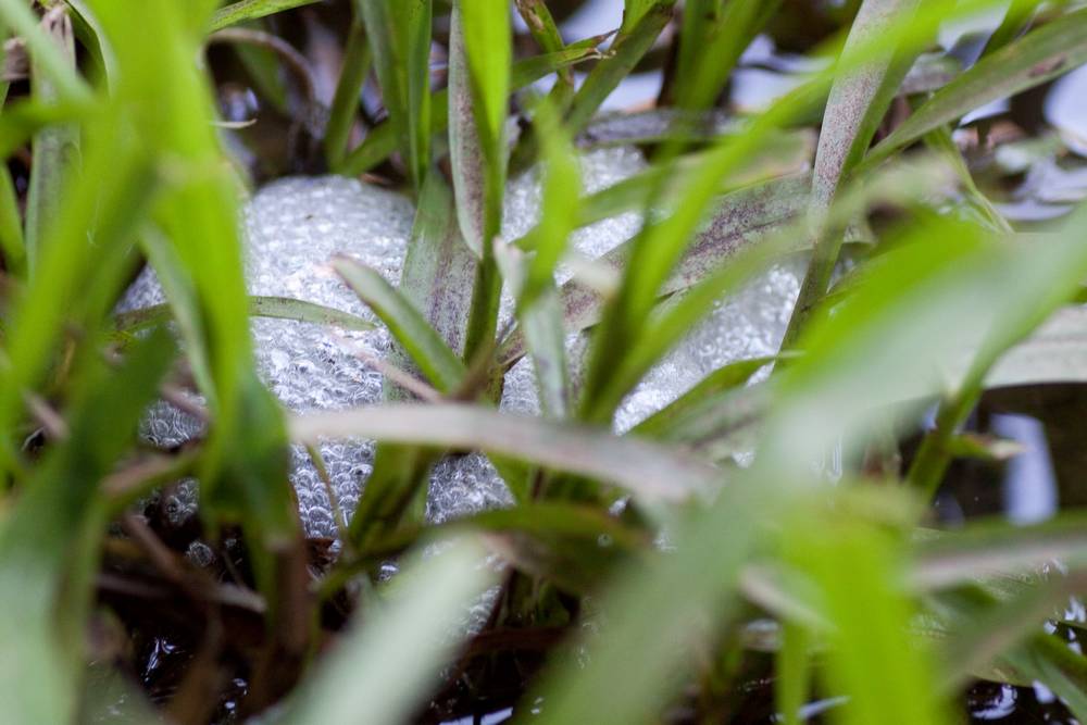
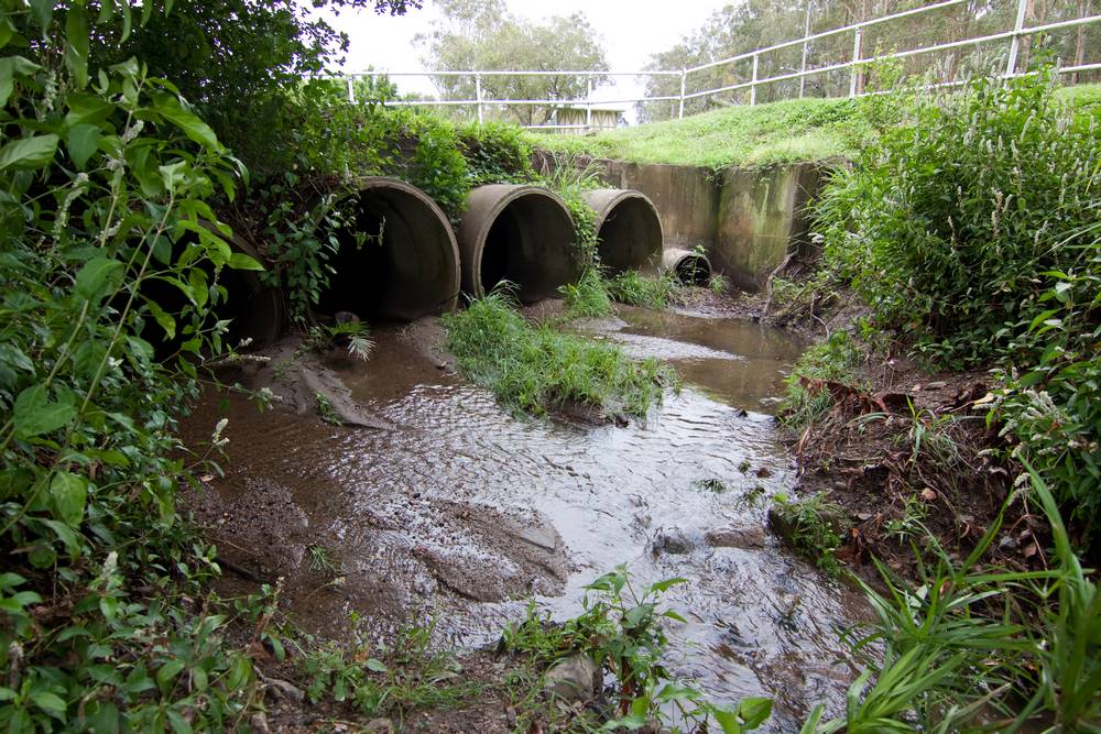
The branch flowing from Birdwood Terrace begins with two identifiable tributaries above Tristania Drive, the more prominent one being marked on the map shown earlier. The tributaries converge at the sewage pipe just before Tristania Drive. The gully here is quite large, as is the culvert under the road, and the water drains away fairly quickly so you have to be quick to see it flowing. The same goes for much of the rest of this channel: it is for the most part wider (and steeper?) than the Stuartholme branch, but drains roughly the same amount of water, so it flows for a shorter period of time. Like the Stuartholme branch, the vegetation along the Birdwood branch is dominated by weed species. The gully on the other side of Tristania Drive, for example, seems to be carpeted entirely with weeds (though I don’t know what they are). Some longer lasting ponds appear as the land flattens out near the junction at the Couldrey Street clearing. These ponds are quite pleasant, but as the picture at the top of this page shows, you wouldn’t want to be drinking from them.

View of from a footbridge over the channel in the Birdwood branch of the Weedy Wonderland

A channel in the Birdwood branch of the Weedy Wonderland (October 2011)

A channel in the Birdwood branch of the Weedy Wonderland (October 2011)
Couldrey Street to the Roundabout

Aerial view of the creek from the Couldrey Street clearing to the Boundary Road roundabout
The two branches of the Western Creek headwaters meet at a grassy clearing at the bottom of Couldrey Street. The grass here is kept mowed, presumably by the Council. This patch of grass is often boggy, and ponds up after rain. When I visited in October 2011, there were striped marsh frogs and frogspawn in the pond. Unfortunately there was no follow-up rain, so the pond would have dried up not long after the eggs hatched, if not before. Once upon a time, this might have been something of a haven for frogs. As it turns out, there was a large waterhole here until the adjacent land was developed in the late 1970s.

A pond at the junction of the Weedy Wonderland and the Couldrey Street clearing (October 2011)

The clearing at the bottom of Couldrey Street (October 2011). This site is often boggy, and ponds form when there is good rain.

A temporary pond on the Couldrey Street clearing. When I visited here after rain in October 2011, Striped marsh frogs were breeding in this pond. I doubt they were successful though, as the pond soon dried up.

The stream at the bottom of the blocks on Sixth Avenue, flowing towards Haining Street (October 2011)
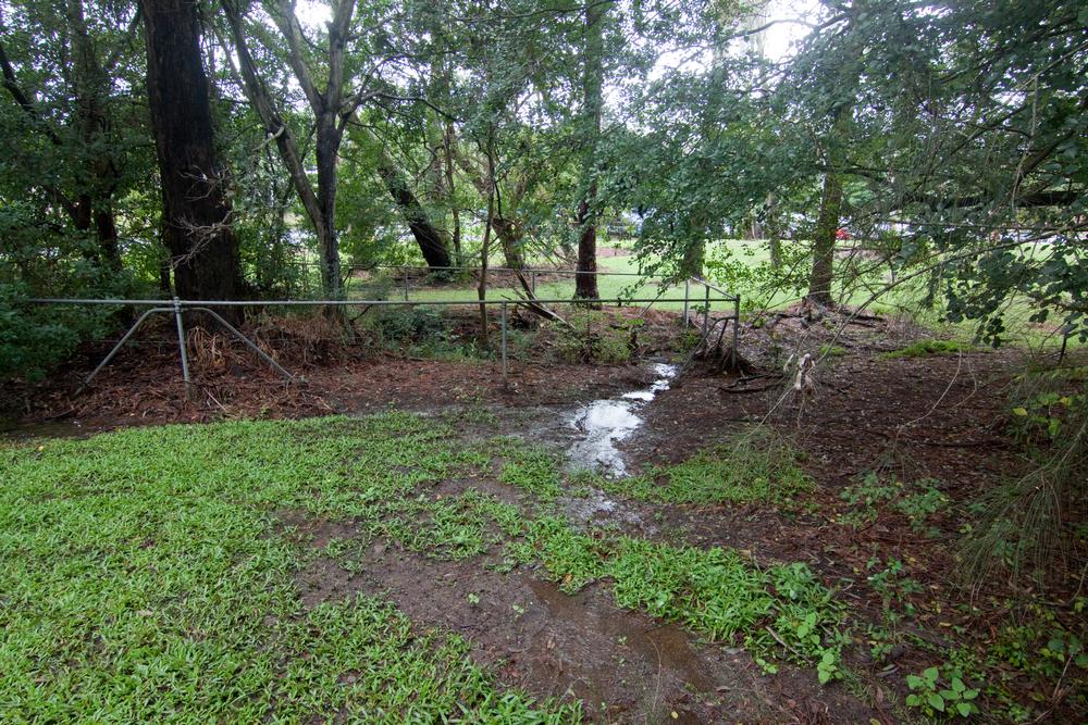
At the bottom end of the clearing, there is a short stretch of rocks and lomandras, a sure sign that someone has attempted to restore a streambed (I’d love to know who!). This stretch continues behind the houses at the bottom of Couldrey Street, but I’m not sure what becomes of the stream here until it emerges at the bottom of a steep gully behind the houses on Sixth Avenue (right). This is the last time the creek sees the light of day in anything approaching a natural channel. A surprising amount of water can collect here, and seems to remain for some weeks after rain.

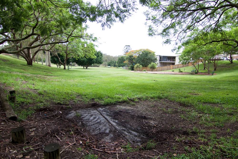
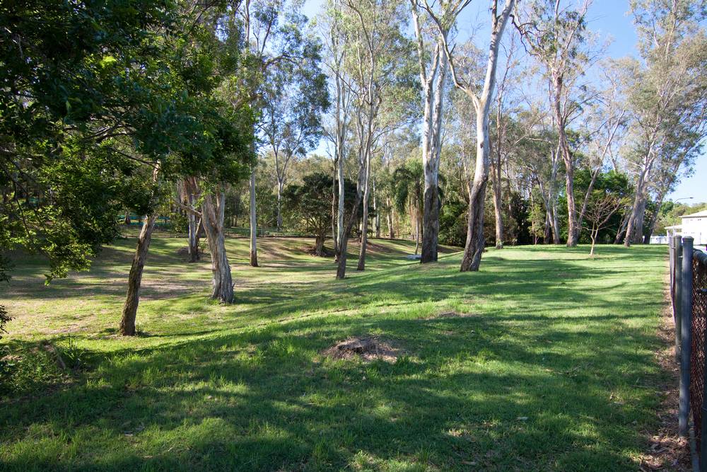
Rainworth Park, where you can still see the contours of the old stream bed.
From here on in, the creek has been filled in and pushed into underground drains. In Rainworth Park you can still make out the contours of its banks. But for the remainder of its length until it re-emerges as Milton Drain, there are few such reminders left of the creek’s existence.
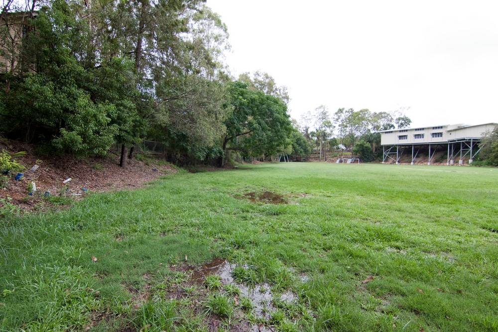
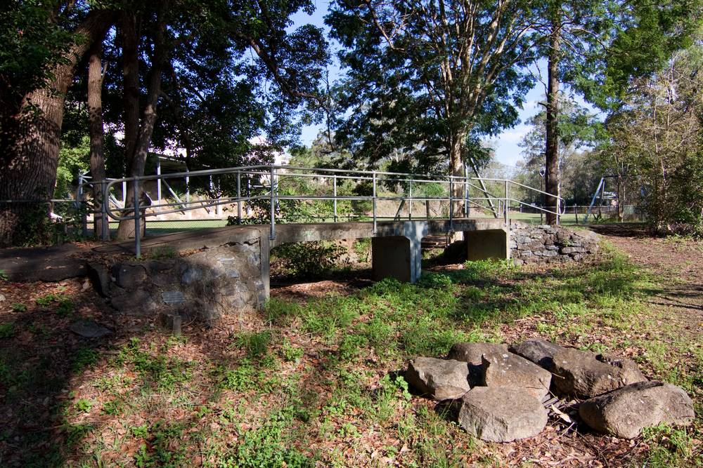
After snaking through the park, the creek would have passed through the bottom of the Magdalene Court retirement village and then into what is now the playing field of Rainworth State School. Along the fence of the field, there is a walkway that includes a small bridge. It is hard to see the purpose of this bridge, unless we imagine that a stream or channel once passed underneath it. From here the creek worked its way through the playing field towards the tennis courts at the end of Runic Street, and continued through the backyards all the way down Runic Street to the site of the old petrol station, currently a discount plant nursery.
Norman Buchan Park

Aerial view of the creek across Norman Buchan Park and the bottom of the Fernberg property (from Google Maps).
From the petrol station, the creek must have gone through what is now the roundabout at the bottom of Boundary Road, as the next part of its course was clearly Norman Buchan Park. Partly concealed at the bottom of the embankment from the roundabout is a concrete drain cover. When I visited there after rain in December 2011, I could hear the water rushing beneath me. From here we can only guess at the exact route the creek took through the park, especially since a large part of the park has been leveled to provide a playing field. At the other end of the park some signs of the creek reappear in the form of two open pits and a smattering of drain covers. Here the ground becomes noticeably depressed and boggy, particularly as you approach the pond.

Pond at Norman Buchan park by the culvert under Baroona Road
In the first of the open drain pits you can see a barrage of four large concrete pipes, plus one smaller pipe. Interestingly, these are succeeded by only a single small pipe. The second pit (see left) is a pond just before the culvert under Baroona Road. There is usually water in this pond, and on good days, you may even find a few ducks. Generally though, you’ll be lucky to find anything more than a softdrink bottle nesting amongst the Singapore daisy. On the other side of the bridge, things are a little different.
Fernberg
The pond in Norman Buchan Park continues under Baroona Road and into the grounds of Fernberg, the Governor’s House property. On this side, the pond is much more appealing, thanks to some rehabilitation work.1 There are lomandras in place of the Singapore daisy, and several tall trees including eucalypts and melalucas shelter this pond from the constant baking sun. Beyond the pond, the creek again disappears underground. Like in Rainworth Park, however, the ghost of the original stream can still be seen in the contours of the Fernberg grounds. The stream surfaces again briefly for one last breath before flowing back into the drain under Murruba Street.

Rehabilitated pond on the Fernberg grounds (Governor’s House), October 2011
Tributaries

The subcatchment bounded by Simpsons Road and Boundary Road
The above account of Western Creek’s path through Rainworth ignored a large part of this section of the catchment. The area in question is that bounded by Boundary Road, Simpsons Road and Macgregor Terrace. At least two tributaries to the main stream can be identified in this area. The first would have begun around the Bardon Scout Den on Bee Street and continued more or less along Gerler Street before cutting across Selby and Brown streets to meet the main stream near the roundabout.
The second tributary would have started among the steep slopes around Greer and Shaw streets and continued roughly along Warburton Street towards the main stream in Norman Buchan Park. Its entrance to the park would have been via what is now the walkway under Boundary Road, and then along a depression that is still etched into the edge of the park.
Continue to the Rosalie section
Notes:
- This work was done in 2007 by members of Enoggera Creek catchment group, Save Our Waterways Now Inc. and the neighbouring catchment group Cubberla-Witton Catchment Network, working with the Government House gardening staff. Thanks to Anne Jones for this information! ↩
Last modified: August 30, 2018