The course of Western Creek
Time for the tour!
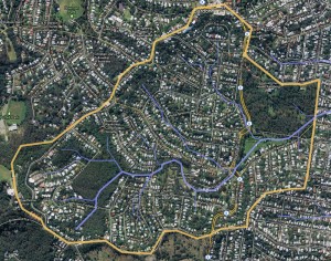
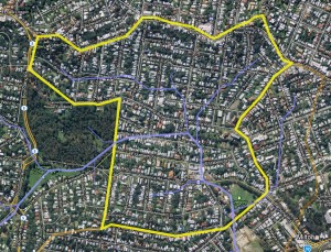
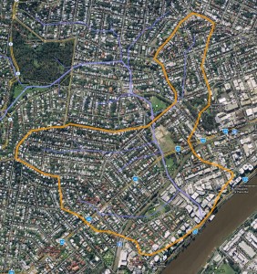
If you’ve read the pages about the creek and its catchment, you would have already seen the map below showing the approximate course of the Western Creek and some of its tributaries. It is now time to examines the course of Western Creek in more detail, using existing landmarks as reference points. What follows is akin to a guided local heritage walk, except the object of interest can no longer be seen, and must instead be imagined.
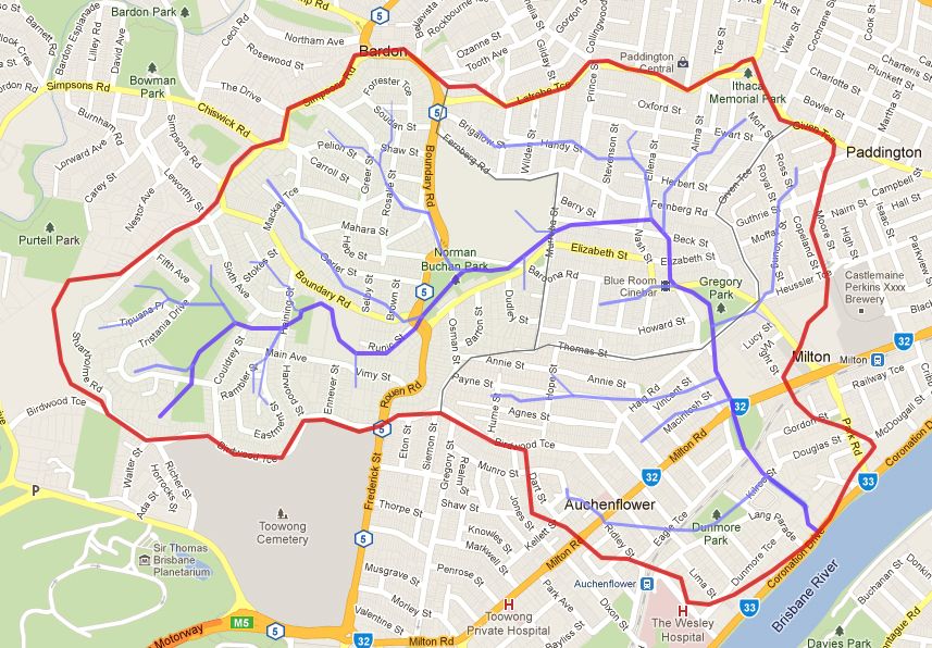
The catchment boundary and streams of Western Creek. The stream paths are approximations only. (Google Maps)
Keep in mind that for the most part we can only guess at the exact path of the creek. Not only has it been pushed underground, but also the surrounding land has reshaped, leaving few clues about the finer nuances of the creek’s course. But these changes are only at the local scale. The general contours of the landscape remain the same, and it is from these that we can deduce the approximate path of the creek.
The flyover
Before we put on our walking shoes, let’s see Western Creek from the air. If you have Google Earth installed, or can spare a few moments to install it (it’s free after all), then you can enjoy a live-action, birds-eye tour of Western Creek. The necessary files and instructions can be found on the data page (it’s easy, trust me!). If you don’t have access to Google Earth, you can still download the data and explore it using Google Maps, but it’s not as much fun.
Flyover commentary
The following commentary talks through some of the highlights of the flyover. If you’re not watching it on Google Earth, you’ll have to use your imagination.
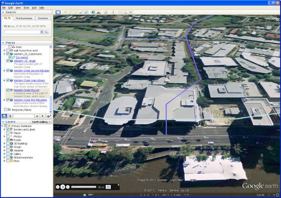
We start at the bottom of the catchment, where where the creek meets the river. The mouth of the creek is more or less concealed by the bike track, Coronation Drive and what is left of the floating restaurant. The large office block in the centre of the screen is the John Oxley Centre, so named because it sits on top of the very inlet that enticed John Oxley in 1824 to come ashore and proclaim the site as “by no means an ineligible station for a first settlement up the river”.1 Behind the John Oxley Centre we can see an open section of the Milton Drain, tucked away behind more offices and commercial buildings. At about 0:18 we see the drain disappear beneath Kilroe and Camford Streets. It then reappears just past the railway line at Milton Park, before disappearing again under Milton Road and the old Tennis Centre site.
At about 0:33 we reach Gregory Park, once known as Red Jacket Swamp. We then fly over Milton School, across Baroona Road and over the Blue Room Cinema and the Rosalie Mews carpark (0:40). This area was also once swampy land. After crossing Elizabeth Street we turn to the west and follow a path approximately in line with Beck Street.
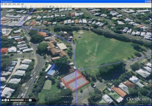
At 0:58 we pass through the bottom of the Governor’s House property, and then through Norman Buchan Park, where if you look closely you can see some openings to the drain. We then pass over the roundabout (1:14), the old the petrol station (currently a nursery) and the houses along Runic Street. The next landmark is the playing field of Rainworth School (1:23), after which we take a tight turn around the back of the Magdalene Court retirement village and through Rainworth Park. The creek then re-emerges as an open channel behind the houses on Sixth Avenue (1:42) and then as a boggy patch of grass at the bottom of Couldrey Street.
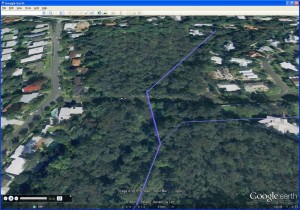
We then reach what I call the Weedy Wonderland, a small reserve of bush near the Stuartholme housing estate in which you can find the sewage main leading from Taringa to Enoggera. This is where you can also see the creek in something approaching its natural form, though the chances are it will be dry unless there has been recent rain. As we fly over the trees you can just about make out a depression in the canopy along the route of the stream. There is a final road crossing at Tristania Drive (1:52) before we move up the hill towards the edge of the catchment at Birdwood Terrace.
The tour by foot
The detailed tour of the creek is broken up into three sections, just to keep things tidy. Click on the headings below to go to the relevant page. Note that unlike the flyover, this tour starts at the top of the catchment and works downhill towards the river.
Rainworth
The Rainworth section of the creek begins in the headwaters up around Stuartholme and flows along the southern side of Boundary Road, passing through the Rainworth School sportsfield, Norman Buchan Park and the bottom of the Government House (‘Fernberg’) property. It also includes the tributaries on the northern side of Boundary Road which converge with the main stream at Norman Buchan Park.
Rosalie
The stream in this section starts at Murruba Street and continues more or less along Beck Street, before heading across Elizabeth Street towards the Blue Room Cinema on Baroona Road. It then flows across Gregory Park in front of Milton School. Probably the main tributary in this section is the one that starts in the valley between Fernberg Road and Latrobe Terrace and meets the main stream near the junction of Ellena and Nash Streets.
Milton
The Milton section of the stream starts near the roundabout on Haig Road and traverses the site of the old Milton Tennis Centre (Frew Park) before it crosses Milton Road and finally sees the light of day in the form of Milton Drain. The drain is covered again briefly past the railway line, but re-emerges at Kilroe Street and remains open until it flows under the John Oxley Centre and Coronation Drive, where it finally meets the river.
Notes:
- Oxley’s 1824 journal can be viewed on the New South Wales State Library website. Oxley’s landing at Western Creek is discussed in John Pearn’s Auchenflower: The suburb and the name (1997) and Matthew Condon’s Brisbane (2010) (listed on the references page). See also J.G. Steele (1972), The Explorers of the Moreton Bay District 1770-1830, University of Queensland Press. ↩
Last modified: August 30, 2018

