A site map for oncewasacreek.org

Much of the content of this site resides within the posts of the Newsroom rather than in the page structure defined by the menu above. This is largely because I have ended up writing about a wider range of topics and locations than I originally set out to do.

The map below provides an easy way to find pages about a given location. Just click on any marker to see a list of relevant pages. To get a closer look at a particular area, you can zoom and pan just as you would on Google Maps. All of the marked locations and relevant pages are also listed beneath the map.

KML-LogoFullscreen-LogoQR-code-logoGeoJSON-LogoGeoRSS-LogoWikitude-Logo
Places explored in oncewasacreek.org

loading map - please wait...

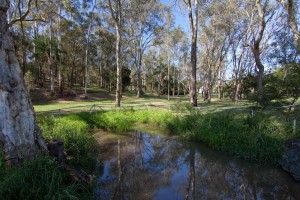
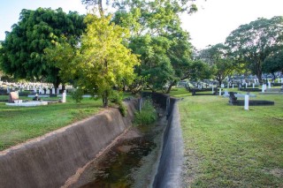
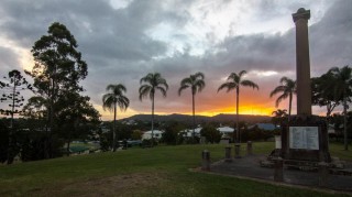
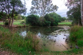
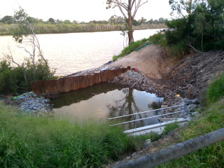
Gregory Park (Red Jacket Swamp): -27.466889, 152.999790
Coronation Drive Office Park: -27.468945, 153.009210
Toowong Creek: -27.492322, 152.991271
Miskin Street: -27.487468, 152.983160
XXXX Brewery: -27.467726, 153.005412
The Milton Drain: -27.471667, 153.000669
Suncorp Stadium: -27.464642, 153.009639
E.E. McCormick Place: -27.466470, 153.015282
The Governer\'s Pond: -27.465413, 152.991850
Fernberg (Government House): -27.463785, 152.990842
Norman Buchan Park: -27.465822, 152.990069
Mouth of Western Creek: -27.474789, 153.003609
North Quay: -27.467631, 153.017610
The Couldrey Street Clearing: -27.467517, 152.980757
The Weedy Wonderland: -27.467841, 152.979255
Moorlands Park: -27.479768, 152.997547
Toowong Cemetery: -27.474828, 152.982516
Mount Coot-tha Botanic Gardens: -27.476008, 152.976422
Treetops on Birdwood: -27.470944, 152.972367
Bushland near Walter Street: -27.472990, 152.975414
Toowong Memorial Park: -27.479910, 152.994618
Anzac Park: -27.479682, 152.981164
Walsh Street and surrounds (the Milton Estate): -27.470125, 153.006721
Dunmore Terrance and surrounds (the Dunmore Estate): -27.476579, 152.999961
Milton Village Commercial Centre: -27.473542, 153.001420
Herbert Street: -27.462281, 152.996314
Oogarding (100 Simpsons Road): -27.462036, 152.981874
Rosalie Village: -27.466279, 152.997172
Leybourne Street: -27.519081, 152.987173
Caladenia Street (Indooroopilly): -27.494130, 152.960072
Cubberla Creek tributary (Chapel Hill): -27.483527, 152.947948
 Fullscreen-Logo
Gregory Park (Red Jacket Swamp)
Gregrory Park starts to fill (January 11, 2011)
Gregory Park features in:
From Red Jacket Swamp to Rosalie's Playground
John Oxley and the Chain of Ponds
The swamp runneth over
The waters of Milton
January 2013 flood (gallery)
January 2011 flood (gallery)
Then and now: A birds-eye view
 Fullscreen-Logo
Coronation Drive Office Park
The Coronation Drive Office Park features in:
The history of the Coronation Drive Office Park.
The lost creeks rise again
 Fullscreen-Logo
Toowong Creek
Toowong Creek near low tide, at the downstream end of Perrin Park
Toowong Creek features in:
Toowong Creek: the sole survivor of the Crescent Reach
Time and tides
The catchments of the Crescent Reach
The broken lands of Toowong
 Fullscreen-Logo
Miskin Street
Miskin Street features in:
The broken lands of Toowong
 Fullscreen-Logo
XXXX Brewery


The XXXX Brewery features in:
Bottles and Cans: an adventure in suburban archaeology
The history of the Coronation Drive Office Park
 Fullscreen-Logo
The Milton Drain
The Milton Drain
milton-drain-01
The Milton Drain features in:
Milton Drain’s tidal limits
When waters collide
The moon, the drain and the diving bats
A floodgate for Western Creek
Backflow to the future
January 2013 flood (gallery)
January 2011 flood (gallery)
Then and now: A birds-eye view
The Western Creek floodgate: a reality after 125 years
 Fullscreen-Logo
Suncorp Stadium
Suncorp Stadium features in:
The waters of Milton
The history of the Coronation Drive Office Park
The lost creeks rise again
 Fullscreen-Logo
E.E. McCormick Place
E.E. McCormick Place features in:
Milton: Brisbane’s western frontier
Bottles and Cans: an adventure in suburban archaeology
 Fullscreen-Logo
The Governer's Pond

The Governer's Pond features in:
Let’s talk about the weather
The bird on the fence by the pond
Fernberg from the inside
The pond is not the spring
John Oxley and the chain of ponds
 Fullscreen-Logo
Fernberg (Government House)

Fernberg features in:
Fernberg from the inside
Guppies and geysers: memories of Rosalie's drains in the 1970s
 Fullscreen-Logo
Norman Buchan Park
The pond by the culvert under Baroona Road at Norman Buchan Park
Norman Buchan Park features in:
Guppies & Geysers: Rosalie’s drains in the 1970s
Let’s talk about the weather
Rainworth
Then and now: A birds-eye view
 Fullscreen-Logo
Mouth of Western Creek
The mouth of Western Creek viewed from the boardwalk under Coronation Drive
The mouth of Western Creek features in:
A floodgate for Western Creek
Western Creek on display
Backflow to the Future
John Oxley Centre renovations
John Oxley Centre fail
John Oxley and the chain of ponds
Guppies and geysers: memories of Rosalie's drains in the 1970s
January 2013 flood (gallery)
Then and now: A birds-eye view
 Fullscreen-Logo
North Quay

North Quay features in:
John Oxley and the chain of ponds
Milton: Brisbane's western frontier
Bottles and cans: and adventure in suburban archaeology
 Fullscreen-Logo
The Couldrey Street Clearing
The clearing at the bottom of Couldrey Street
The Couldrey Street Clearing features in:
Nuns, Kids and Cows: The story of the Couldrey Street Clearing
The Rainworth section of Western Creek
When it really rains
 Fullscreen-Logo
The Weedy Wonderland
wonderland_29
The Weedy Wonderland features in:
The Rainworth section of Western Creek
When it really rains
Nuns, Kids and Cows: the story of the Couldrey Street Clearing
Then and now: A birds-eye view
 Fullscreen-Logo
Moorlands Park
What's left of Langsville Creek - the drain at Moorlands Park, Auchenflower.
Moorlands Park features in:
Uncovering Langsville Creek — Part 1
Milton: Brisbane’s western frontier
The lost creeks rise again
 Fullscreen-Logo
Toowong Cemetery
toowong-cemetery-01
Toowong Cemetery features in:
The broken lands of Toowong
Uncovering Langsville Creek, Part 2
Exploring McKellar’s map in Google Earth
Uncovering Langsville Creek, Part 4
Up hill and down dale: where did Elizabeth drown?
 Fullscreen-Logo
Mount Coot-tha Botanic Gardens
The upstream part of the main lagoon at the Mount Coot-tha Gardens.
The Mount Coot-tha Botanic Gardens feature in:
Uncovering Langsville Creek, Part 3
The broken lands of Toowong
 Fullscreen-Logo
Treetops on Birdwood

The 'Treetops on Birdwood' feature in :
Uncovering Langsville Creek, Part 2
Uncovering Langsville Creek, Part 3
 Fullscreen-Logo
Bushland near Walter Street

The bushland near Walter Street features in:
Bottles and cans: an adventure in suburban archaeology
Uncovering Langsville Creek, Part 3
 Fullscreen-Logo
Toowong Memorial Park

Toowong Memorial Park features in:
Uncovering Langsville Creek, Part 1
 Fullscreen-Logo
Anzac Park

Anzac Park features in:
The broken lands of Toowong
 Fullscreen-Logo
Walsh Street and surrounds (the Milton Estate)
Walsh Street and surrounds (the Milton Estate feature in:)
The legend of the lost lagoon
The waters of Milton
Milton: Brisbane's western frontier
The history of the Coronation Drive Office Park
 Fullscreen-Logo
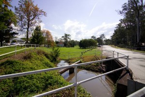
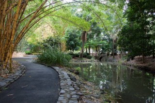
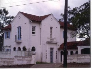
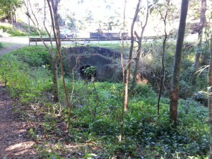
Dunmore Terrance and surrounds (the Dunmore Estate)
Dunmore Terrance and surrounds (the Dunmore Estate) feature in:
Milton: Brisbane's western frontier
 Fullscreen-Logo
Milton Village Commercial Centre
Milton Village Commercial Centre features in:
Bottles and cans: and adventure in suburban archaeology
The waters of Milton
 Fullscreen-Logo
Herbert Street
Herbert Street features in:
Guppies and geysers: memories of Rosalie's drains in the 1970s
 Fullscreen-Logo
Oogarding (100 Simpsons Road)

Oogarding features in:
Bottles and cans: an adventure in suburban archaeology
 Fullscreen-Logo
Rosalie Village
Rosalie Village during the January 2011 flood
Rosalie Village features in:
The Rosalie section of Western Creek
Then and now: A birds-eye view
 Fullscreen-Logo
Leybourne Street
A temporary dam at the outlet of the Leybourne Street drainage system, where the duckbill valves will be installed.
Leybourne Street features in:
The Duckbill Dimension
 Fullscreen-Logo
Caladenia Street (Indooroopilly)
Where the bush becomes suburbia and the creek becomes a drain at Caladenia Street, Indooroopilly.
Caladenia Street features in:
The Mystery of the Cubberla Creek Campsite
 Fullscreen-Logo
Cubberla Creek tributary (Chapel Hill)
A pond in the Cubberla Creek tributary
This tributary of Cubberla Creek features in:
The Mystery of the Cubberla Creek Campsite
Return to Cubberla Creek

Last modified: May 3, 2014

2 thoughts on “Site map

  1. I have checked your website and i’ve found some duplicate content, that’s
    why you don’t rank high in google, but there is a tool that can help you to create 100% unique articles,
    search for; Boorfe’s tips unlimited content

Leave a Reply

Your email address will not be published. Required fields are marked *