The lost creeks rise again

The extent of the 2011 flood in Western Creek (DERM / Google Maps)
There’s nothing like a flood to make you realise where the high and low points of the landscape really are. If someone had asked me, before the floodwaters rose in January 2011, to guess which parts of which streets in Milton, Rosalie and Auchenflower would go under, I would have been doing just that — guessing. When the water did rise, I was struck by how deep it was in some streets (Torwood Street sticks out in my mind), while other streets just nearby were high and dry. This got me thinking about where water belonged in this landscape, and led to the realisation that there once was a creek (or two!) flowing through these suburbs.
Now that I know where the creek ran, the shape of the floodline makes perfect sense. Though the creek has long been buried or otherwise transformed, its old course still marks out the lowest parts of the suburbs. And of course the same goes for other flooded areas as well. Each area of major flooding along the Milton Reach corresponds with the location of a long-buried creek.

The 2011 floodline along the Milton Reach (Brisbane City Council interim flood level maps)

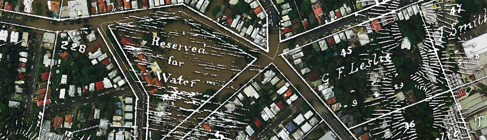
The Milton Reach of the Bisbane River, depicted on a map produced by the Queensland Surveyor General’s Office in 1884
The office blocks between Hale Street and Cribb Street, for example, are built right on top of the old Boundary Creek, which continued inland along Castlemaine Street next to Suncorp Stadium, and then into Neal Macrossan Park on the other side of Caxton Street. In Auchenflower, the flooding around Moorlands Park, Toowong Memorial Park and McIlwraith Park occurred along what used to be Langsville Creek.
You can see the alignment of floodlines and old creeks by looking at the two side by side (see right), but the pictures below bring the past and present together a little more closely. These pictures combine details from maps dating from about 150 years ago with areal photographs from the January 2011 flood. The maps have been digitised (one by the Brisbane City Archives, the other by the Queensland State Archives), Photoshopped (to transform them into inverted monochrome images) and geo-referenced in ArcGIS, a powerful mapping program. The aerial photos are freely available from the Queensland Government Information Service.
Boundary Creek
Once the natural western boundary of Brisbane Town, this creek flowed through what is now the Coronation Drive Office Park and then alongside what is now Suncorp Stadium (and which was once Brisbane’s general cemetery). The depiction of the creek below is from a map from 1864 that shows the proposed route of the water mains from Enoggera Creek Reservoir to the Town of Brisbane. The map and the wonderfully detailed digital reproduction from which this is derived are held by the Brisbane City Archives.

Boundary Creek as depicted in 1864 overlaid on the flood of January 2011. (The map is titled “Plan of Brisbane Water Works” and is held by the Brisbane City Archives; the photograph is from the Department of Natural Resources & Mines)
The Railway Terrace Lagoon
I have no idea what this lagoon was really called, or if it ever had a name, but it was mentioned in an account of the area from 1872, which described “a fine lagoon” running across the property, where “frequently black swans and an odd pelican or two” could be seen.1 Located between Park Road and Cribb Street, the lagoon is shaded roughly in the image below, and aligns almost exactly with the extent of the floodwater. The map showing this lagoon dates from 1859, and is titled ‘Plan of Portions 203 to 257 in the Environs of Brisbane, Parish of Enoggera, County of Stanley, New South Wales’. You can see it at the Queensland State Archives (Item ID620656) and at the State Library (Record 727379).

A lagoon, as depicted on a map from 1859 ( Queensland State Archives, Item ID620656), overlaid on a photograph of the January 2011 flood (Department of Natural Resources and Mines)
Western Creek
Western Creek was the longest of the creeks along the Milton Reach (not including Toowong Creek), and is where the floodwaters reached farthest inland from the river. Looking at the image below, it is no surprise that the offices and commercial blocks between the river and the railway went under: they were built right on top of Western Creek’s winding course. Dunmore Park, towards the bottom-left of the picture, was once a swampy tributary of the tidal part of the creek. Across the railway, the creek flowed through Milton Park (where there is now an open drain) and then into Frew Park (the old Tennis Centre) where it gave way to a large swamp (Red Jacket Swamp) that extended through most of what is now Gregory Park. (The creek, and the floodwaters, then continued into Rosalie Village, which is not shown on this image.)

Western Creek as depicted on a map from 1859 (Queensland State Archives Item ID620656) overlaid on an aerial photograph of the January 2011 flood (Department of Natural Resouces & Mines)
Langsville Creek
John Oxley camped by this creek in 1824, but being in the middle of a drought, failed to find any fresh water. Judging from the picture below, however, this would have been a wet place indeed during rainy periods. The creek’s branches snaked around Land Street, Moorlands Park, McIlwraith Park and Toowong Memorial Park, all of which flooded. Reaching from Toowong Memorial Park into the neigbouring residential blocks is what appears to be a large swamp or lagoon.

Langsville Creek, as depicted on a map from on a map from 1859 (Queensland State Archives Item ID620656), overlaid on an aerial photograph of the January 2011 flood (Department of Natural Resouces & Mines)
Notes:
- John O Neill Brenan (1972), “A few rough remeniscences of Early Toowong, etc.”, cited in Pearn, John (1997), Auchenflower – the suburb and the name: A history of Auchenflower, Brisbane, Australia, Amphion Press: Herston, Qld, p52. ↩
Last modified: August 30, 2018
Love your work
a9yl67
w674ep
hocjwc
eyld1q
jwx0z1
x9s1g8
4omy69
djqnok
re4lag
cjcxr2
i1kutm
qetx4a
3paa59
8g26bp
0jmczg
v71xr6