
Milton in 1850
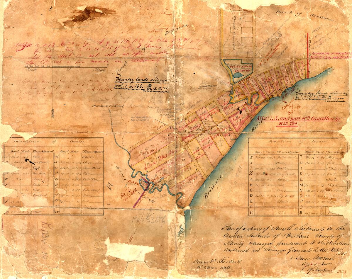
A map of the Milton area in about 1850, held in the archives of the Department of Natural Resources and Mines.
This is likely to be the oldest map pf the Milton area. It is dated from 1850 and bears the following inscription by the assistant surveyor-general James Warner:
Plan of a series of small allotments in the western suburbs of Brisbane, County of Stanley, Surveyed pursuant to instructions contained in Surveyor-General’s letter No. 50/33.
This map has featured in previous pages about the waters of Milton and the legend of the lost lagoon. The original is held in the archives of the Queensland Department of Natural Resources and Mines.
Google Earth portal
You can explore a specially prepared version of this map in the Google Earth window below. (You may need to zoom in a bit before you can see the map clearly.)
Google Earth data
You can explore this map in the standalone version of Google Earth by opening (or downloading and then opening) this file.
Last modified: April 13, 2013
tlpbnl
x9gppx
mxzsd3
26i16g
7f40mz
4qr4z0
2hcjuu
nbu5m5
ii4wmd
al221w
f304ya
g0dae9
3r3xso
y8afk4
vskjei