
Then and now: A birds-eye view
The images below use aerial photographs from 1946 to illustrate how the landscape of Western Creek has changed over the last six and a half decades. The 1946 aerial photos are, as far as I know, the earliest that exist of Brisbane. They are used extensively in planning, development and other applications that call for a historical record of the built and natural environment. You can explore them for yourself via the City Council’s PDOnline Interactive Mapping page (follow the links from “PD Online – property development and application search tool”).
But here, you get something more. I’ve done what the Council should already be doing, and imported these images into Google Earth. Don’t they look a treat? Now, for the real magic, just hover your cursor over an image, and the modern landscape will appear in its place. (If you are using a smartphone or tablet, try tapping the image and then tapping a blank space around it.)
I could stare at these images going back and forth for hours. In just an instant they reveal so much. I’ve provided some commentary, but really I think they speak for themselves.
Enjoy!
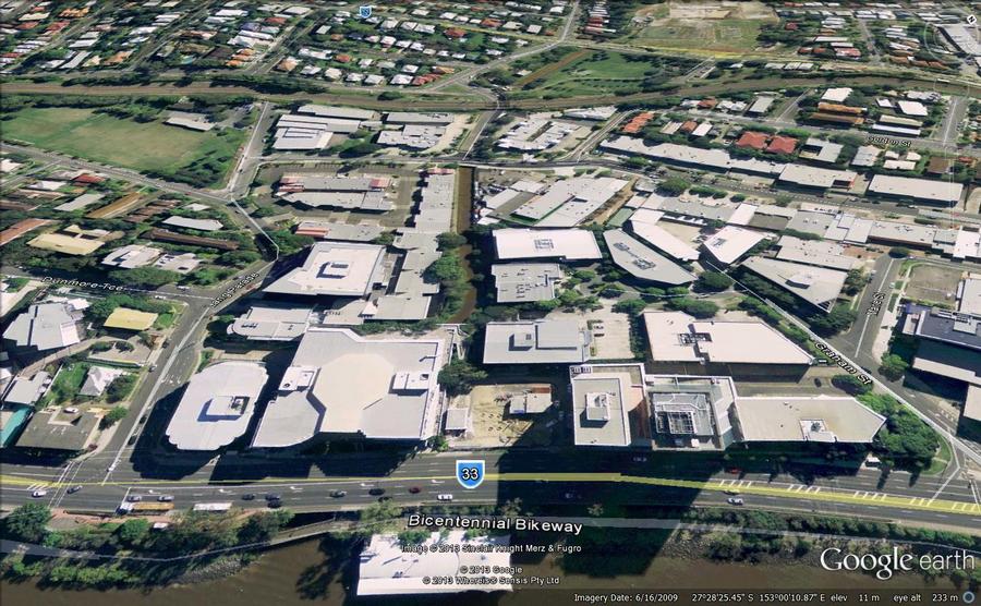
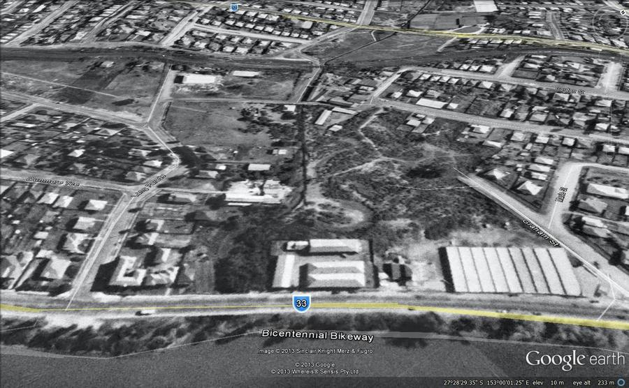
The mouth of Western Creek, with Milton Park and Frew Park visible in the distance. The creek has been drained but the footprint of the original stream is still visible in the foreground. Also, the drain is much narrower than the Milton Drain that we know today.
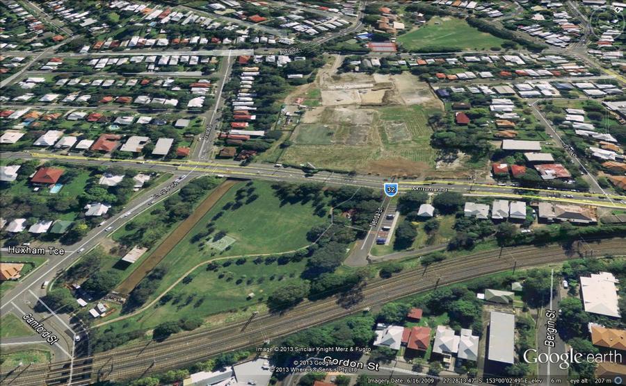
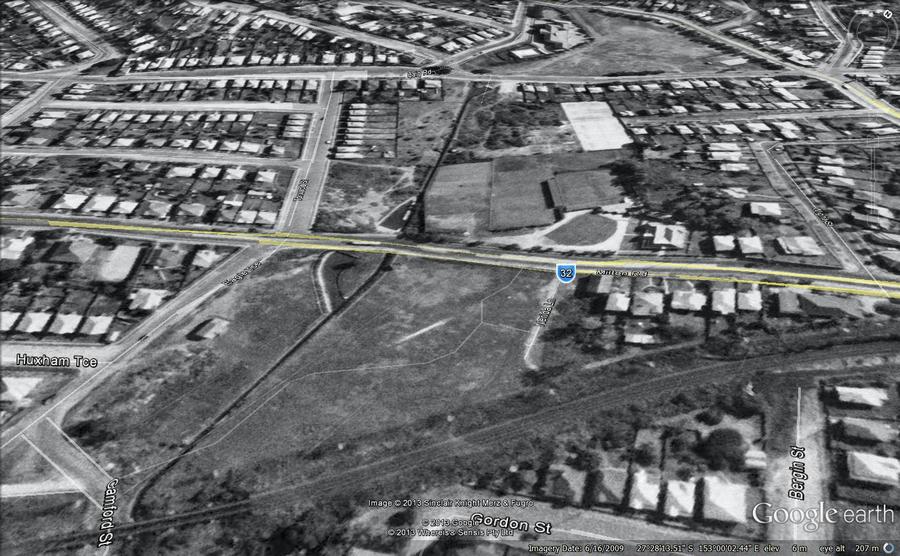
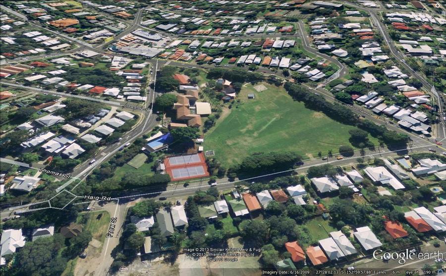
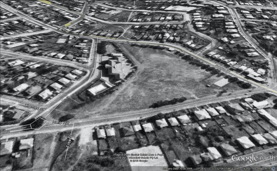
Milton Park (foreground), Frew Park and Gregory Park. Notice the changed alignment and size of the drain through Milton Park, and the open drain through Frew Park.
Gregory Park, with Rosalie Village in the background. Haven’t those fig trees grown!
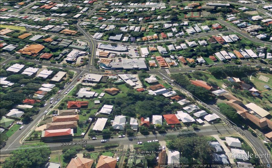
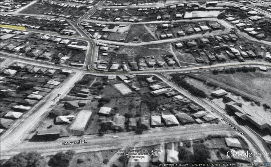
Rosalie, looking from above Howard Street. Western Creek had been drained and buried, but much of the land around its path remained undeveloped.
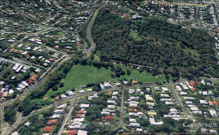
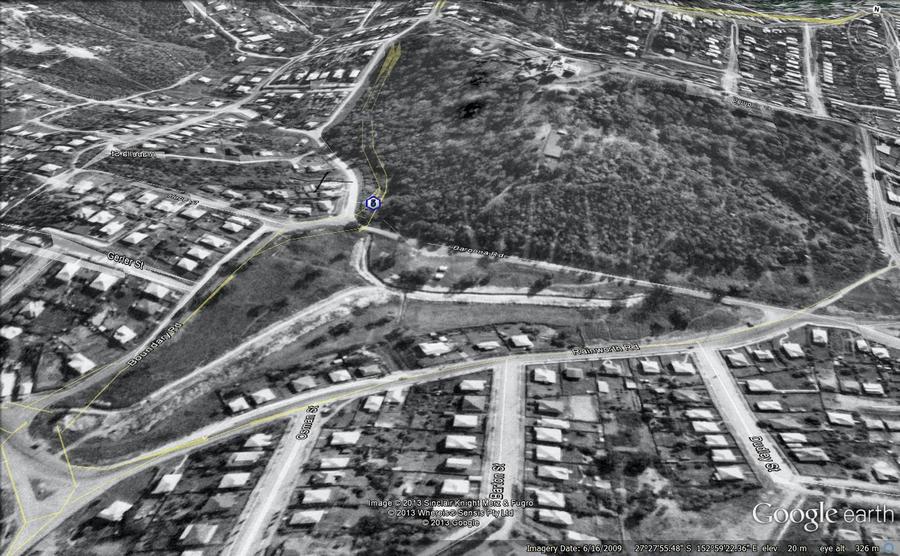
Norman Buchan Park and the Governor’s residence (Fernberg). The most striking feature is the open drain running through the park, but notice also the roads. In 1946 Baroona Road connected to Boundary Road, and the way to Macgregor Terrace was via Warburton and Kaye streets.
Rainworth School (right), St Pauls Villa (middle) and Rainworth Park (right). An open channel runs past the school’s playing field, but elsewhere the creek has been covered up.
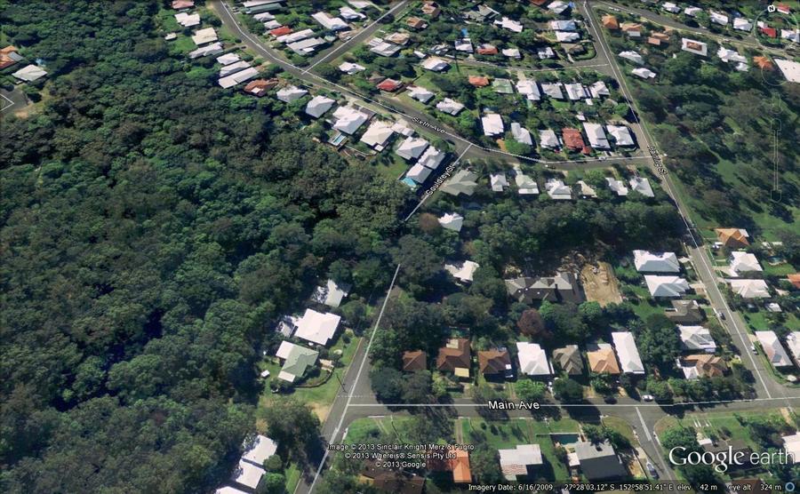
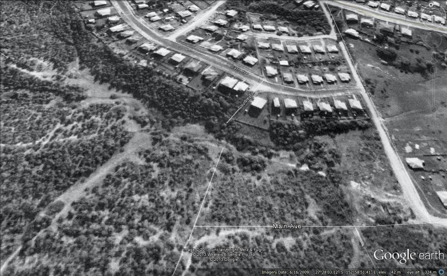
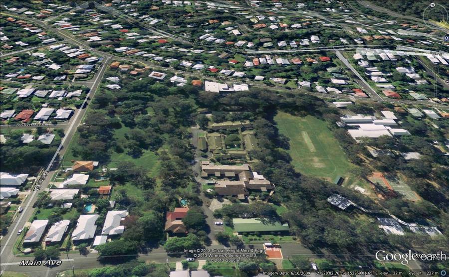
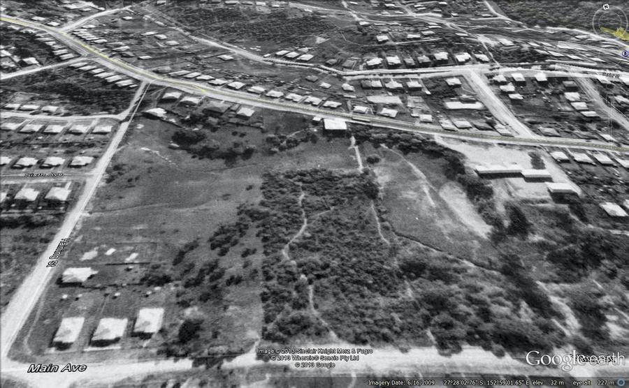
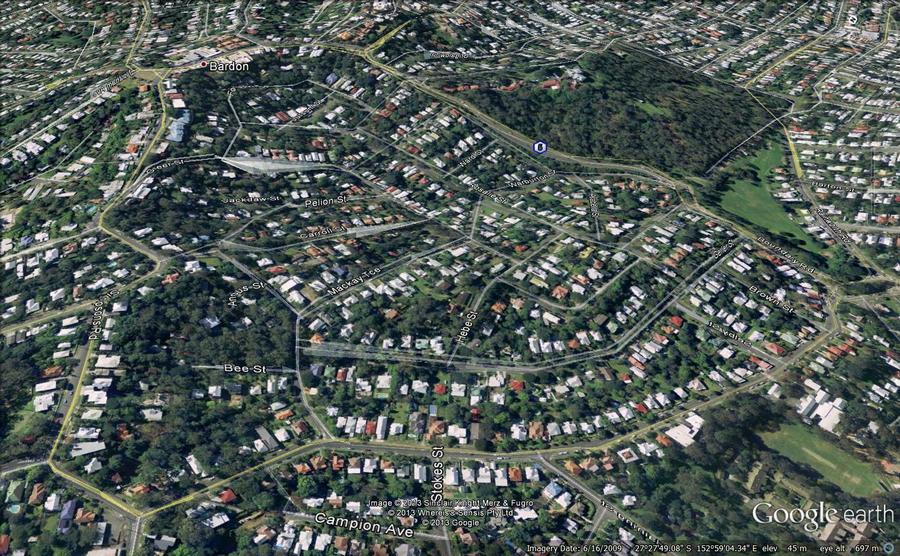
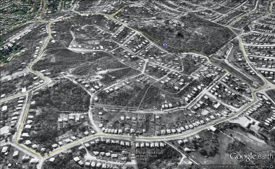
The area between Main Avenue and Sixth Avenue. The vegetation around the open streambed was evidently cleared prior to 1946. It has grown back, but largely as weeds.
The area beneath Stuartholme Road and Birdwood Terrace. I think this one speaks for itself.
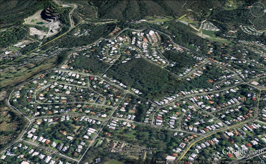
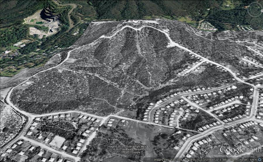
The area between Boundary Road and Macgregor Terrace. This is why I am grateful that the Governor lives here.
Last modified: June 18, 2017
Great images and comparisons. Thanks!
my son told me of your site yesterday and I have just had a very brief look
I grew up in 21 Arabella St Bardon (was Cumes / Alexandria Sts) between 1936 & 1962 attended Rainworth S S & Industrial H S as a student Joined the {PMG as a Technician
more to the point all of the children of the era spent masses of time in and around Western Ck – even walked thru the drain pipes between R S S and Griffo paddock now Norm Buchan Pk under Runic St
will try to talk more later & maybe give you some names to follow up
regards
Greg Kruger
Thanks Greg. I keep hearing things about the drain pipes between Rainworth School and Norm B Park. They must have been quite an attraction!
Great website! Thanks for your time in compiling it. Really interesting for all is Rosalie locals. Thanks!
Hi, a little nostalgia. I attended Milton State School, and on Armistice day each year, which was revered, individual classes’ would plant a tree, some in the school grounds or the park, in remembrance of our world war one soldiers. In 1961, 6th grade, my class was responsible for planting the present Silky Oak tree near the corner of Haig Rd and Baroona Rd. Our elderly teacher gave me the privilege of putting the sapling into the hole on behalf of my class mates. I can recall her stating the figs you mentioned along Baroona Rd were planted in honour of our WW1 Solders.
Thanks also as above the work you did is priceless..
I have been looking for the mansion which was demolished at 5 Simpsons Road Bardon. Your map is just short of that unfortunately
Cheers
Cheryl
Thank you for a fantastic website and the work you have obviously put into it. I never thought I would find such detailed info recorded for posterity. I grew up at 114 Gerler Street Rainworth from 1948 till the house was sold year 2000. I too have happy memories of adventures in the drainpipes between RSS & NB Park – I was always too scared to go further in than about 50 metres but my brothers were very brave and used to do the whole length to NB Park with candles and torches – an activity forbidden by Mum and Dad of course. When the house was being built on the rather steep sloping block in 1947/48 Dad needed many truck loads of fill (he used ashes so the water could still flow under) to level out the front yard which he said was a creek. I now know thanks to your research this creek was a tributary of Western Creek. The block needed clearing (with a reaping hook) of lantana but there were no large trees on it – Dad said the land was part of a Dairy Farm. We were surrounded by bush and spent many hours up in what is now Mt Cootha Forest catching guppies in pristine creeks. Many thanks. Margaret
Thanks for sharing that, Margaret. I’ve not gotten around to researching that area at all (one day, perhaps!), so that information is really fascinating and valuable.
OMG! Fantastic stuff! Brings back more than memories … the creek, the bush and all my RSS school mates (many of us still meet for a lunch each year, almost 60 years down the track). First time ever I’ve seen the old family home in Harwood Street in a 1946 aerial photo. Would like to get some of these photos in high res … can this be done?
Hi Greg. Thanks for the message. It’s worth checking out the 1946 imagery on the council’s PDOnline site (the link on this page was broken, but I’ve just fixed it). The interface is now a little confusing, but you can zoom in to a pretty high level of detail. If you’re interested in seeing the originals, I believe they are housed at the Brisbane City Archives in Moorooka.
hs4dvvs0rqy1dx0g3l
google
google
i57tko4dr3r51ru07b
Afternoon, great site you have set up here.
I’m doing a little research in the location of an old FLOODED QUARRY
AT MORNINGSIDE, BRISBANE, QLD
ALSO KNOWN AS LAKE EMERSON DURING WWII.
Any idea where I might find a layover map like yours ??
kind regards
Love the pics. A great idea! If you can find the images Hamish, I’d be happy to try and give you a hand with the Morningside one.
Loved the pics. Grew up on Birdwood tce and spent many happy days playing in the bush and down in the creek with mates. We made a small dam across the creek and had a small pond to swim in and sail toy boats and catch yabbies. Great childhood. The ‘new estate’ came in the early 60s and the bush behind our place was developed in the late 70’s early 80’s. Lot of the old neighbourhood war service weatherboard homes replaced by mansions now.
Great site.
In the 2000’s I worked a building next to Western Creek on Milton and spent many a pleasant lunch hour watching the fish and birdlife there.
There is some more historical images of the Paddington Queensland area on our website.
https://suburbmaps.com/blogs/aerial-photos/1946-aerial-photo-of-paddington
tqzlng
49bwu6
hx4n5t
1r6osc
6amv7z
hx94re
vu6ala
ffxp6y
hi5mnj
v6iamj
vsu00f
dkanob
125ugo
oui1k4
2dx675
0o2w58
nvhqso
n8wq1i
sjmk7x
n4p7uq
0awqk5
sg301d
hiy6hq
61c4hd