The Duckbill Dimension

I wrote last week about the backflow prevention device — let’s call it a floodgate — that the council is installing at the end of the Milton Drain to protect the Western Creek drainage system from backflow flooding (that is, flooding from the river rather than from local stormwater). The Western Creek floodgate is the most recent — and probably the most ambitious — in a series of such works being done across Brisbane as part of the City Council’s Backflow Program.

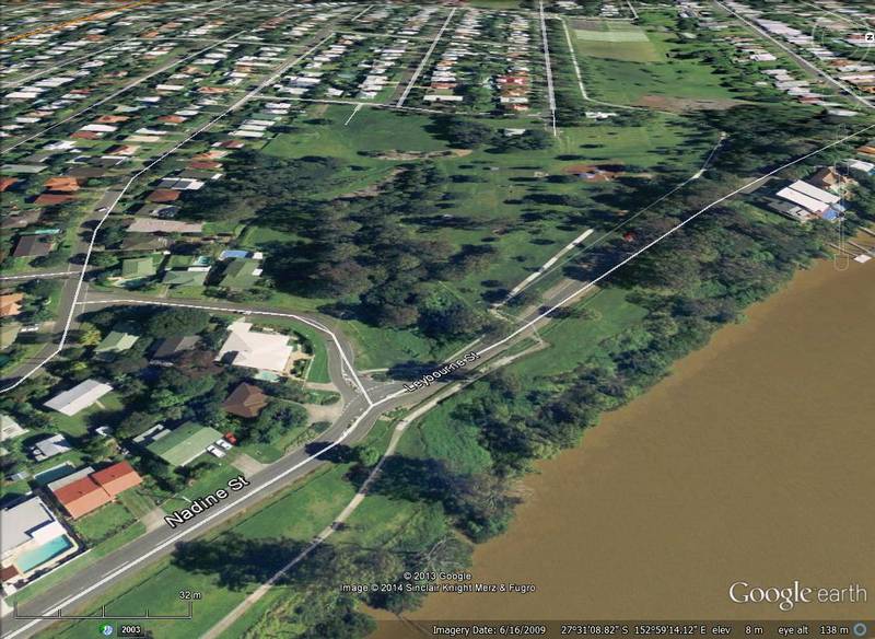
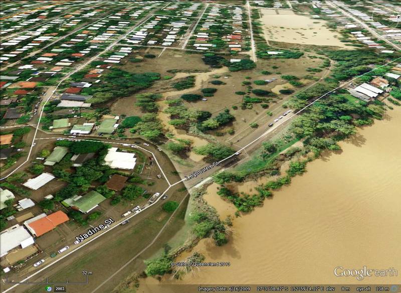
Another place where a floodgate is presently being constructed is the outlet of the Leybourne Street drainage system in Chelmer. This system meets the river as a large open channel at Faulkner Park. There isn’t much of a creek left, and I don’t know what it used to be called. Evidently though, it flooded quite seriously in January 2011.

The end of the Leybourne Street drainage system in Chelmer, soon after the peak of the 2011 flood (note that a larger area was flooded — including the road — at the peak). Hover over the image (or tap it if you are using a tablet or smartphone) to see the normal landscape. Flood imagery from Queensland Globe.

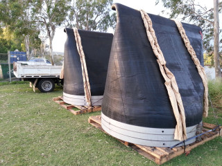
Two large duckbill valves waiting to be installed near Leybourne Street, Chelmer.

Two large duckbill valves waiting to be installed near Leybourne Street, Chelmer.

I see this place several times a week because I ride past it on my way to work. For some weeks now there has been excavation work going on in the channel on both sides of the road. There have been tractors, trucks, fences, signs, portaloos, the whole works. In this last week, the stars of the show have arrived: two enormous duckbill valves.

Duckbill valves seem to be the City Council’s favoured backflow prevention device, as they are popping up everywhere. There are two already at Milton just downstream from the Western Creek system, and just last weekend I noticed one at Merthyr Park at Newfarm. But the specimens I have seen so far are all modestly sized — certainly less than a metre across. The two at Leybourne Street are of another scale altogether. Each of them must be nearly two metres wide, and in their current position on the grass they stand more than two metres tall (even at full stretch I could not reach their tops). They are made of some sort of very hard rubber-like material — so hard that I have trouble imagining it yielding even to a torrent of stormwater. But this is exactly what these devices have been designed to to, or else they would cause local flooding every time there is a downpour.
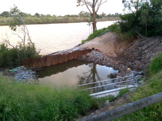
A temporary dam at the outlet of the Leybourne Street drainage system, where the duckbill valves will be installed.

A temporary dam at the outlet of the Leybourne Street drainage system, where the duckbill valves will be installed.

Looking over the embankment towards the river, you can see the new concrete structure into which these duckbills will be fixed. Curiously, the area in front of it has been made into a small temporary dam. I’m not sure why.

These devices will bring some comfort to residents in this area who were flooded in 2011. But it is worth being aware of their limitations. If you look closely at the Queensland Globe flood imagery (best done via Google Earth rather than the image above), you will notice that there is mud all over the road at Leybourne Street. This is a telltale sign that the river broke its banks here, flooding the area directly rather than just through the drains. Indeed, the river spilled over the banks for much of the length of the Chelmer Reach. This means that the two duckbill valves, as big as they are, will not protect this drainage system from a flood as high as 2011 unless the bank itself is raised. Even so, they will hold off the flood until the riverbank is breached, and should stop most floods that are below the 2011 mark.

These are not the sort of devices that I expect to see installed at Western Creek, where to have any real impact a floodgate will need to fill up the large space around the footbridge under Coronation Drive. But as the Backflow Program proceeds, I will be curious to see if any duckbills appear that are bigger than these two.
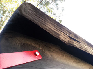
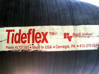
A sticker showing the manufacturer of the two big duckbill valves.

A sticker showing the manufacturer of the two big duckbill valves.

The tip of the duckbill valve.

The tip of the duckbill valve. The rubber is thick and hard, but will open up when there is enough water pressure behind it. We hope.

UPDATE – 11 August 2014

The duckbills have of course been in place for some time now, but I only recently got around to checking them out. When I visited, there was a small but constant stream of water trickling through one of the valves, as you can see in this short video.
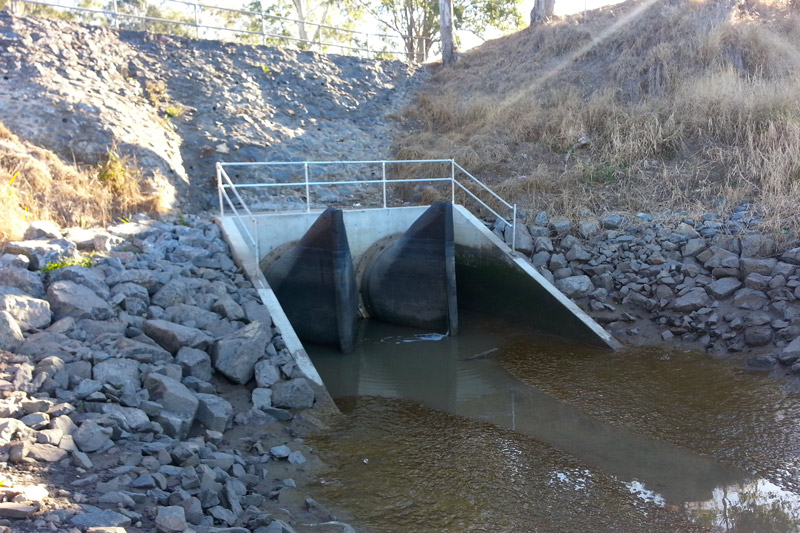
The installed duckbill valves. If you look closely, you can see some water trickling through the one on the right.

The installed duckbill valves. If you look closely, you can see some water trickling through the one on the right.
A floodgate for Western Creek

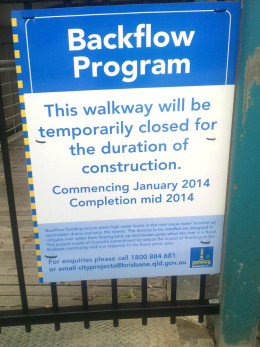
A sign announcing the construction of a backflow valve at the mouth of Western Creek.

A sign announcing the construction of a backflow valve at the mouth of Western Creek. It is erected on the gate to the footbridge under Coronation Drive. (Photo: S. Cowley)

So, it’s really happening. If this sign is to be believed, then Western Creek is finally going to have its floodgate. The photo was snapped at the entrance to the footbridge under Coronation Drive at the mouth of Western Creek (otherwise known as the Milton Drain) a few weeks ago by Steven Cowley, who has been my eyes on the ground at Western Creek ever since I moved to the southside last year.

The sign doesn’t mention a floodgate, but that is essentially what the ‘devices to be installed’ as part of the ‘Backflow Program’ are. They are contraptions of varying designs that ‘mitigate river water from flowing back up stormwater pipes when the river is in flood’. Such devices have already been installed just downstream near Cribb Street and the Go-Between Bridge. The City Council’s website has a page listing all of the places where backflow devices have been, or might soon be, installed. The page also provides links to the technical reports about these devices that the council commissioned in the wake of the 2011 flood. Continue reading

Email problems

UPDATE (15th January) — The contact form is now working, so please feel free to use it. Please note, though, that I cannot retrieve any messages that were sent while it was not working.

If you have tried to email me recently via the contact page, the chances are that I have not received your email.

I have just discovered that the site’s email feature is not working. I’m not sure how long this has been the case: a week at the least, but probably longer — possibly several weeks.

I will update this post when I have managed to resolve the problem. Until then, please to NOT use the contact form to contact me. Instead, you can:

  • post a comment at the end of a post or article
  • post a comment in The Forum
  • email me directly at angusveitch-at-gmail-dot-com (replacing ‘-at-‘ with ‘@’ and ‘-dot-‘ with ‘.’).

I sincerely apologise if you have sent me something and received no reply. I have no way of retrieving the lost emails, so I’m afraid you will need to contact me again using one of the methods above.

Fingers crossed, normal service will resume shortly.
-Angus

The broken lands of Toowong

Note – many of the pictures in this post contain two images, which flip back forth when you hover your mouse over them. On a mobile device these images will switch when you touch them, and then switch back when you scroll away … if you are lucky. For best results, please view this article on a desktop or laptop.

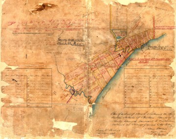
A survey plan of the Milton area in about 1850 (B.1234.14), held by Queensland's Museum of Lands, Mapping and Surveying.

Figure 1. A survey plan of the Milton area in about 1850 (B.1234.14), held by Queensland’s Museum of Lands, Mapping and Surveying.

In an earlier post called The Waters of Milton, I explored a survey plan of Milton drawn in 1850 (Figure 1). Survey plans are valuable historical artifacts because they generally represent the first efforts to capture the landscape on paper. They reveal natural features that have long since vanished, such as creeks, swamps and even hills. They also provide insights into how the colonists saw the land, indicating its potential uses and specifying how it was to be divided up among its new owners.

Since writing that post, I have obtained several more digitised survey plans of the Milton Reach and Western Creek areas, thanks to the assistance of the Museum of Lands, Mapping and Surveying, which is part of the Queensland Department of Natural Resources and Mines. I look forward to featuring them all in articles in the future, but today I will explore just one of them. This particular plan carries the catalogue name of M.31.65. I have no idea what that means, but then there is a lot about these plans that I am still fuzzy about. Some of the surveying markings may as well be hieroglyphs to me, but thankfully there is much that can be gleaned even without specialist knowledge.

Unlike the Milton plan, this one depicts an area inland from the river. I’ll get to the precise area shortly, but first we need to dispense with some formalities.
Continue reading