Movement at the horse paddock

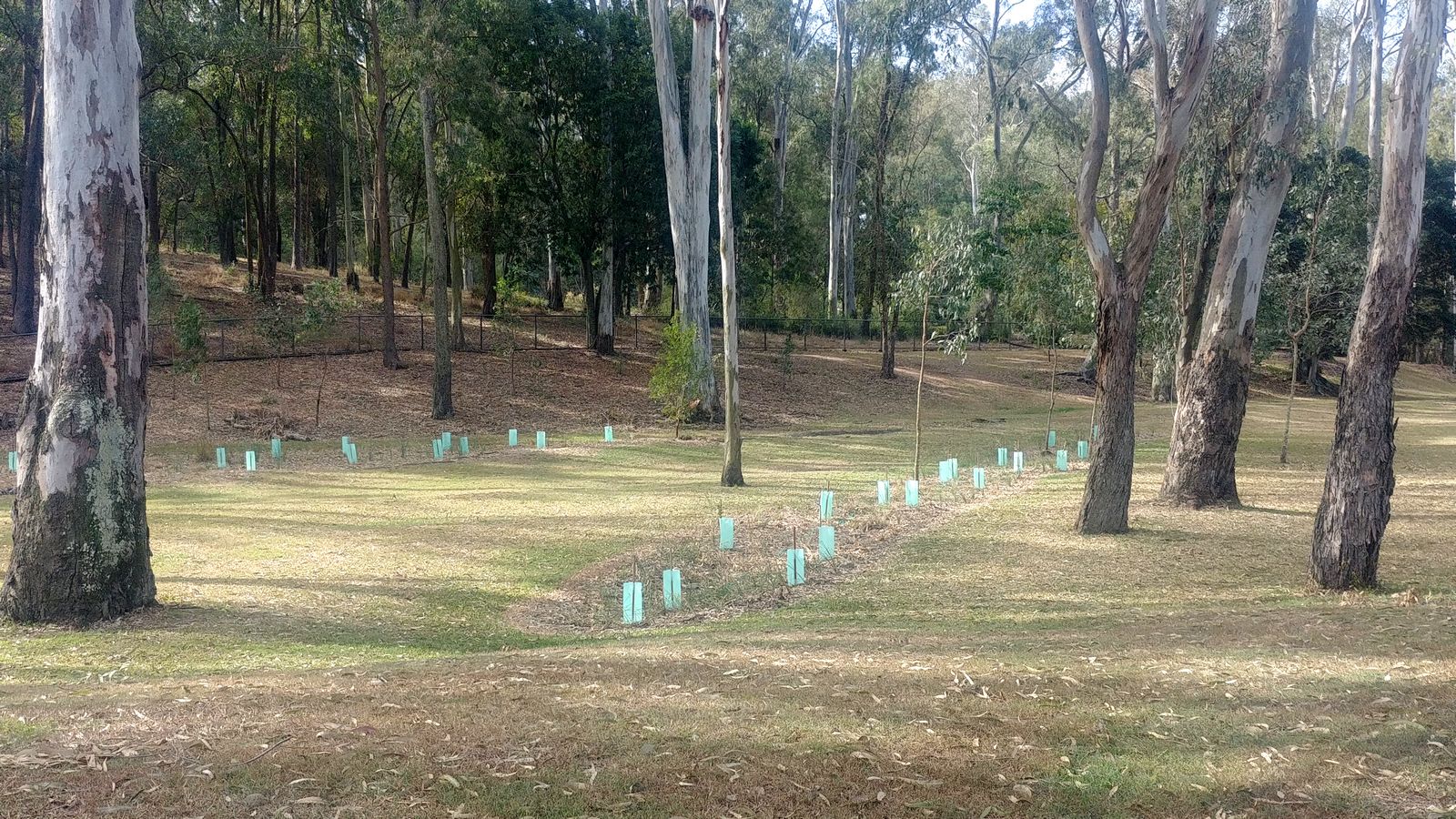
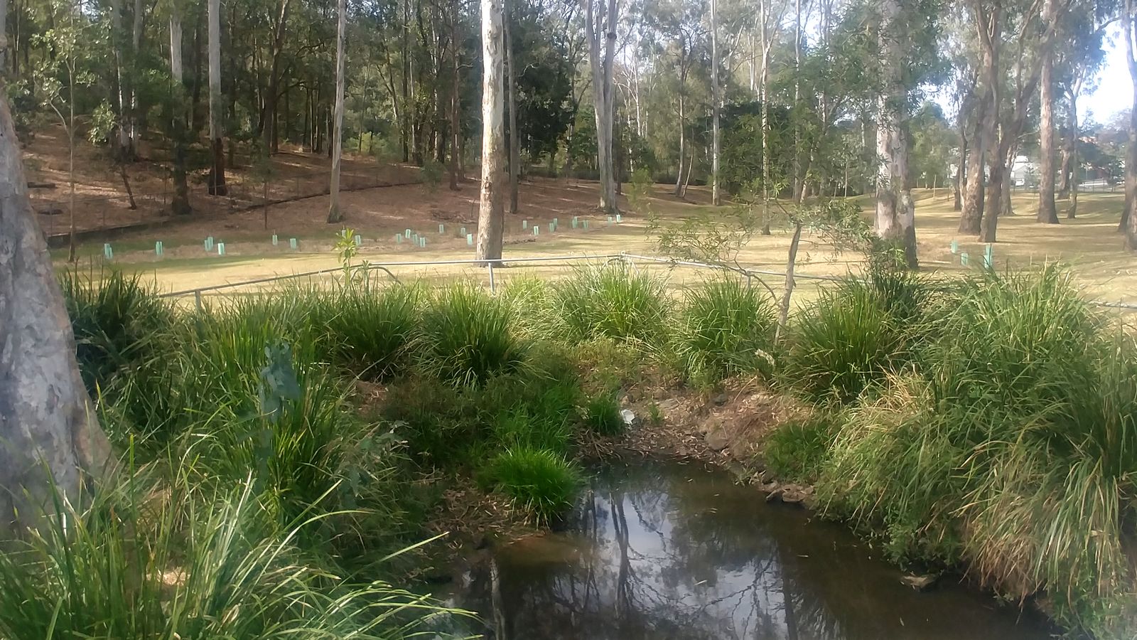
Recently, while driving along Rainworth Road past the south-east corner of the governor’s property, I noticed something new. Running through this grassy area, which I understand to be the governor’s old horse paddock, were two rows of newly planted trees. Interspersed among the new trees, which still were housed in their protective plastic tents, were what looked to be some native grasses or lomandras.

The pond at the edge of the governor’s paddock. The two rows of newly planted trees can be seen in the background.

One of the two plantings follows a course that might be similar to that of the original stream of Western Creek, which once flowed through this land.

The two new plantings in the governor’s paddock at the south-east corner of the Fernberg property.

I’ve suggested previously that this piece of land is something of a missed opportunity. It is visually uninspiring, ecologically bland, and inaccessible to the public. Its one redeeming feature is the rehabilitated pond along the fence, the beauty of which only serves to illustrate what could be done with the rest of the site if the will was there.

These new plantings, while far from a full-scale restoration of the site, are a positive sign. I look forward to seeing how they develop, and to learning if they might be part of a larger rehabilitation effort.

Tiger, brandy, oyster saloon: A new way to read the Brisbane Courier

It’s reboot time! It’s been eighteen months since I last posted here, and four years since I started my PhD. But my thesis now is nearly out of the way, which means I can return to more recreational forms of writing. It also means I can unveil what I have been working on to keep myself sane during the final stages of my PhD. In case I never fully explained, my PhD was about the application of a computational text analysis technique called topic modelling within social science. Basically, I spent the last four years learning how to do useful things with large amounts of textual data — a practice known as text mining or text analytics. Along the way, I also spent time experimenting with ways of putting textual data on a map. You can see some of the early results in my other blog, which for the last couple of years has been just as neglected as this one.

The methods I explored in my thesis were all based on a dataset of news articles and other texts about coal seam gas development, which has been a touchy topic in recent years in Australia. But I never forgot about my local history blog, and I always hoped to return to it armed with a new bag of tricks. And now here I am, with bag in hand.

Cultural cartography

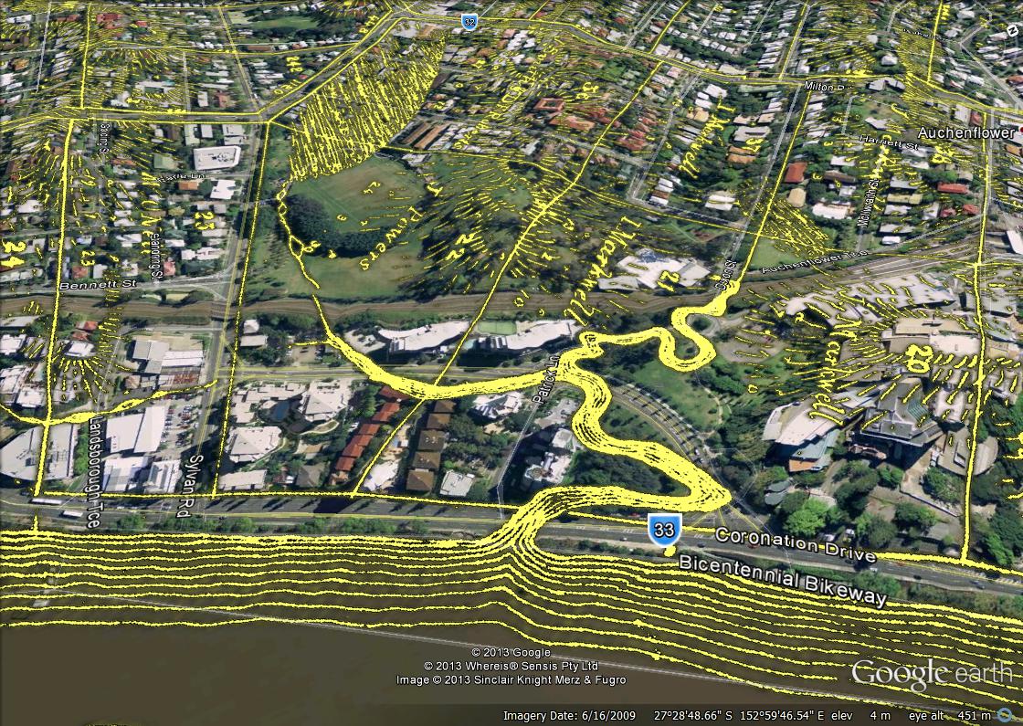
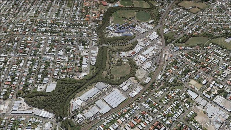
If you’ve spent any time exploring this site, you’ll know that I’m fond of projecting old maps and plans onto the modern landscape as a way of seeing how things have changed. I’ve done this by photoshopping the maps to extract the details and then loading the results into Google Earth, where they can be explored immersively and in three dimensions.

Langsville Creek as depicted in 1859, overlaid on the present-day landscape.

Figure 1. Langsville Creek as depicted in 1859, overlaid on the present-day landscape.

Continue reading

Navigating the history of Norman Creek

While I continue to neglect my own website, I did recently find time to contribute to someone else’s. In collaboration with Trish FitzSimons, who recently produced a wonderful series of short films featured in the Museum of Brisbane’s Navigating Norman Creek exhibit, and with support from the Brisbane City Council’s Community History Grant, I contributed to two pages about the history of Norman Creek for the website of the Norman Creek Catchment Coordinating Committee, or N4C.

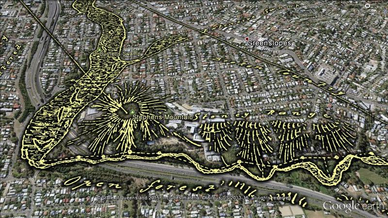
The first of these two pages explores a plan of Norman Creek drawn in 1839 by the government surveyor James Warner. This plan, held today by the Queensland Museum of Lands, Mapping and Surveying, is a real treasure. It traces the entire length of Norman Creek, from its headwaters in Mount Gravatt to its junction with the Brisbane River. Warner not only depicted the course and form of the stream, but also described the surrounding terrain and vegetation as it was before Brisbane had developed beyond the penal settlement at the site of the modern CBD. His plan links us to the natural history of what is now a highly urbanised catchment.

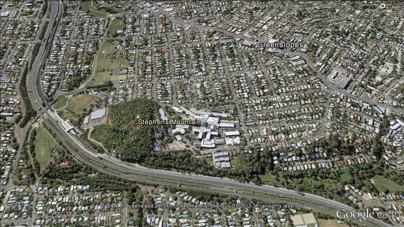
The page, Navigating Norman Creek: Maps from 1839 and 2015, provides a guided tour of Warner’s plan, using Google Earth (in combination with some other special magic) to show how the features on the plan correspond with today’s suburban landscape. The image below is just one example.

Warner sketched an open forest and a stoney range on either side of what is now the Pacific Motorway as it passes the Greenslopes Hospital. Downstream, he found a large swamp that has since become parkland.

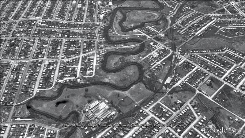
The second page explores another slice of Norman Creek’s history, this time via the 1946 aerial imagery of Brisbane. The image below, which will transition to the modern landscape if you hover your cursor on it (or touch it if you are using a mobile device), illustrates the level of modification that the creek has undergone since the middle of the 20th century.

The stretch of Norman Creek between Deshon Street and Stanley Street, Woolloongabba, was straightened during the early 1990s, with several meanders and sharp bends bypassed. Meanwhile, the previously cleared Moorhen Flats has been revegetated.

If you’ve been hanging out for some new content here at oncewasacreek.org, I hope these explorations of Norman Creek provide some satisfaction. I can’t promise any more material in the immediate future, but if you happen to be interested in the intersection between data visualisation and the study of public discourse, you might find more joy at my other blog, seenanotherway.com, which has just lurched back into life and is likely to get a lot more attention in the coming months as I enter the next phase of my PhD.
May Day mayday! A tale of extraordinary weather and extra-ordinary lasagne.

It’s been a long time between posts. As per the forecast, my PhD has reduced this blog from a bubbling stream to a lifeless dry creek bed. But any stream can be revived with a little rain. And with a lot of rain, it all comes flooding back.

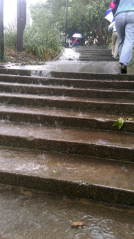
'UQ Falls' - posted to the Facebook group UQ StalkerSpace by Panashé Machinguara just after midday on 1 May 2015.

‘UQ Falls’ – posted to the Facebook group ‘UQ StalkerSpace’ by Panashé Machinguara just after midday on 1 May 2015.

‘A lot of rain’ is one way to describe what Brisbane experienced on Friday the 1st of May, 2015. ‘Extraordinary weather event’ would be another. The gauge in the CBD recorded 182mm of rain in the 24-hour period from 9am that morning. To put that in perspective, the historical average rainfall for the entire month of May is 74mm. The record for the largest daily fall at this time of year stands at 190mm on 26 April 1989, but the recent event set a new daily record for May, with the previous record being 149mm on 9 May 1980.1

Personally, I’d had enough of the rain long before any records were broken. My trip into the University of Queensland at St Lucia that morning took nearly two hours because of a track fault somewhere near Yeronga Station. ‘Local flooding’ was said to be the cause. I enjoyed the rain a lot more from the other side of my office window, but was forced to venture out again at around 4pm. By that time, every road and pathway on the campus was a raging torrent. Continue reading

Notes:

  1. All of this rainfall data is available from the Climate Data Online section of the Bureau of Meteorology website. The historical data comes from the the Brisbane Regional Office station (040214), which operated from 1840 until 1994, while the more recent data comes from the Brisbane station (040913), which commenced operating in 1999.

Brisbane Biodiversity Forum, Tuesday October 21.

Things have been pretty quiet here recently, and I’m afraid that they are likely to remain so, at least for a little while. I’ve just commenced a PhD at the university of Queensland, so naturally enough, that’s where nearly all of my mental energy is being channelled. And rather than keeping things simple by basing my PhD on this website, I’ve chosen a different direction altogether. I’m looking to explore large-scale text analysis and data visualisation as methods for examining social discourse.

And as if I needed a further distraction, I have started another blog as an outlet for my text analysis and data-viz experiments. It’s called Seen Another Way, and the first post may be of interest to followers of this site. It features some animations that I created with the Queensland Government’s database of groundwater bores. The animations show 144 years of groundwater development history in the space of 72 seconds.

But I have not completely switched off from oncewasacreek.org. On Tuesday 17 October at the Kenmore Library from 6pm, I will be speaking at the Brisbane City Council’s Biodiversity Seminar. The theme for the evening is ‘Creeks: past, present and future’, and there are no prizes for guessing which part of that theme I will be focussing on. There will be three other speakers — Leo Lee, Grant Witheridge and Andrew Wallace — who between them will discuss topics including fish distribution, flooding and creek restoration. It promises to be a very interesting evening.

Full details about the forum are available here. The forum is free, but if you wish to attend you will need to book, as places are limited.

Perhaps I will see some of you there!