The catchments of the Crescent Reach

This post was updated on 24 May 2013 to include a revised outline of Langsville Creek catchment.

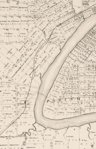
The Milton/Toowong Reach of the Brisbane River, depicted on a map from 1884.

The Milton/Toowong Reach of the Brisbane River, depicted on a map published in 1884

One of the first things I did when I created this website was to map out the catchment of Western Creek. While Western Creek has remained my focus, I have increasingly spent time thinking and writing about its neighbouring catchments as well, especially its three ‘sister’ catchments along what John Oxley called the Crescent Reach: Boundary Creek, Langsville Creek and Toowong Creek. These creeks are visible in several old maps, such as the one shown to the right, which dates from 1884.1

I figured that it was about time to put these other catchments onto a map. So, I fired up ArcMap, fed it some digital elevation data and eventually coaxed out of it the catchment boundaries. And of course, I then loaded them into Google Earth. The image below shows, from left to right, the catchments of Toowong Creek, Langsville Creek, Western Creek and Boundary Creek. (I haven’t mapped out the streams of the other catchments — that can wait for another day.)
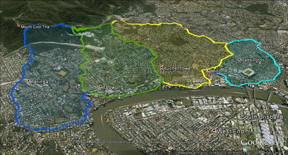
The catchments of the Crescent Reach. From left to right: Toowong Creek, Langsville Creek, Western Creek and Boundary Creek.

The catchments of the Crescent Reach. From left to right: Toowong Creek, Langsville Creek, Western Creek and Boundary Creek.

The precision of these boundaries is limited by the data used to create them, and you can tell by their jagged shapes that they are only approximations. Defining these boundaries can get particularly tricky as you get closer to the river, where the terrain is relatively flat.

But these boundaries don’t have to be perfect in order to be useful. The most interesting thing that they convey is the overall shape and size of the four catchments. At a glance, we can see that Boundary Creek is the smallest, while Toowong Creek and Western Creek are the largest. Using my GIS software, I calculated the catchment areas as follows:

Western Creek: 4.1 km2
Toowong Creek: 3.9 km2
Langsville Creek: 3.3 km2
Boundary Creek: 1.5 km2

I was surprised to discover that the Toowong Creek and Western Creek catchments are about the same size. I had always assumed that Toowong Creek was larger, and that this might be one reason why it (mostly) survived while Western Creek was (mostly) obliterated. But since their catchments are about the same size, their streams (at least in the lower reaches) should also have been comparable. Does this mean that we can use Toowong Creek as a reference point to tell us what Western Creek might have been like? Maybe, maybe not, as I suspect you would have to account for any notable differences in the geology, vegetation, topography and overall shape of the two catchments first. It is an interesting prospect, though.

Over the hill and far away

All four of these catchments share their uppermost boundaries with another catchment: that of Ithaca Creek. Ithaca Creek begins in the slopes of Mount Coot-tha and flows through Bardon, Ashgrove and Red Hill, where it meets its ‘parent’ stream, Enoggera Creek. The catchments of Ithaca Creek and Enoggera Creek are both shown in the image below, along with the four catchments of the Crescent Reach.
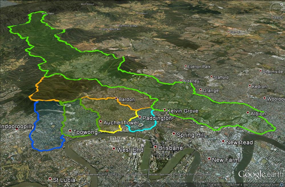
The four catchments of the Crescent Reach along with the larger catchments of Ithaca Creek and Enoggera Creek.

The four catchments of the Crescent Reach along with the larger catchments of Ithaca Creek and Enoggera Creek.

Ithaca Creek’s catchment covers an area of 11 km2 — almost as much as the four Crescent Reach catchments combined. But it too is dwarfed by the catchment of Enoggera Creek, which covers about 76 km2 (including Ithaca Creek, which is one of its tributaries) and extends all the way up through The Gap and into the D’Aguilar Range. No wonder Enoggera Creek was chosen to provide Brisbane’s first large-scale water supply.

And the rest of Brisbane? It could be mapped like this, too. In fact, I’d be surprised if the council hasn’t done it already, since these same catchments would delineate the networks of sewers and stormwater drains that the council maintains. And of course, where notable creeks still exist, their catchments will have been mapped to support monitoring and management initiatives such as Healthy Waterways. I hope that at some stage, this information will be made available for people to explore through Google Earth or similar platforms.

For now, you’ll have to make do with the six catchments I’ve discussed above. If you have installed Google Earth, then you can explore them yourself by opening (or downloading then opening) this file.

Notes:

  1. This map was produced by the Surveyor General’s Office in 1884. It is called ‘Moreton 20 chains to an inch, Sheet 1B’. It is held by the National Library of Australia, and is avaialble via Trove.

Where a creek begins

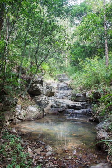
A pond in a tributary of Ithaca Creek, Mount Coot-tha. (February 2013)

A pond in a tributary of Ithaca Creek, Mount Coot-tha. (February 2013)

This is just a quick plug for a side-project of mine that has mostly sat on the back-burner since this website was conceived. Before I started mapping out Western Creek in my imagination, I had started to map out Ithaca Creek (a real creek!) photographically. My plan was (and still is) to photograph Ithaca creek from one end to the other, documenting its journey from the headwaters in Mount Coot-tha Forest through to the much more suburban surrounds of Red Hill where it joins its bigger brother, Enoggera Creek.

Ithaca Creek is a neighbour of Western Creek, sharing a catchment boundary along the ridge of Stuartholme Road, Simpson’s Road, Macgregor Terrace and much of Latrobe Terrace.

To see the Ithaca Creek photo-map, click here and then click on the small banner at the top of the page to go to the Picasa Web Album (Google appears to be phasing out Web Albums in favour of the happy-snap functionality of Google+, so I don’t know how long this will remain functional). Beneath the small map on the right-hand side of the album there is a link which takes you to a proper map view of the album.

Continue reading

Exploring McKellar’s map in Google Earth

The fun with maps continues…

As detailed in last week’s post, I have recently been experimenting with ways of importing historical maps into Google Earth, which enables them to be explored from a whole new perspective. I initially did this for three maps, dating from 1843, 1859 and 1864. Today I’ve done the same for another map — Sheet 7 from a series of maps drawn by the government lithographer A.R. McKellar in 1895. This map shows the Milton Reach of the river and the area to the west up to Mount Coot-tha. You can see what the original version of this map looks like at the Queensland Historical Atlas.

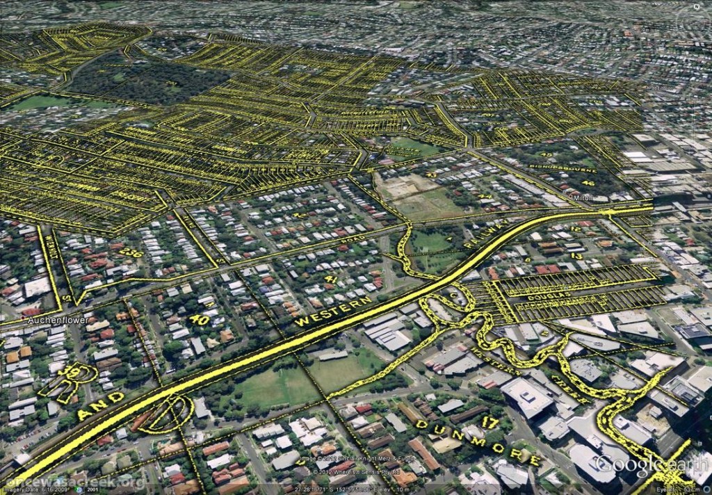
You would already be familiar with this map’s depiction of Western Creek — it is the one shown at the top of this page and all throughout this website. The picture below shows this same part of McKellar’s map in Google Earth. Dunmore Park is in the foreground, and Milton Park, Frew Park and Gregory Park can also be seen along the creek’s path.

Western Creek as depicted on McKellar's 1895 map, viewed in Google Earth.

Western Creek as depicted on McKellar’s 1895 map, viewed in Google Earth.

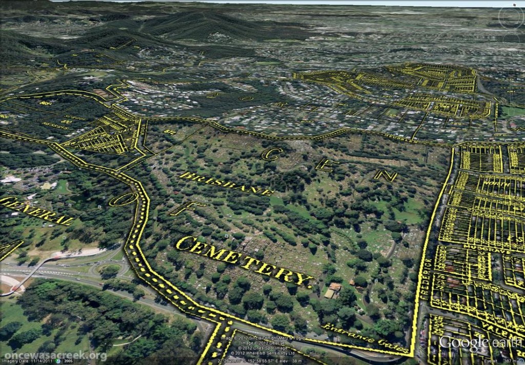
The image below shows the Toowong Cemetery. Beyond the cemetery, towards the upper right of the picture, is the area bounded by Boundary Road, Simpsons Road and Macgregor Terrace. This subcatchment of Western Creek is marked on McKeller’s map as the Lizzy Lee, Soudan and Rose Hill estates — names that all seem to have been lost, with the exception of Soudan Street. To the left of the cemetery, a ‘school reserve’ is marked on an area that is still bushland today.

The Toowong Cemetery as depicted on McKellar’s 1895 map. Further in the distance are the Lizzy Lee, Soudan and Rose Hill estates.

The Toowong Cemetery as depicted on McKellar’s 1895 map. Further in the distance are the Lizzy Lee, Soudan and Rose Hill estates.

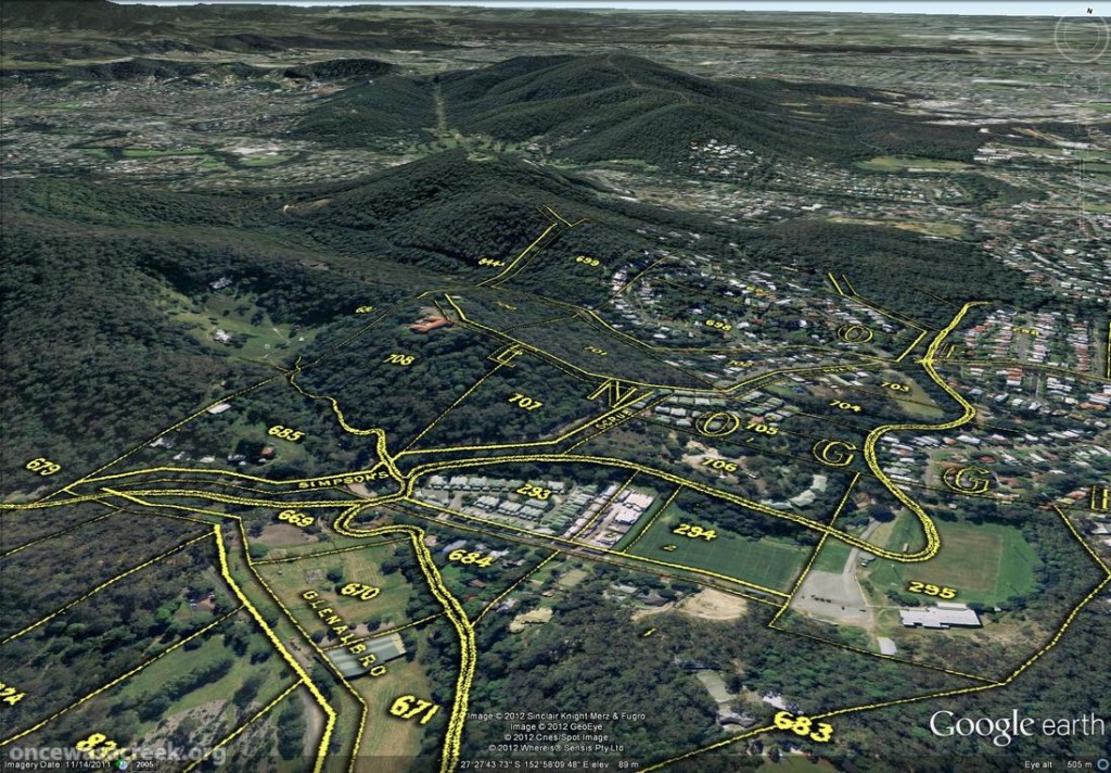
McKellar’s map also depicts part of Ithaca Creek, the catchment of which neighbours the Western Creek catchment. The picture below shows two branches of Ithaca Creek meeting near Carwoola Street. In the immediate foreground, under the name ‘Glenalbro’, you can see the roof of the old Freers chip factory. At the lower-right of the picture is Purtell Park, and right on top of it is the creek as it appears in McKellar’s map. I’ve know this spot for all of my life, but I never realised until now that the path of the creek had been changed to make way for the park.

Part of Ithaca Creek as depicted on McKellar's 1895 map. At the lower-right of the picture, the old path of the creek can be seen over Purtell Park.

Part of Ithaca Creek as depicted on McKellar’s 1895 map. At the lower-right of the picture, the old path of the creek can be seen over Purtell Park.

To explore McKellar’s map for yourself, all you need to do is download either of the following files and open it in Google Earth (you will need to download and install Google Earth first if you haven’t already). The first file shows McKellar’s map features in yellow but without any shadow effect. The second file is the same, but includes the shadow effect that you can see in the images above. The first file is much smaller and will load quicker, but some features on the map will not be as easy to see without the shadow.

Have fun!