The broken lands of Toowong

Note – many of the pictures in this post contain two images, which flip back forth when you hover your mouse over them. On a mobile device these images will switch when you touch them, and then switch back when you scroll away … if you are lucky. For best results, please view this article on a desktop or laptop.
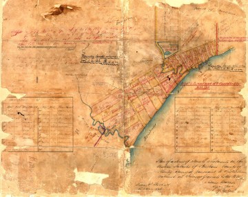
A survey plan of the Milton area in about 1850 (B.1234.14), held by Queensland's Museum of Lands, Mapping and Surveying.

Figure 1. A survey plan of the Milton area in about 1850 (B.1234.14), held by Queensland’s Museum of Lands, Mapping and Surveying.

In an earlier post called The Waters of Milton, I explored a survey plan of Milton drawn in 1850 (Figure 1). Survey plans are valuable historical artifacts because they generally represent the first efforts to capture the landscape on paper. They reveal natural features that have long since vanished, such as creeks, swamps and even hills. They also provide insights into how the colonists saw the land, indicating its potential uses and specifying how it was to be divided up among its new owners.

Since writing that post, I have obtained several more digitised survey plans of the Milton Reach and Western Creek areas, thanks to the assistance of the Museum of Lands, Mapping and Surveying, which is part of the Queensland Department of Natural Resources and Mines. I look forward to featuring them all in articles in the future, but today I will explore just one of them. This particular plan carries the catalogue name of M.31.65. I have no idea what that means, but then there is a lot about these plans that I am still fuzzy about. Some of the surveying markings may as well be hieroglyphs to me, but thankfully there is much that can be gleaned even without specialist knowledge.

Unlike the Milton plan, this one depicts an area inland from the river. I’ll get to the precise area shortly, but first we need to dispense with some formalities.
Continue reading

There once was a waterhole . . .

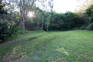
What do kids, cows and nuns have in common? The answer is Western Creek — a special part of Western Creek that no longer exists. For at the bottom of Couldrey Street, where there now is just a clearing, there once was a waterhole! As recently as the late 1970s or early 1980s, this was the local Wet-n-Wild for the neighbourhood kids, at least when there was enough rain to get the creek flowing through the bush. Going further back, before the suburb had fully moved in, the pond was used as a swimming hole by the nuns at Stuartholme when they ventured down to fetch the convent milk.

The clearing at the bottom of Couldrey Street

The clearing at the bottom of Couldrey Street

This is just the kind of story I was hoping to uncover when I started this website. And I owe it to Jonathon Freer, who is an ex-resident of Couldrey Street, and his mum Di, who still lives there in the house where Jonathon grew up. You can read all about it on this new page.

There must be other past and present residents of Couldrey Street out there who have stores and (I’m hoping) photographs to share about the waterhole and surrounding creek. If this is you, please get in touch with me!

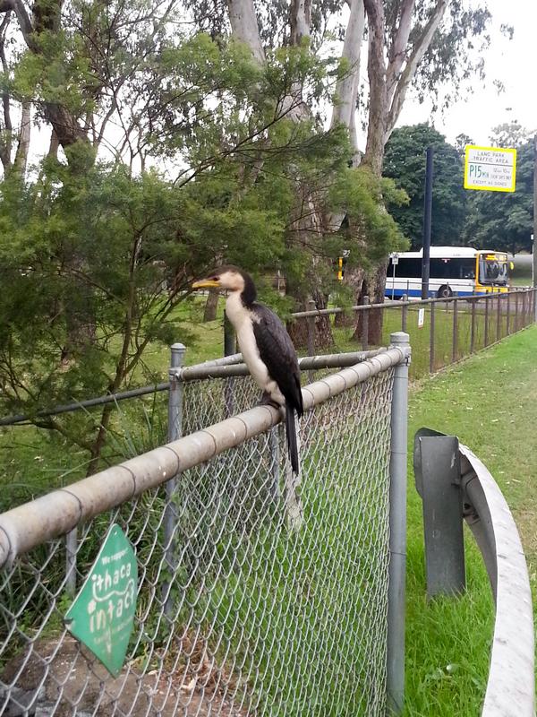
The bird on the fence by the pond

A waterbird sitting on the fence by the pond at the bottom of the Fernberg grounds

A waterbird sitting on the fence by the pond at the bottom of the Fernberg grounds

I walked past the pond at the bottom of the Fernberg grounds today and saw this bird sitting on the fence. It looks familiar but I have no idea what it is. I’ve never seen this sort of bird around here before.

It let me get surprisingly close — within a couple of metres. Even at that distance, this is the best I could do with the camera on my phone. Though it stayed in the one spot on the fence, it frequently moved its body, occasionally stretching out its long neck. When I finally got too close, the bird flew down into the pond, and proceeded to dive over and over again, seemingly combing the bottom with its beak, looking for things to eat. A very able diver, it reminded me a bit of a platypus.

It’s nice to know that this little restored remnant of Western Creek holds an attraction for wildlife in the area.

So… does anyone know what sort of bird it is?

When it really rains

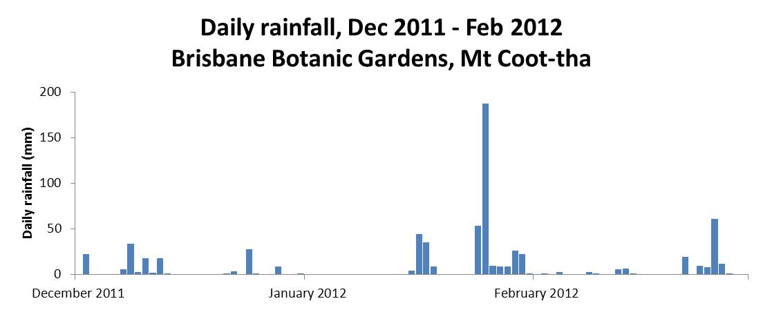
La Nina has now officially left us, and already the Bureau is watching for signs of what next summer will bring. The summer of 2011-12 certainly was wet, but for the most part it was also rather gentle. Nearly all of the 700mm or so of rain that fell in Brisbane from the start of December 2011 to the end of February 2012 was delivered in doses of less than 50mm in a day. The one marked exception to this pattern occurred in the lead-up to Australia Day, with 187mm falling in the 24 hours before 9am, 26 January 2012.

Daily rainfall at the Mt Coot-tha Botanic Gardens, December 2011 to February 2012. (Bureau of Meteorology, Climate Data Online)

Daily rainfall at the Mt Coot-tha Botanic Gardens, December 2011 to February 2012. (Bureau of Meteorology, Climate Data Online)

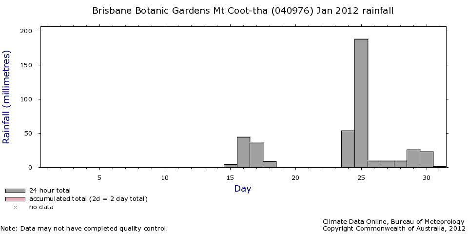
Most of that rain fell on Wednesday 25 January, and I remember watching it from the comfort of my desk at 400 George Street. As I gazed out through the floor-to-ceiling windows, I also remember thinking about how the streams at the top of Western Creek must have been gushing; I was anxious to get up there and take some photos. Having observed how quickly that part of the catchment tends to drain, I wanted to get there as soon as possible after a good fall of rain. The opportunity finally came on the morning of Sunday the 29th. The rain had eased after a fall of about 25mm overnight, so I donned my camera and my raincoat and hot-footed it up to the Weedy Wonderland at the top of Western Creek.

Daily rainfall at the Mount Coot-tha Botanic Gardens in January 2012

Daily rainfall at the Mount Coot-tha Botanic Gardens in January 2012

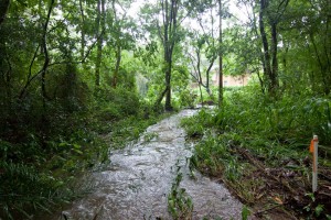
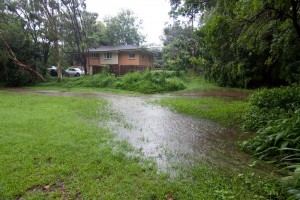
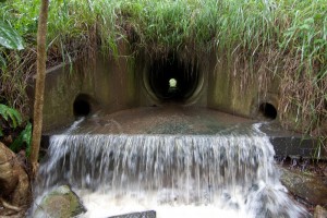
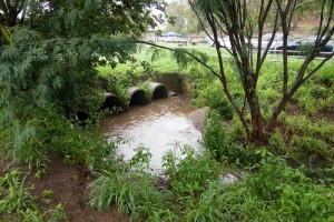
Needless to say, the rain resumed as soon as I got to Couldrey Street. Nursing my Canon 50D under the front zip of my raincoat, and whipping it out as briefly as I could to take photos, I trundled up the stream and through the scrub, clambering to vantage points that I’m sure no sane person would, all in the name of documenting Western Creek in full flow. Well, almost full flow, as it was clear that the water had been been significantly higher in the hours before I got there.

The results are in this gallery page, and there is a sneak preview just below.

I hope it was all worth it, because despite my efforts to dry out my camera gear when I returned home (this included a very slow bake in the oven for a couple of hours), I recently discovered that one of my lenses has succumbed to a fungal infection. And believe it or not, this lens was a replacement for another lens that met a similar fate after I dropped it (and the camera — and myself!) into the floodwaters at Torwood Street in January 2011. Folks, water and SLR cameras are not a good mix.

One of the streams leading to the Couldrey Street clearing, 29 January 2012

One of the streams leading to the Couldrey Street clearing, 29 January 2012

The Couldrey Street clearing, 29 January 2012

The Couldrey Street clearing, 29 January 2012


The Tristania Falls, 29 January 2012

The Tristania Falls, 29 January 2012

The drain at Norman Buchan Park, 29 January 2012

The drain at Norman Buchan Park, 29 January 2012