Return to Cubberla Creek

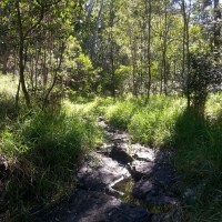
The descent from Sir Samuel Griffith Drive, down to the tributary of Cubberla Creek

The steep descent from Sir Samuel Griffith Drive, down to the tributary of Cubberla Creek

Recently, I returned to the tributary of Cubberla Creek that I wrote about here just over a month ago. I was determined to see more of it than I did on the first visit. So this time, I approached it from the top, with the aim of working my way downstream. There is no path to this creek, so I just scrambled straight down through the scrub from the side of Sir Samuel Griffith Drive, not far from the Kuta Cafe on the top of Mount Coot-tha. I soon discovered that this was a pretty dumb idea, and for one simple reason: lantana.

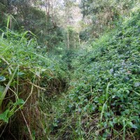
The path I carved through the lantana that covered most of the stream

A path carved through the lantana that covered most of the stream

Whoever introduced this infernal weed to this country has a lot to answer for. More than a few times, I wished it was them instead of me getting scratched to pieces as I slashed my way (with a stick!) through the thickets that covered nearly the whole length of this stream. So it was tough going, but it in the end it was worth it for the pleasure of discovering the few beautiful pockets of the creek where the lantana did not intrude. In fact, pausing in these places was all the more rewarding given the work required to find them, and knowing that in all likelihood, no-one else had stood in these places for some time (surely it can’t be that often that a fool like me stumbles down here).

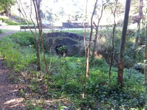
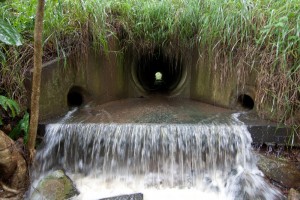
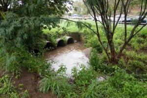
Anyway, this time I made a point of taking my camera, so I at least have something to show for this little adventure besides smartphone snaps. You can see some of the results above and blow, and there are more in this set on my flickr page. Something that interests me about this creek is the way that it abruptly ends when it disappears into a drain under the residential blocks at Ringway Place, Chapel Hill. On one side there is the creek in a near-natural state (if you can ignore the lantana), and on the other side is suburbia, in all its sanitized glory. They are two different worlds, and yet they were once the same.

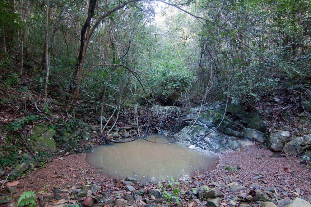
A pond in the Cubberla Creek tributary

A pond in the Cubberla Creek tributary

Seeing the past and the present in the same view like this is not so easy in Western Creek — except perhaps up in the headwaters near Tristania Drive, but let’s face it, even here you’ve got to use your imagination here to see the creek sometimes. Wouldn’t it be nice if just a little bit more had been left for us to enjoy?

The Mystery of the Cubberla Creek Campsite

Today I went up to the summit of Mount Coot-tha. It was another glorious, cloudless winter day, and while I did spend some time looking out over Brisbane while enjoying an ice cream, my main objective was to explore some of the walking tracks that begin from the summit and lead in various directions into the bush.

The Caladenia Creek

A small creek near the Lookout Trail leading from the summit of Mount Coot-tha towards Caladenia Street, Indooroopilly.

A small creek near the Lookout Trail leading from the summit of Mount Coot-tha towards Caladenia Street, Indooroopilly.

The first track I took was the Lookout Trail, which starts at the bottom of the carpark leading up to the cafe. After first following a gentle slope, this track quickly plummets at a perilously steep angle down towards Indooroopilly. The slope then eases again and the track heads along a slight ridge. To the left lies a residential estate, and to the right, a gully leading down to a rocky creek bed. The track and the creek then converge and come to an abrupt end top of Caladenia Street. The track gives way to a bitumen road, and the creek is swallowed up by a large drainpipe running beneath the road.

Where the bush becomes suburbia and the creek becomes a drain at Caladenia Street, Indooroopilly.

Where the bush becomes suburbia and the creek becomes a drain at Caladenia Street, Indooroopilly.

I’ve spent considerable time wandering around Western Creek trying to imagine what the landscape looked like before it was developed. It’s not easy to do, because so little bushland is left there except for a few patches around Government House and around Tristania Drive. But here at Caladenia Street, the before-and-after comparison couldn’t be easier. The past and the present are conveniently juxtaposed, divided neatly by a straight line. On one side there is the bush and creek, more or less as they always would have been; on the other side is the modified suburban landscape, bearing absolutely no resemblance to what it replaced.


Where the forest meets the suburb, at Caladenia Street, Indooroopilly. View Larger Map

Continue reading

When it really rains

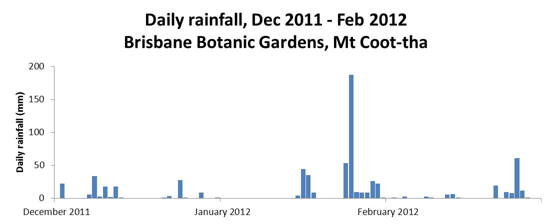
La Nina has now officially left us, and already the Bureau is watching for signs of what next summer will bring. The summer of 2011-12 certainly was wet, but for the most part it was also rather gentle. Nearly all of the 700mm or so of rain that fell in Brisbane from the start of December 2011 to the end of February 2012 was delivered in doses of less than 50mm in a day. The one marked exception to this pattern occurred in the lead-up to Australia Day, with 187mm falling in the 24 hours before 9am, 26 January 2012.

Daily rainfall at the Mt Coot-tha Botanic Gardens, December 2011 to February 2012. (Bureau of Meteorology, Climate Data Online)

Daily rainfall at the Mt Coot-tha Botanic Gardens, December 2011 to February 2012. (Bureau of Meteorology, Climate Data Online)

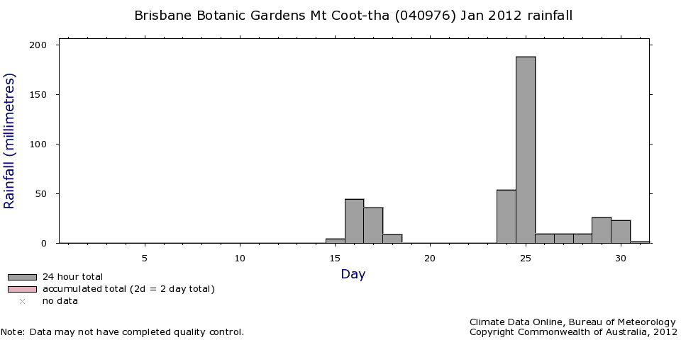
Most of that rain fell on Wednesday 25 January, and I remember watching it from the comfort of my desk at 400 George Street. As I gazed out through the floor-to-ceiling windows, I also remember thinking about how the streams at the top of Western Creek must have been gushing; I was anxious to get up there and take some photos. Having observed how quickly that part of the catchment tends to drain, I wanted to get there as soon as possible after a good fall of rain. The opportunity finally came on the morning of Sunday the 29th. The rain had eased after a fall of about 25mm overnight, so I donned my camera and my raincoat and hot-footed it up to the Weedy Wonderland at the top of Western Creek.

Daily rainfall at the Mount Coot-tha Botanic Gardens in January 2012

Daily rainfall at the Mount Coot-tha Botanic Gardens in January 2012

Needless to say, the rain resumed as soon as I got to Couldrey Street. Nursing my Canon 50D under the front zip of my raincoat, and whipping it out as briefly as I could to take photos, I trundled up the stream and through the scrub, clambering to vantage points that I’m sure no sane person would, all in the name of documenting Western Creek in full flow. Well, almost full flow, as it was clear that the water had been been significantly higher in the hours before I got there.

The results are in this gallery page, and there is a sneak preview just below.

I hope it was all worth it, because despite my efforts to dry out my camera gear when I returned home (this included a very slow bake in the oven for a couple of hours), I recently discovered that one of my lenses has succumbed to a fungal infection. And believe it or not, this lens was a replacement for another lens that met a similar fate after I dropped it (and the camera — and myself!) into the floodwaters at Torwood Street in January 2011. Folks, water and SLR cameras are not a good mix.

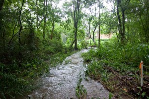
One of the streams leading to the Couldrey Street clearing, 29 January 2012

One of the streams leading to the Couldrey Street clearing, 29 January 2012

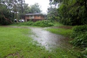
The Couldrey Street clearing, 29 January 2012

The Couldrey Street clearing, 29 January 2012


The Tristania Falls, 29 January 2012

The Tristania Falls, 29 January 2012

The drain at Norman Buchan Park, 29 January 2012

The drain at Norman Buchan Park, 29 January 2012