Detail Plans on Google Earth

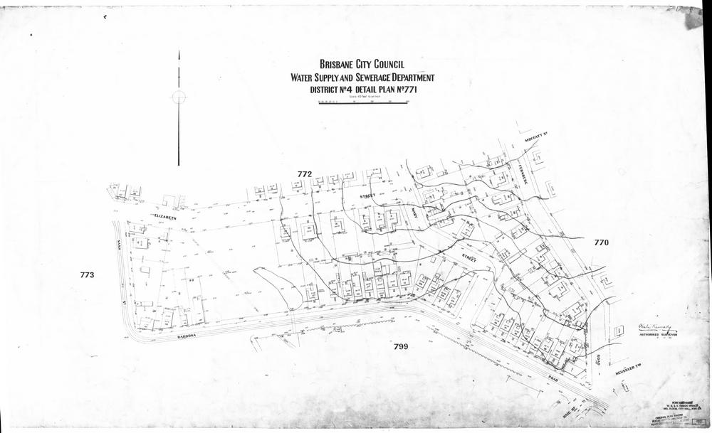
Having recently Google-Earthified several historical maps of the Milton Reach and surrounding suburbs, I thought I’d apply the same technique to some of the City Council’s ‘Detail Plans’. These plans were produced prior to sewerage being installed in Brisbane, and they depict the built environment at a much finer spatial scale than the maps I have used previously. The plans from the Milton and Rosalie areas date primarily from the 1930s, while those further up the Western Creek catchment were made later on, mainly in the 1940s. Each plan covers no more than a few blocks, as in the example below.

Detail Plan no. 771, showing the area between Baroona Road and Elizabeth Street.

Detail Plan no. 771, showing the area between Baroona Road and Elizabeth Street.

These plans show the outline of every house, down to the exact position of its front steps and out-door toilet. They also show things like house names, retaining walls, tram lines, watercourses and drains. Exploring them in Google Earth provides a fascinating way to engage with the history of our built environment.
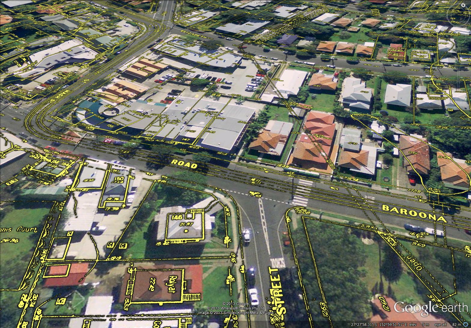
Rosalie Village as depicted on the City Council's 'Detail Plans' from the 1930s.

Rosalie Village as depicted on the City Council’s ‘Detail Plans’ from the 1930s. The concrete drain is covered except for a small section near Baroona Road. The tram line is also visible.

The complete set for Brisbane contains over 3,000 detail plans. I’ve prepared a sample of just 24 in order to explore the course of Western Creek. The results can be found on this page in the form of a gallery of Google Earth screenshots as well as a link to a file that will enable you to explore the plans directly using Google Earth. If you live in the area, you may be able to find the original outline of your own house, and even the location of the outhouse in the backyard.

Digitised versions of the original plans can be obtained from the Brisbane Images section of the City Council’s library catalogue. They are part of the collection of the Brisbane City Archives. I would particularly like to thank Annabel Lloyd from the Archives for providing me with the plans and answering my many questions about them.

Map Mania!

In several posts and pages now I have used screenshots from Google Earth showing overlays of historical maps, such as the example below.

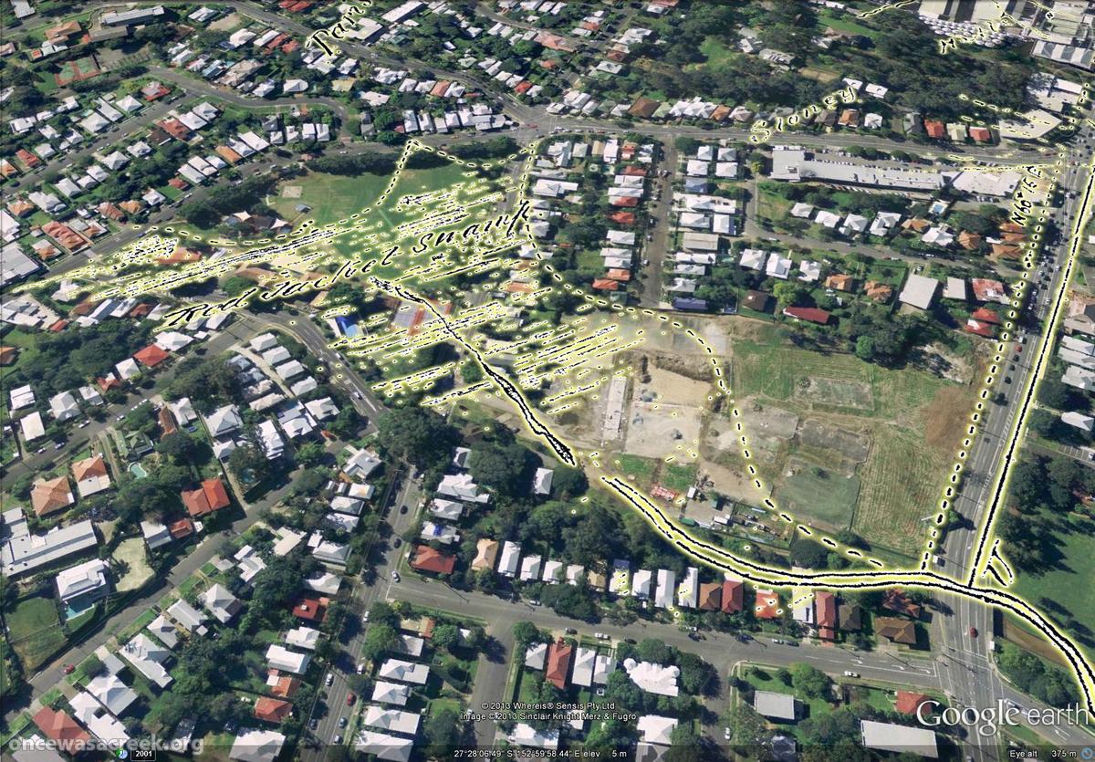
Red Jacket Swamp (now Gregory Park and Frew Park), as depicted in 1850.

Red Jacket Swamp (now Gregory Park and Frew Park), as depicted in 1850.

I have found this to be a very useful way to both explore and present these maps, and because Google Earth is freely available, I had also hoped that it would provide a way for me to share these maps with anyone else who wants to explore them. However, until now the files that I have created have been clumsy and unreliable, at times crashing Google Earth as soon as they are opened. The files were also large and inconvenient to download.

I have now worked out how to prepare the maps so that they open quickly and smoothly in Google Earth. In addition, I have managed to host the files remotely so that they can be accessed from anywhere without being downloaded in their entirety. Even better, Google now provides a ‘gadget’ for viewing the files within a web browser without even opening Google Earth!

So, I have re-packaged the most interesting maps in my collection and uploaded them so that you can explore them for your enjoyment. They can be accessed from a brand new Maps page in The Study section of the site, but for convenience the links are also listed here:

Preparing these maps so that they display clearly in Google Earth is a bit of a challenge, and to this end I’ve experimented with various colour schemes in addition to the bright yellow that I have used in these latest versions. This scheme is probably not perfect for all of the maps, but hopefully it is adequate for research and ‘exploration’ purposes.

I hope you enjoy exploring the maps. And most of all, I hope they work! Hosting Google Earth data in this way is new territory for me, so I won’t be surprised if some technical glitches occur. Please report any problems that you experience when using them.

And stay tuned… there may be more maps coming in the near future!