New site map

When I created this site, my vision was of a neat history of the Western Creek catchment. Each part of the catchment would have a page devoted to it, and each page would fit snugly within the structure of the site. But as the site has progressed I have ended up writing about a wider range of topics and locations than I anticipated. The story of Western Creek has become just one chapter within a broader story about the Milton and Toowong reaches of the Brisbane River, which in turn is part of an even broader story about suburban development in Brisbane.

Consequently, much of what I have written does not fit within the site’s page structure, and resides instead within the blog-style posts of the Newsroom. You may have noticed the tag-cloud in the newsroom that attempts to index the assortment of topics and locations discussed on the site, but if you’ve gotten much value out of it, I’ll be surprised. This site’s content is principally about locations, so it really needs a location-based index — otherwise known as a map.

So here it is: the new site map for oncewasacreek.org. You can also access it via the site’s main menu.

Each marker on the map indicates a location that I have written about somewhere on the site. If you click on a marker, you will get a list of the pages and posts that discuss it. This is the most logical and efficient way I have come up with to index the site’s contents, though it does depend on my vigilance in identifying all of the relevant pages for each location. It is entirely possible that I have missed some, in which case you can feel free to suggest some additions.

Also, if you are watching very carefully, you may notice that the Forum is no longer in the site menu. I have decided to retire the Forum, since barely anyone ever used it.

Email problems

UPDATE (15th January) — The contact form is now working, so please feel free to use it. Please note, though, that I cannot retrieve any messages that were sent while it was not working.

If you have tried to email me recently via the contact page, the chances are that I have not received your email.

I have just discovered that the site’s email feature is not working. I’m not sure how long this has been the case: a week at the least, but probably longer — possibly several weeks.

I will update this post when I have managed to resolve the problem. Until then, please to NOT use the contact form to contact me. Instead, you can:

  • post a comment at the end of a post or article
  • post a comment in The Forum
  • email me directly at angusveitch-at-gmail-dot-com (replacing ‘-at-‘ with ‘@’ and ‘-dot-‘ with ‘.’).

I sincerely apologise if you have sent me something and received no reply. I have no way of retrieving the lost emails, so I’m afraid you will need to contact me again using one of the methods above.

Fingers crossed, normal service will resume shortly.
-Angus

Page display problems

Just a quick note to acknowledge that there is evidently something wrong with how some pages on the site are displaying. No, I have not deliberately made some pages green and made random parts of the text small and unreadable.

The cause is a WordPress plugin that I use to generate footnotes, so you’ll notice the problem on pages with lots of footnotes. Unfortunately, If I disable the plugin, these pages will become unreadable for other reasons. If I can’t resolve the problem soon I will have to find another way to manage the many footnotes on the site, and this could take a lot of time.

Anyway, fingers crossed, things will be back to normal soon.

UPDATE 20/03/2013: In case anyone cares, I’ve sorted this out by switching to a different footnote plugin. The pages that were playing up seem to be working now, but it is possible that I’ve missed something, so do let me know if something looks awry.

Exploring McKellar’s map in Google Earth

The fun with maps continues…

As detailed in last week’s post, I have recently been experimenting with ways of importing historical maps into Google Earth, which enables them to be explored from a whole new perspective. I initially did this for three maps, dating from 1843, 1859 and 1864. Today I’ve done the same for another map — Sheet 7 from a series of maps drawn by the government lithographer A.R. McKellar in 1895. This map shows the Milton Reach of the river and the area to the west up to Mount Coot-tha. You can see what the original version of this map looks like at the Queensland Historical Atlas.

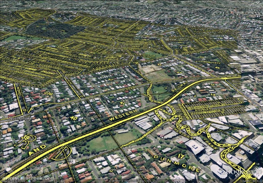
You would already be familiar with this map’s depiction of Western Creek — it is the one shown at the top of this page and all throughout this website. The picture below shows this same part of McKellar’s map in Google Earth. Dunmore Park is in the foreground, and Milton Park, Frew Park and Gregory Park can also be seen along the creek’s path.

Western Creek as depicted on McKellar's 1895 map, viewed in Google Earth.

Western Creek as depicted on McKellar’s 1895 map, viewed in Google Earth.

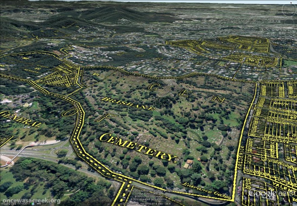
The image below shows the Toowong Cemetery. Beyond the cemetery, towards the upper right of the picture, is the area bounded by Boundary Road, Simpsons Road and Macgregor Terrace. This subcatchment of Western Creek is marked on McKeller’s map as the Lizzy Lee, Soudan and Rose Hill estates — names that all seem to have been lost, with the exception of Soudan Street. To the left of the cemetery, a ‘school reserve’ is marked on an area that is still bushland today.

The Toowong Cemetery as depicted on McKellar’s 1895 map. Further in the distance are the Lizzy Lee, Soudan and Rose Hill estates.

The Toowong Cemetery as depicted on McKellar’s 1895 map. Further in the distance are the Lizzy Lee, Soudan and Rose Hill estates.

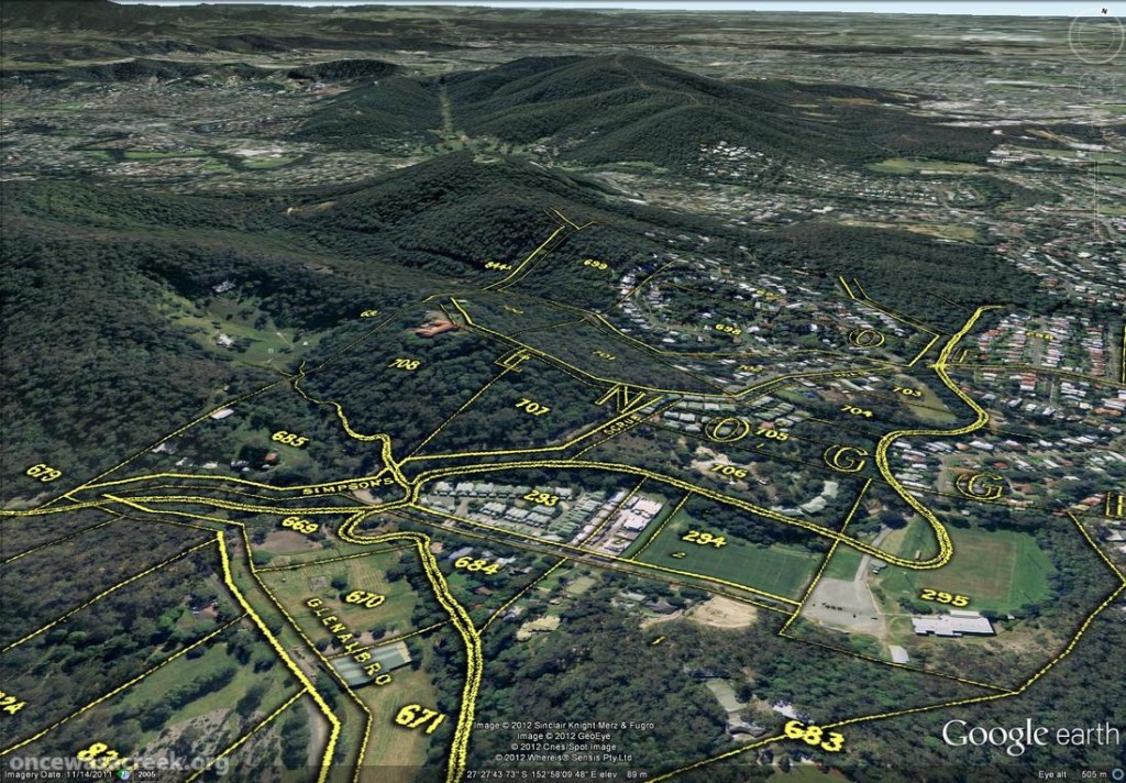
McKellar’s map also depicts part of Ithaca Creek, the catchment of which neighbours the Western Creek catchment. The picture below shows two branches of Ithaca Creek meeting near Carwoola Street. In the immediate foreground, under the name ‘Glenalbro’, you can see the roof of the old Freers chip factory. At the lower-right of the picture is Purtell Park, and right on top of it is the creek as it appears in McKellar’s map. I’ve know this spot for all of my life, but I never realised until now that the path of the creek had been changed to make way for the park.

Part of Ithaca Creek as depicted on McKellar's 1895 map. At the lower-right of the picture, the old path of the creek can be seen over Purtell Park.

Part of Ithaca Creek as depicted on McKellar’s 1895 map. At the lower-right of the picture, the old path of the creek can be seen over Purtell Park.

To explore McKellar’s map for yourself, all you need to do is download either of the following files and open it in Google Earth (you will need to download and install Google Earth first if you haven’t already). The first file shows McKellar’s map features in yellow but without any shadow effect. The second file is the same, but includes the shadow effect that you can see in the images above. The first file is much smaller and will load quicker, but some features on the map will not be as easy to see without the shadow.

Have fun!