Brisbane,1946… on Google Earth!

As a certain amply-sized entrepreneur of self-branded cleaning products used to say, “I’m excited!”

I’m excited because I’ve just made a new gallery featuring aerial imagery from 1946 (the earliest of Brisbane, as far as I know) as you’ve never1 seen it before: in Google Earth!

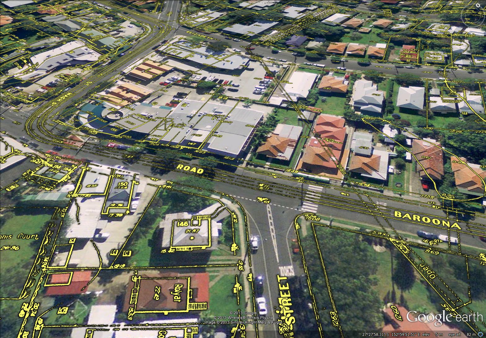
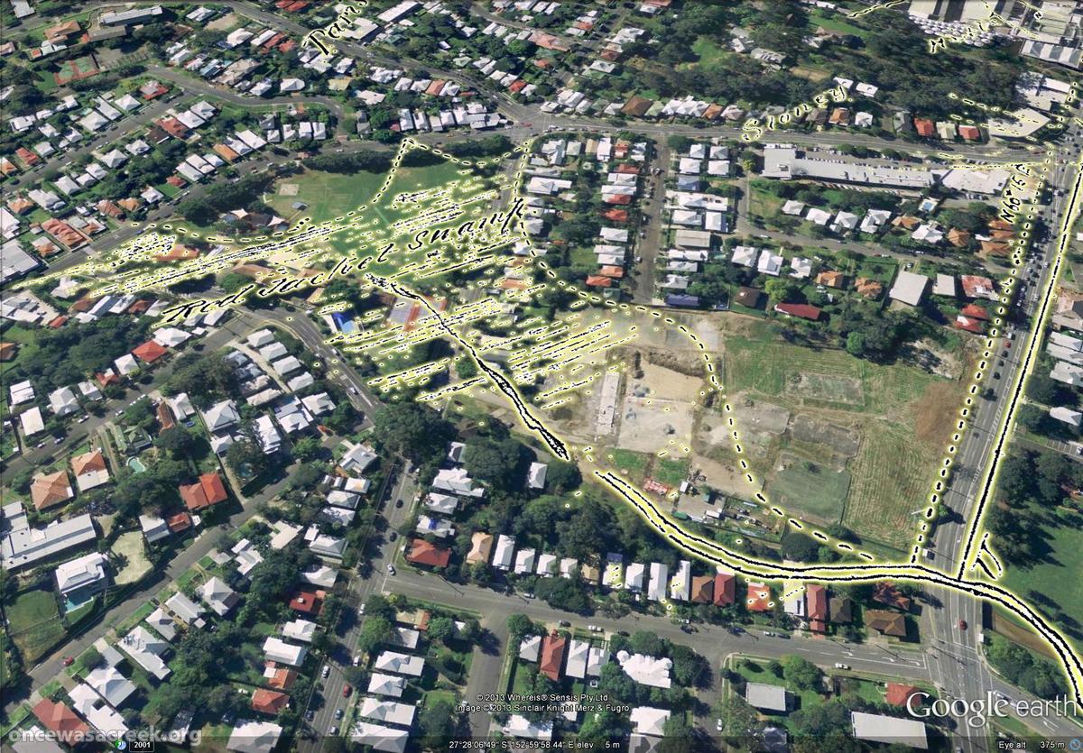
Even better, you can see the difference between then and now just by hovering your cursor over the images — try it on the example below, which shows Norman Buchan Park and the Government House grounds. (If you are using a smartphone or tablet, try tapping the image and then tapping a blank space around it.)


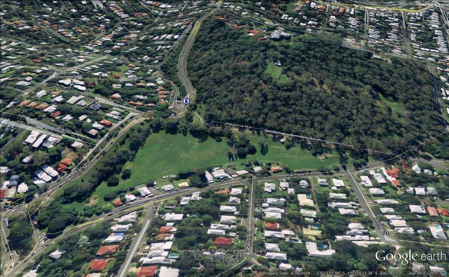
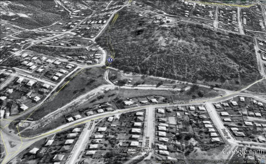
With just the wave of your mouse you can see where the trees have grown, where the bush has been cleared, where the drains have been covered, and much more. All in all, I think this is pretty nifty. Don’t forget to visit the gallery for more images like this one.

One thing these images don’t convey is the experience of actually navigating through 1946 Brisbane in Google Earth. I can tell you that it’s bloody marvellous. And when you see it, you realise that this is where these images belong: on a publicly accessible platform that enables them to be explored from any angle and in conjunction with other spatial information.

But it’s not my business to host these images, and if I did so I would probably be breaching some piece of fine print or another. That is the business of the custodian of this imagery, which I presume is the Brisbane City Council. They have the full dataset already geo-aligned, ready to go. (I, on the other hand, had to stitch together dozens of separate screengrabs from PDOnline, and align them myself using GIS software before converting them into Google Earth’s native format.)

There is a precedent for doing this. The State Government’s Queensland Globe initiative has created a framework that would readily accommodate the 1946 imagery. Queensland Globe (and the open data strategy of which it is a part) is a giant leap in the right direction for making the state’s spatial data publicly accessible. By downloading a single file that opens in Google Earth, you can access various additional layers of information including property and suburb boundaries, land tenure, and an alternative set of aerial images. More layers will — I hope — be added soon.

Queensland Globe would be a natural home for historical aerial imagery such as the 1946 series of Brisbane. Or perhaps the council can create a similar initiative of their own. I don’t really care how it is done. I just hope that before long, you’ll be able to see images like these somewhere other than my humble website.

Notes:

  1. If you have already seen it like this, I want to know where!

Detail Plans on Google Earth

Having recently Google-Earthified several historical maps of the Milton Reach and surrounding suburbs, I thought I’d apply the same technique to some of the City Council’s ‘Detail Plans’. These plans were produced prior to sewerage being installed in Brisbane, and they depict the built environment at a much finer spatial scale than the maps I have used previously. The plans from the Milton and Rosalie areas date primarily from the 1930s, while those further up the Western Creek catchment were made later on, mainly in the 1940s. Each plan covers no more than a few blocks, as in the example below.

Detail Plan no. 771, showing the area between Baroona Road and Elizabeth Street.

Detail Plan no. 771, showing the area between Baroona Road and Elizabeth Street.

These plans show the outline of every house, down to the exact position of its front steps and out-door toilet. They also show things like house names, retaining walls, tram lines, watercourses and drains. Exploring them in Google Earth provides a fascinating way to engage with the history of our built environment.

Rosalie Village as depicted on the City Council's 'Detail Plans' from the 1930s.

Rosalie Village as depicted on the City Council’s ‘Detail Plans’ from the 1930s. The concrete drain is covered except for a small section near Baroona Road. The tram line is also visible.

The complete set for Brisbane contains over 3,000 detail plans. I’ve prepared a sample of just 24 in order to explore the course of Western Creek. The results can be found on this page in the form of a gallery of Google Earth screenshots as well as a link to a file that will enable you to explore the plans directly using Google Earth. If you live in the area, you may be able to find the original outline of your own house, and even the location of the outhouse in the backyard.

Digitised versions of the original plans can be obtained from the Brisbane Images section of the City Council’s library catalogue. They are part of the collection of the Brisbane City Archives. I would particularly like to thank Annabel Lloyd from the Archives for providing me with the plans and answering my many questions about them.

Map Mania!

In several posts and pages now I have used screenshots from Google Earth showing overlays of historical maps, such as the example below.

Red Jacket Swamp (now Gregory Park and Frew Park), as depicted in 1850.

Red Jacket Swamp (now Gregory Park and Frew Park), as depicted in 1850.

I have found this to be a very useful way to both explore and present these maps, and because Google Earth is freely available, I had also hoped that it would provide a way for me to share these maps with anyone else who wants to explore them. However, until now the files that I have created have been clumsy and unreliable, at times crashing Google Earth as soon as they are opened. The files were also large and inconvenient to download.

I have now worked out how to prepare the maps so that they open quickly and smoothly in Google Earth. In addition, I have managed to host the files remotely so that they can be accessed from anywhere without being downloaded in their entirety. Even better, Google now provides a ‘gadget’ for viewing the files within a web browser without even opening Google Earth!

So, I have re-packaged the most interesting maps in my collection and uploaded them so that you can explore them for your enjoyment. They can be accessed from a brand new Maps page in The Study section of the site, but for convenience the links are also listed here:

Preparing these maps so that they display clearly in Google Earth is a bit of a challenge, and to this end I’ve experimented with various colour schemes in addition to the bright yellow that I have used in these latest versions. This scheme is probably not perfect for all of the maps, but hopefully it is adequate for research and ‘exploration’ purposes.

I hope you enjoy exploring the maps. And most of all, I hope they work! Hosting Google Earth data in this way is new territory for me, so I won’t be surprised if some technical glitches occur. Please report any problems that you experience when using them.

And stay tuned… there may be more maps coming in the near future!

Floods aniversary special

Two years ago today, Rosalie and many other parts of Brisbane were underwater. Any misconceptions we had about the power of Wivenhoe Dam to save us from ever being flooded again were swept away, and before long, attention turned to what, if anything, we could do to stop this from happening again.

In a post in The Forum (actually the first!), a visitor named Barry noted that the Council plans to install a floodgate at the mouth of Western Creek (Milton Drain) to mitigate future flooding in Milton and Auchenflower. As in many other parts of Brisbane in January 2011, the floodwaters that inundated the Western Creek catchment did not spill over the riverbanks, but entered instead via the stormwater drains that discharge to the river. The diagram below, taken from the Council’s fact sheet on backflow flooding, illustrates how this kind of flooding occurs.

Concept diagram of backflow flooding, taken from the Brisbane City Council's <a href="http://www.brisbane.qld.gov.au/downloads/environment_waste/water/Backflow%20Fact%20Sheet%20June%202012.pdf">factsheet</a>.

Concept diagram of backflow flooding, taken from the Brisbane City Council’s factsheet.

The Council has indeed stepped up to the plate and has already started building backflow prevention devices in Milton and elsewhere. And among the areas that have been flagged for future attention is the mouth of Western Creek.

This is a laudable idea, but the Council can hardly claim credit for it. The idea of using floodgates to protect Milton and Rosalie has been doing the rounds for over a century. In a new page entitled Backflow to the Future, or: How we learned to stop worrying and love the floods, I present a retrospective of these past proposals, courtesy of newspaper clippings from The Brisbane Courier and The Courier Mail that I have found while trawling through Trove.

The title of the essay is strictly tongue-in-cheek, and I’ll admit, downright cheeky. I’m not suggesting for a minute that we really enjoy the floods, and I don’t want to offend anyone who has suffered from them. But I do hope to put into stark focus the question of why, after all these years, we have not adopted such simple measures as floodgates to ease the pain. And I confess, the temptation to structure an essay around Dr Strangelove was just too much for me to resist.

I hope you enjoy the new page. It has been a fascinating journey to write.

-Angus

Picturing the past

If a picture says a thousand words, then today’s post should more than compensate for the lack of writing that I’ve done in recent weeks.

For a while now I have been collecting any historical photographs I can find of The Western Creek catchment and surrounding area. So far these are limited to those that have already been catalogued and digitised by the State Library of Queensland, the Queensland State Archives, the Brisbane City Council and the National Library of Australia. I like to think that there are still some more old photos out there, waiting to be dusted off and contributed to collections like these.

Rather than just post the photos I’ve collected into a standard gallery, I’ve done my best to determine where they were taken so that they can be put onto a map. The resulting map will live on this page under The Gallery, but the smaller version below provides a sneak-peak. You can navigate the map and click on the photos to view them.


View Western Creek History in a larger map

An open drain in a backyard at Ellena Street, c1905. (State Library of Queensland, Image no. 47486)

An open drain in a backyard at Ellena Street, c1905. (State Library of Queensland, Image no. 47486)

Among the highlights is the photo below from 1905, which shows a very sad and sorry looking creek bed flowing (according to the original caption) between Fernberg Road and Beck Street (then known as Mary Street). I suspect it was taken not far from Ellena Street, looking up towards Fernberg Road and Given Terrace. This creek bed could very well be the main channel of Western Creek. Another photo (see right) shows an open drain in a backyard in Ellena Street; I suspect this is also the main channel of Western Creek, just metres upstream of the other photo. Alternately, one or both photos could be of a tributary to the main channel. Whichever the case, these pictures neatly capture the fate of many waterways like Western Creek that stood in the path of early development. Besides these, I know of no other photos depicting the original channel of Western Creek.

Old creek bed running between Fernberg Road and Mary Street, Paddington, ca. 1905. (State Library of Queensland, Negative no. 47487)

Old creek bed running between Fernberg Road and Mary Street, Paddington, ca. 1905. (State Library of Queensland, Negative no. 47487)

The Langsville Bridge at Auchenflower, ca. 1914. John Oxley Library, State Library of Queensland, Neg: 10579.

The Langsville Bridge at Auchenflower, ca. 1914. John Oxley Library, State Library of Queensland, Neg: 10579.

Also on the map are several photos of the River Road (Coronation Drive), including some of the bridge over Langsville Creek, which flowed through what is now Moorlands Park. Or perhaps some of these show the bridge over Western Creek instead — I confess that in some cases I am not sure, and I don’t trust some of the original captions either!

There are lots more that I could talk about, but instead I’ll leave you to explore the map yourself. If you spot a photo that you think is out of place, please let me know. And if you know of any photos that are not included, particularly from sources other than the ones I have used, I would love to see them.

Floods

1893 flood taken from the Rosalie Torwood area looking towards old Bishopsbourne. (State Library of Queensland, Image number: 6288-0001-0001)

1893 flood taken from the Rosalie Torwood area looking towards old Bishopsbourne. (State Library of Queensland, Image number: 6288-0001-0001)

Not surprisingly, many of the surviving historical photos of this area were taken during floods, including those that occurred in 1890, 1893 and 1930. Several of these are on the map, but there are several others whose locations I have been unable to determine. I’ll make these the topic of a separate page or post in the near future.