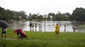
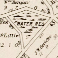
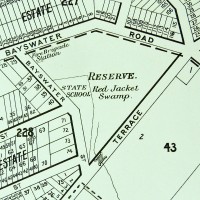
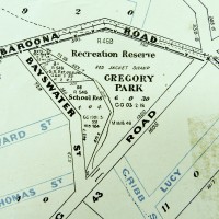
At about 10.30am on Saturday morning, a freak storm raced through Brisbane. The rain was so heavy that parts of Gregory Park went underwater, bringing back memories of the lead-up to the 2011 flood and reminding us again of this park’s swampy origins. Unfortunately I was not in a position to take any photos, given that I was viewing the scene through the window of an ambulance, having just broken my wrist after slipping on the flooded kitchen floor. But that’s another story.
Unlike in 2011, the water in Gregory Park on Saturday came not from the rising river (though the high tide certainly played a role), but from the stormwater racing through the catchment upstream. It’s easy to forget how much water gets channeled through the drains that are tucked away beneath our roads, footpaths and backyards. The fact that we so rarely think about them is a testament to how well these drains have been engineered: they’ve been sized to the right capacity, built to the correct gradient and constructed to withstand the pressure of the gushing water.
But that’s not to say that our drains were all built right the first time around. In the pages of The Brisbane Courier from the late 1800s and early 1900s there is no shortage of Council minutes and letters to the editor complaining of ineffective, faulty and smelly drains. And as you can read in this brand new page contributed by Steven Cowley, some drains in the area were still a work in progress even as late as the 1970s. Steven has recorded some wonderful stories recalled by his friend Rhonda, who grew up in Herbert Street in the 1970s. A brick drain used to run through Rhonda’s backyard, and in heavy rain the drain would often burst, sending geysers of water into the air. This was no doubt an exciting spectacle for a child, but a big nuisance for the council workers (and sometimes Rhonda’s father) who had to repair the damage.
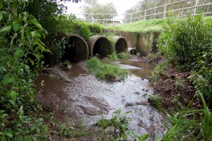
The drain pit in Norman Buchan Park, after rain. This was once a favourite spot for the kids of the neighbourhood.
In drier times, the neighbourhood drains were also a place of exploration and discovery for Rhonda and her friends. The big pit in Norman Buchan Park was teeming with guppies, tadpoles, and even eels (I can verify that there are still eels in this drain!). The boys, being somewhat more adventurous — and much less sensible — than the girls, ventured some distance into the drain, getting as far as Gregory Park before the water got too deep and smelly. Rhonda now acknowledges how dangerous all this was, and advises against anyone doing it today. I find it interesting though, that without a creek to explore, kids often turn to the next closest thing: the drain that replaced it.
Rhonda also remembers the lower end of Western Creek before the old bridge was replaced and the banks were concreted over. ‘It used to be a place where you could sit’, she recalls. You could even catch a fish or crab for dinner.
The new page is called Guppies & geysers: memories of playing around and under Paddington in the 1970s. I am hoping that Rhonda’s stories will be familiar to some of you. I get the impression that exploring the drains in Norman Buchan Park was once something of a rite of passage for kids in this neighbourhood. Or perhaps you remember the old bridge and creek banks where Western Creek met the river. If you have any stories to tell or memories to share, I’d love to hear from you.

