Dipping into the history of Norman Creek

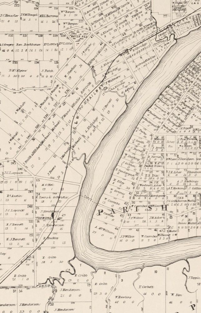
It’s always good to learn that you are not alone in pursuing a particular passion. It’s a welcoming sign that you might not be crazy after all, or that if you are, you are at least in good company. The history of Brisbane’s creeks (extinct or otherwise) is not a topic that has received a lot of attention. This is, I’ll admit, partly why the topic appealed to me. But at the same time, I liked to believe that I wasn’t the only one spending so much time thinking about it.

This is why I was delighted to meet Trish FitzSimons and learn about her research into Norman Creek. Trish is a documentary film maker and social historian who has made two beautiful short films exploring Norman Creek and its place in the lives of people who have lived, and worked and played on its waters, its shores and its floodplain.

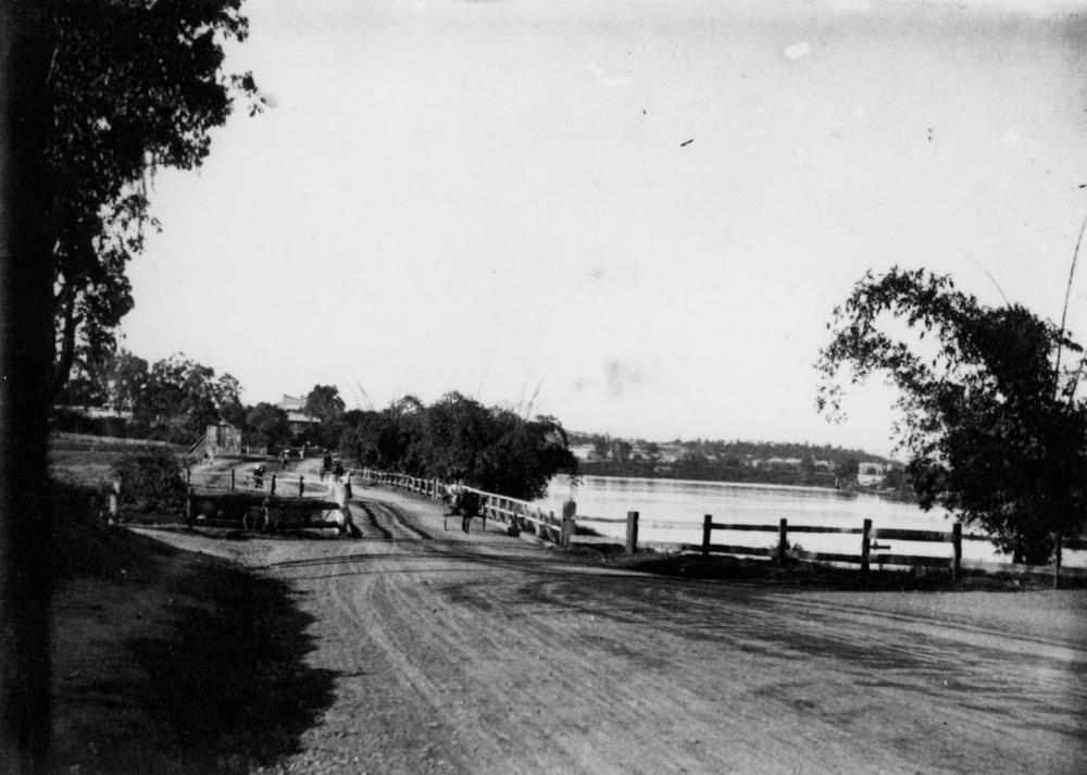
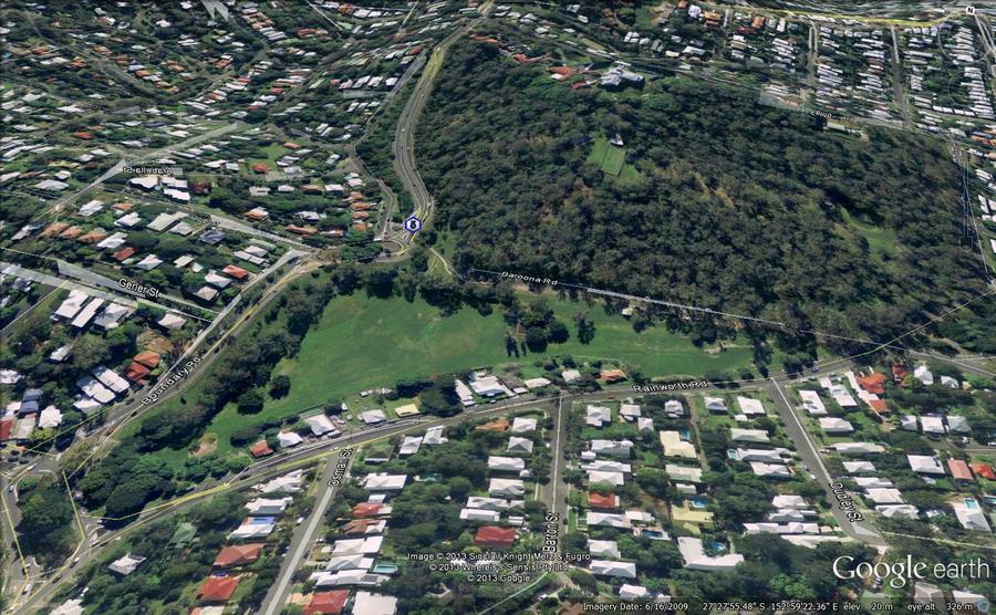
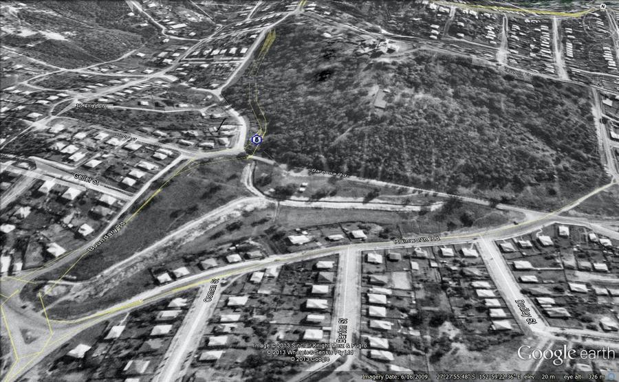
Unlike Western Creek, Norman Creek is not just a faded memory. It is still very much alive and flowing — at least in parts. Its mangrove-flanked lower reaches meander through the suburbs of East Brisbane, Norman Park and Coorparoo, but its catchment area extends all the way up to the slopes of Mount Gravatt.

The catchment area of Norman Creek.

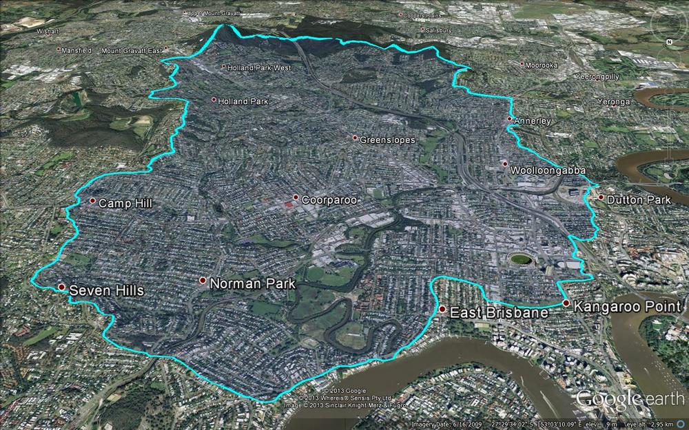
The catchment area of Norman Creek. (Catchment boundary obtained from this map created by the Norman Creek Catchment Coordinating Committee.)

This is a creek that has seen its fair share of use, abuse, transformation and rejuvenation over the years. And yet its story, so rich in both social and natural history, is probably all but unknown to the many people who walk past or drive over it every day. Trish’s two films — Time and Tide: The Life of Norman Creek and Time and Tide: The Boat Builders of Norman Creek — reveal how the creek has supported industry, provided livelihoods, even inspired poetry. The films also highlight how the creek has in turn been shaped and transformed over the years by a community grappling with the legacy of floodplain development.

You can watch Trish’s films via the links on this page of the website of the Norman Creek Catchment Coordinating Committee. The films were made using support from the Lord Mayor’s ‘Helen Taylor bequest for Local History’, and they are an important contribution to the story of our city. Yet at the same time, they are but tantalising sips from a much deeper pool of history that is waiting to be explored. Trish tells me that she has many more stories to tell about Norman Creek, and that they might even feature in a public exhibition somewhere down the line. I can’t wait to dive in!

Correction – Langsville Creek catchment area

Just a quick note to mention that I have just updated the recent post about the catchments of the Crescent Reach to include a revised outline of the Langsville Creek catchment.

My first attempt at mapping that catchment omitted an area between (roughly) Ascog Terrace and Kensington Terrace, and including Toowong Village. I thought this might have been a separate catchment that discharged straight to the river, but closer inspection showed that it was actually a subcatchment of Langsville Creek. The give-away was the fact that one of the branches of Langsville Creek as depicted on the map from 1859 reached a good distance into this area.

So, Toowong Village is part of the Langsville Creek catchment after all (in fact I suspect it was built right on top of a watercourse), and the area of the catchment is about 3.3 km2 rather than the 2.7 km2 that I think I estimated the first time around.

I have also updated the kmz file that you can use in Google Earth to explore the catchments.

The catchments of the Crescent Reach

This post was updated on 24 May 2013 to include a revised outline of Langsville Creek catchment.

The Milton/Toowong Reach of the Brisbane River, depicted on a map from 1884.

The Milton/Toowong Reach of the Brisbane River, depicted on a map published in 1884

One of the first things I did when I created this website was to map out the catchment of Western Creek. While Western Creek has remained my focus, I have increasingly spent time thinking and writing about its neighbouring catchments as well, especially its three ‘sister’ catchments along what John Oxley called the Crescent Reach: Boundary Creek, Langsville Creek and Toowong Creek. These creeks are visible in several old maps, such as the one shown to the right, which dates from 1884.1

I figured that it was about time to put these other catchments onto a map. So, I fired up ArcMap, fed it some digital elevation data and eventually coaxed out of it the catchment boundaries. And of course, I then loaded them into Google Earth. The image below shows, from left to right, the catchments of Toowong Creek, Langsville Creek, Western Creek and Boundary Creek. (I haven’t mapped out the streams of the other catchments — that can wait for another day.)

The catchments of the Crescent Reach. From left to right: Toowong Creek, Langsville Creek, Western Creek and Boundary Creek.

The catchments of the Crescent Reach. From left to right: Toowong Creek, Langsville Creek, Western Creek and Boundary Creek.

The precision of these boundaries is limited by the data used to create them, and you can tell by their jagged shapes that they are only approximations. Defining these boundaries can get particularly tricky as you get closer to the river, where the terrain is relatively flat.

But these boundaries don’t have to be perfect in order to be useful. The most interesting thing that they convey is the overall shape and size of the four catchments. At a glance, we can see that Boundary Creek is the smallest, while Toowong Creek and Western Creek are the largest. Using my GIS software, I calculated the catchment areas as follows:

Western Creek: 4.1 km2
Toowong Creek: 3.9 km2
Langsville Creek: 3.3 km2
Boundary Creek: 1.5 km2

I was surprised to discover that the Toowong Creek and Western Creek catchments are about the same size. I had always assumed that Toowong Creek was larger, and that this might be one reason why it (mostly) survived while Western Creek was (mostly) obliterated. But since their catchments are about the same size, their streams (at least in the lower reaches) should also have been comparable. Does this mean that we can use Toowong Creek as a reference point to tell us what Western Creek might have been like? Maybe, maybe not, as I suspect you would have to account for any notable differences in the geology, vegetation, topography and overall shape of the two catchments first. It is an interesting prospect, though.

Over the hill and far away

All four of these catchments share their uppermost boundaries with another catchment: that of Ithaca Creek. Ithaca Creek begins in the slopes of Mount Coot-tha and flows through Bardon, Ashgrove and Red Hill, where it meets its ‘parent’ stream, Enoggera Creek. The catchments of Ithaca Creek and Enoggera Creek are both shown in the image below, along with the four catchments of the Crescent Reach.

The four catchments of the Crescent Reach along with the larger catchments of Ithaca Creek and Enoggera Creek.

The four catchments of the Crescent Reach along with the larger catchments of Ithaca Creek and Enoggera Creek.

Ithaca Creek’s catchment covers an area of 11 km2 — almost as much as the four Crescent Reach catchments combined. But it too is dwarfed by the catchment of Enoggera Creek, which covers about 76 km2 (including Ithaca Creek, which is one of its tributaries) and extends all the way up through The Gap and into the D’Aguilar Range. No wonder Enoggera Creek was chosen to provide Brisbane’s first large-scale water supply.

And the rest of Brisbane? It could be mapped like this, too. In fact, I’d be surprised if the council hasn’t done it already, since these same catchments would delineate the networks of sewers and stormwater drains that the council maintains. And of course, where notable creeks still exist, their catchments will have been mapped to support monitoring and management initiatives such as Healthy Waterways. I hope that at some stage, this information will be made available for people to explore through Google Earth or similar platforms.

For now, you’ll have to make do with the six catchments I’ve discussed above. If you have installed Google Earth, then you can explore them yourself by opening (or downloading then opening) this file.

Notes:

  1. This map was produced by the Surveyor General’s Office in 1884. It is called ‘Moreton 20 chains to an inch, Sheet 1B’. It is held by the National Library of Australia, and is avaialble via Trove.

Uncovering Langsville Creek — Part 1

This is the first in a series of posts about Langsville Creek, which was Western Creek’s upstream neighbour on the Toowong/Milton Reach. I do not intend to research Langsville Creek fully at this stage, as I have too much still to learn about Western Creek. But I couldn’t resist tracing the path of this (mostly) lost creek and seeing what can be learned by looking at the some of the old maps and aerial photographs. Each post will look at a different part of Langsville Creek. This one focuses on the lowest reaches of the creek, near where it met the Brisbane River. You can also now read Part 2 and Part 3 of the series.

The meanders of Moorlands

Toowong Cemetery … Anzac Park … the Mount Coot-tha Botanical Gardens … Quinn Park … the McIlwraith Croquet Club … Toowong Memorial Park … Moorlands Park.

What do all of these places have in common? The answer is a creek. Not a creek you are likely to have seen or heard of, for there are few traces of it left today. But there once was a creek that flowed through all of these locations.

The creek uniting these locations was known to early Brisbanites as Langsville Creek, though I imagine that it also had names given to it by the Turrbal people long before Europeans arrived. I’ve not read up on how and when it came to be known as Langsville Creek, but given that just about everything else in this part of Brisbane is named after John Dunmore Lang, I’m going to take a punt and guess that this creek was as well.

Langsville Bridge at Auchenflower, ca.1910. (State Library of Queensland, Negative no. 118279)

Langsville Bridge at Auchenflower, ca.1910. (State Library of Queensland, Negative no. 118279)

You can see Langsville Creek — or at least part of it — on the early maps of Brisbane. It’s depicted most clearly on McKellar’s 1895 map, the relevant portion of which is reproduced below. The creek itself is unnamed on this map, except by way of the bridge that crosses it where Patrick Lane meets the River Road (now Coronation Drive). The creek looks rather like an outgrowth of the river, as if the river has put out tentacles or feelers, each one meandering through the landscape much as the river winds its way to the bay. The land surrounding it appears to be mostly undeveloped, presumably because it was damp and flood-prone.

Continue reading

Brisbane,1946… on Google Earth!

As a certain amply-sized entrepreneur of self-branded cleaning products used to say, “I’m excited!”

I’m excited because I’ve just made a new gallery featuring aerial imagery from 1946 (the earliest of Brisbane, as far as I know) as you’ve never1 seen it before: in Google Earth!

Even better, you can see the difference between then and now just by hovering your cursor over the images — try it on the example below, which shows Norman Buchan Park and the Government House grounds. (If you are using a smartphone or tablet, try tapping the image and then tapping a blank space around it.)


With just the wave of your mouse you can see where the trees have grown, where the bush has been cleared, where the drains have been covered, and much more. All in all, I think this is pretty nifty. Don’t forget to visit the gallery for more images like this one.

One thing these images don’t convey is the experience of actually navigating through 1946 Brisbane in Google Earth. I can tell you that it’s bloody marvellous. And when you see it, you realise that this is where these images belong: on a publicly accessible platform that enables them to be explored from any angle and in conjunction with other spatial information.

But it’s not my business to host these images, and if I did so I would probably be breaching some piece of fine print or another. That is the business of the custodian of this imagery, which I presume is the Brisbane City Council. They have the full dataset already geo-aligned, ready to go. (I, on the other hand, had to stitch together dozens of separate screengrabs from PDOnline, and align them myself using GIS software before converting them into Google Earth’s native format.)

There is a precedent for doing this. The State Government’s Queensland Globe initiative has created a framework that would readily accommodate the 1946 imagery. Queensland Globe (and the open data strategy of which it is a part) is a giant leap in the right direction for making the state’s spatial data publicly accessible. By downloading a single file that opens in Google Earth, you can access various additional layers of information including property and suburb boundaries, land tenure, and an alternative set of aerial images. More layers will — I hope — be added soon.

Queensland Globe would be a natural home for historical aerial imagery such as the 1946 series of Brisbane. Or perhaps the council can create a similar initiative of their own. I don’t really care how it is done. I just hope that before long, you’ll be able to see images like these somewhere other than my humble website.

Notes:

  1. If you have already seen it like this, I want to know where!