
I’ve expressed previously my enthusiasm for old maps. The older they are, the more they tend to reveal about the original landscape.
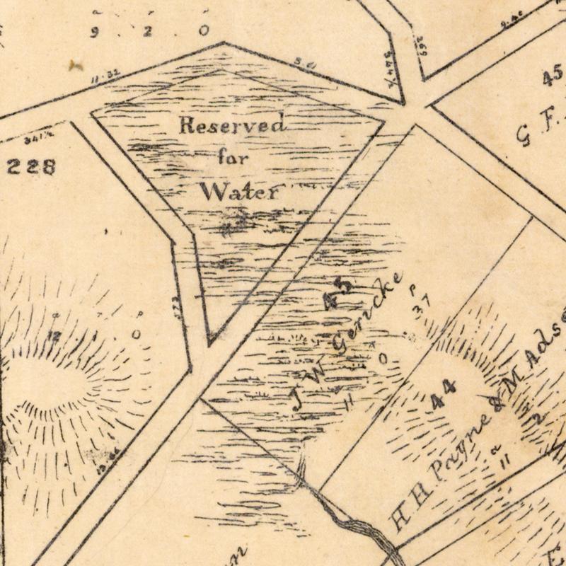
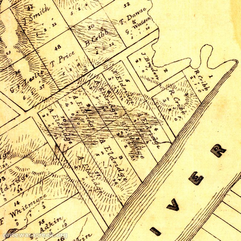
Until recently, the oldest map that I had found of the Milton area dated back to 1859. That map (‘Plan of Portions 203 to 257 in the Environs of Brisbane, Parish of Enoggera, County of Stanley, New South Wales) covers the area between Boundary Creek (which flowed between Cribb Street and Boomerang Street) and Toowong Creek. It depicts several features I had not seen on other maps, such as Red Jacket Swamp spilling over into Frew Park (later maps just show it covering Gregory Park) and a large lagoon between Cribb Street and Park Road.
But now I have an even older one, courtesy of Magnus, who writes the blog ‘A House in Auchenflower‘. Magnus went digging in the Queensland Museum of Lands, Mapping and Surveying and struck gold in the form of the map you see below.
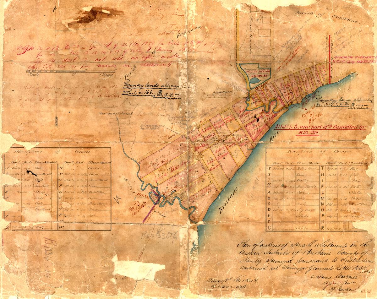
Surveyor James Warner’s plan of the Milton area in 1850, held by the Queensland Museum of Lands, Mapping and Surveying (B1234 14).
This map looks old enough to have fallen off a pirate ship. The various annotations on it show that it has been used and re-used for various purposes, and at different times, but the original drawing appears to date from 1850, when the assistant surveyor-general, James Warner, surveyed the area. Warner’s description of the map appears at the bottom-right corner: Continue reading