Guppies & Geysers – Stories from the drains of Western Creek

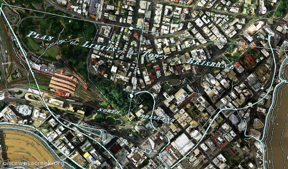
At about 10.30am on Saturday morning, a freak storm raced through Brisbane. The rain was so heavy that parts of Gregory Park went underwater, bringing back memories of the lead-up to the 2011 flood and reminding us again of this park’s swampy origins. Unfortunately I was not in a position to take any photos, given that I was viewing the scene through the window of an ambulance, having just broken my wrist after slipping on the flooded kitchen floor. But that’s another story.

Gregory Park starts to fill (January 11, 2011)

Gregory Park starts to fill (January 11, 2011)

Unlike in 2011, the water in Gregory Park on Saturday came not from the rising river (though the high tide certainly played a role), but from the stormwater racing through the catchment upstream. It’s easy to forget how much water gets channeled through the drains that are tucked away beneath our roads, footpaths and backyards. The fact that we so rarely think about them is a testament to how well these drains have been engineered: they’ve been sized to the right capacity, built to the correct gradient and constructed to withstand the pressure of the gushing water.

But that’s not to say that our drains were all built right the first time around. In the pages of The Brisbane Courier from the late 1800s and early 1900s there is no shortage of Council minutes and letters to the editor complaining of ineffective, faulty and smelly drains. And as you can read in this brand new page contributed by Steven Cowley, some drains in the area were still a work in progress even as late as the 1970s. Steven has recorded some wonderful stories recalled by his friend Rhonda, who grew up in Herbert Street in the 1970s. A brick drain used to run through Rhonda’s backyard, and in heavy rain the drain would often burst, sending geysers of water into the air. This was no doubt an exciting spectacle for a child, but a big nuisance for the council workers (and sometimes Rhonda’s father) who had to repair the damage.

The drain pit in Norman Buchan Park, after rain. This was once a favourite spot for the kids of the neighbourhood.

The drain pit in Norman Buchan Park, after rain. This was once a favourite spot for the kids of the neighbourhood.

In drier times, the neighbourhood drains were also a place of exploration and discovery for Rhonda and her friends. The big pit in Norman Buchan Park was teeming with guppies, tadpoles, and even eels (I can verify that there are still eels in this drain!). The boys, being somewhat more adventurous — and much less sensible — than the girls, ventured some distance into the drain, getting as far as Gregory Park before the water got too deep and smelly. Rhonda now acknowledges how dangerous all this was, and advises against anyone doing it today. I find it interesting though, that without a creek to explore, kids often turn to the next closest thing: the drain that replaced it.

Rhonda also remembers the lower end of Western Creek before the old bridge was replaced and the banks were concreted over. ‘It used to be a place where you could sit’, she recalls. You could even catch a fish or crab for dinner.

The new page is called Guppies & geysers: memories of playing around and under Paddington in the 1970s. I am hoping that Rhonda’s stories will be familiar to some of you. I get the impression that exploring the drains in Norman Buchan Park was once something of a rite of passage for kids in this neighbourhood. Or perhaps you remember the old bridge and creek banks where Western Creek met the river. If you have any stories to tell or memories to share, I’d love to hear from you.

Once upon a time in the west

The Milton area, as depicted on a map from 1859 as depicted on a map from 1859 (Queensland State Archives, Item ID620656), overlaid on Google Maps.

The Milton area, as depicted on a map from 1859 as depicted on a map from 1859 (Queensland State Archives, Item ID620656), overlaid on Google Maps.

I’ve finally finished a new page about the early estates of Milton.

This page focuses on the early land divisions in the Milton area, and the houses and farms built on them by the early landowners. It also goes back a bit further, touching on Brisbane’s beginnings as a penal settlement, and further still, revisiting John Oxley’s discovery of fresh water at Western Creek in 1824.

I’ve tried to bring the story to life with some historical photos of the Milton area from the State Library’s collection, as well as a wonderful account of the view from the River Road written by a contributor to the Moreton Bay Courier in 1859. I’ve also had some more fun with maps, combining features from a map from 1859 with modern-day aerial photos to show the early land holdings.

I intend to follow this page up with one looking at the subdivision of these early holdings into residential estates. To that end, I’ve already spent longer than I ever imagined possible reading 150-year-old real estate columns. The results, I hope, will appear in the not-too-distant future; but as usual, I would not recommend holding your breath!

Panorama from Dunmore Terrace, 1910. (State Library of Queensland, Negatives 183958, 183967 and 183958 and 183967)

Panorama from Dunmore Terrace, 1910. Chasely Street is on the right, running between the block where Chasely Apartments now stand, and the Moorlands Estate (now the Wesley Hospital) (State Library of Queensland, Negatives 183967, 183958 and 183970)

Fun with maps

Western Creek as depicted on a map from 1859 (Queensland State Archives Item ID620656) overlaid on an aerial photograph of the January 2011 flood (Department of Natural Resouces & Mines)

Western Creek as depicted on a map from 1859 overlaid on an aerial photograph of the January 2011 flood

The banner at the top of this page features a depiction of Western Creek from A.R. McKellar’s 1895 map of Brisbane overlaid onto the modern suburban landscape. For me this captured the essence of what the site is about: gaining a deeper understanding the modern landscape though an exploration of its past. This graphic served its purpose, but I always knew that it was just a prototype for what could be achieved on a grander scale.

Now that I’ve collected a few more old maps, and discovered the free aerial photos taken during the 2011 flood (available from the Queensland Government Information Service), I have started to put the two together, and you can see the results on this hastily assembled new page: The lost creeks rise again. That page looks at how the floodzones from January 2011 in Milton and Auchenflower coincided with the location of old creeks, swamps and lagoons that have long been drained and buried. The image to the right (click to enlarge), which shows Western Creek between the river and Gregory Park, is one example.

What you won’t find on that page is the image below, which shows the CBD area overlaid with a plan of Brisbane from 1843. There wasn’t much to Brisbane at that stage (it had only just ceased being a penal colony), but in addition to the few buildings and roads marked, there are some fascinating natural features on this map. For example, notice the creek that begins up in Spring Hill and flows down towards a small dam which is right on top of where the new law courts are today. This was Brisbane’s first water supply. The stream continues through a small pool at King George Square and flows to the river near Creek Street. Click here to see this part of the map in a bit more detail.

A plan of the town limits from 1843 overlaiad on an aerial photo from January 2011.

A plan of the town limits from 1843 overlaid on an aerial photo (Dept of Natural Resources and Mines) from January 2011.

Across the river, nothing is marked in South Brisbane except for a creek that winds through the Convention Centre and Southbank Parklands (where there are now artificial streams). This enlargement shows the area in more detail.

I plan to use images like this wherever I can in future pages on this site, so stay tuned for more in the near future. What I’d really love to see is this done for as many old maps as possible, and the results made publicly available as files that can be imported into GIS software, or even via platforms like Google Maps or NearMap. Combined with historical aerial photographs as well, it would be an absolute treasure trove for professional and armchair researchers alike. So, anyone got some funds?

There once was a waterhole . . .

What do kids, cows and nuns have in common? The answer is Western Creek — a special part of Western Creek that no longer exists. For at the bottom of Couldrey Street, where there now is just a clearing, there once was a waterhole! As recently as the late 1970s or early 1980s, this was the local Wet-n-Wild for the neighbourhood kids, at least when there was enough rain to get the creek flowing through the bush. Going further back, before the suburb had fully moved in, the pond was used as a swimming hole by the nuns at Stuartholme when they ventured down to fetch the convent milk.

The clearing at the bottom of Couldrey Street

The clearing at the bottom of Couldrey Street

This is just the kind of story I was hoping to uncover when I started this website. And I owe it to Jonathon Freer, who is an ex-resident of Couldrey Street, and his mum Di, who still lives there in the house where Jonathon grew up. You can read all about it on this new page.

There must be other past and present residents of Couldrey Street out there who have stores and (I’m hoping) photographs to share about the waterhole and surrounding creek. If this is you, please get in touch with me!

What’s in the Governor’s backyard?

Last Sunday was open day at Government House, the big white mansion at the top of the hill on Fernberg Road. These events only happen once or twice a year, so they are a rare opportunity to see inside the Governor’s backyard — and the Governor’s house, of course, if that takes your fancy.

This was the first open day since I started working on this website (there would have been one on Australia Day but it was rained out), so I did not want to miss the chance to explore and photograph those parts of the grounds that you can’t see from the outside. Along with the weedy scrub up around Tristania Drive and Stuartholme, these grounds contain the only substantial remnant bush in the Western Creek catchment. They also contain three ponds (one natural, two artificial), some steep overgrown gullies and even (thanks to the wet weather) a running stream.

I’ve put the results of my little expedition in a new page called Fernberg from the inside (Fernberg, meaning ‘distant mountain’, is the name given to the property by its first owner, Johann Heussler). I’d be interested to know what other people think about the Fernberg grounds, and particularly whether they could be improved or made more accessible to the public.

The lower of the two ornamental ponds at Fernberg

The lower of the two ornamental ponds at Fernberg