

Western Creek as depicted on a map from 1859 overlaid on an aerial photograph of the January 2011 flood
The banner at the top of this page features a depiction of Western Creek from A.R. McKellar’s 1895 map of Brisbane overlaid onto the modern suburban landscape. For me this captured the essence of what the site is about: gaining a deeper understanding the modern landscape though an exploration of its past. This graphic served its purpose, but I always knew that it was just a prototype for what could be achieved on a grander scale.
Now that I’ve collected a few more old maps, and discovered the free aerial photos taken during the 2011 flood (available from the Queensland Government Information Service), I have started to put the two together, and you can see the results on this hastily assembled new page: The lost creeks rise again. That page looks at how the floodzones from January 2011 in Milton and Auchenflower coincided with the location of old creeks, swamps and lagoons that have long been drained and buried. The image to the right (click to enlarge), which shows Western Creek between the river and Gregory Park, is one example.
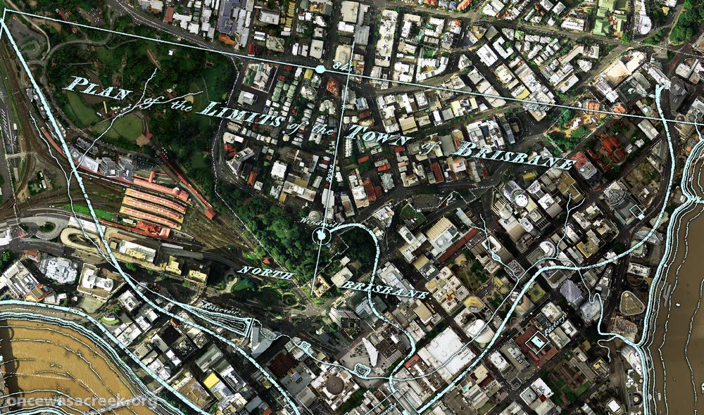
What you won’t find on that page is the image below, which shows the CBD area overlaid with a plan of Brisbane from 1843. There wasn’t much to Brisbane at that stage (it had only just ceased being a penal colony), but in addition to the few buildings and roads marked, there are some fascinating natural features on this map. For example, notice the creek that begins up in Spring Hill and flows down towards a small dam which is right on top of where the new law courts are today. This was Brisbane’s first water supply. The stream continues through a small pool at King George Square and flows to the river near Creek Street. Click here to see this part of the map in a bit more detail.

A plan of the town limits from 1843 overlaid on an aerial photo (Dept of Natural Resources and Mines) from January 2011.
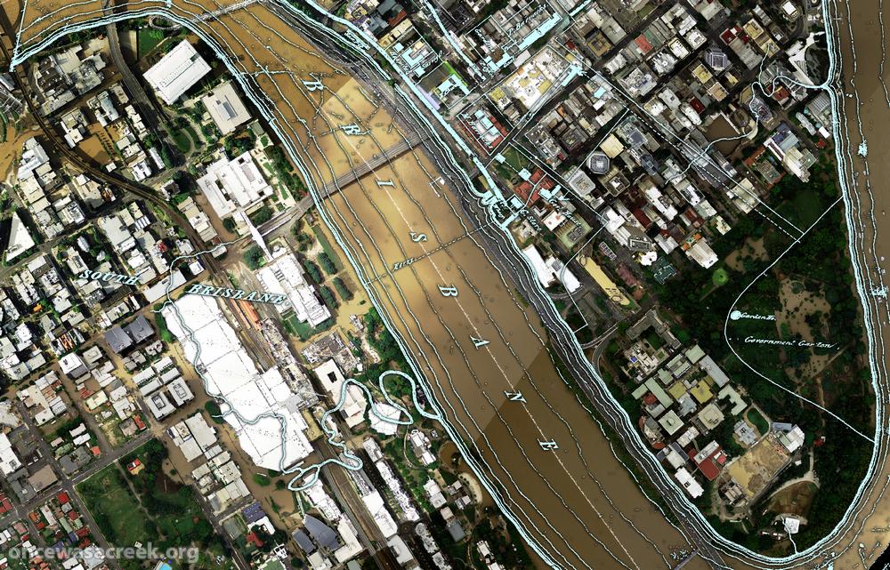
Across the river, nothing is marked in South Brisbane except for a creek that winds through the Convention Centre and Southbank Parklands (where there are now artificial streams). This enlargement shows the area in more detail.
I plan to use images like this wherever I can in future pages on this site, so stay tuned for more in the near future. What I’d really love to see is this done for as many old maps as possible, and the results made publicly available as files that can be imported into GIS software, or even via platforms like Google Maps or NearMap. Combined with historical aerial photographs as well, it would be an absolute treasure trove for professional and armchair researchers alike. So, anyone got some funds?
Pingback: Fun with Google Earth | There once was a creek . . .