The broken lands of Toowong

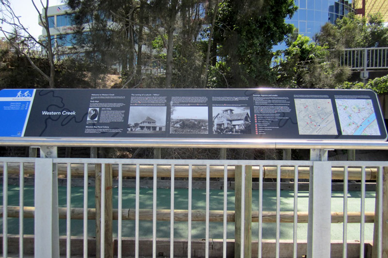
Note – many of the pictures in this post contain two images, which flip back forth when you hover your mouse over them. On a mobile device these images will switch when you touch them, and then switch back when you scroll away … if you are lucky. For best results, please view this article on a desktop or laptop.

A survey plan of the Milton area in about 1850 (B.1234.14), held by Queensland's Museum of Lands, Mapping and Surveying.

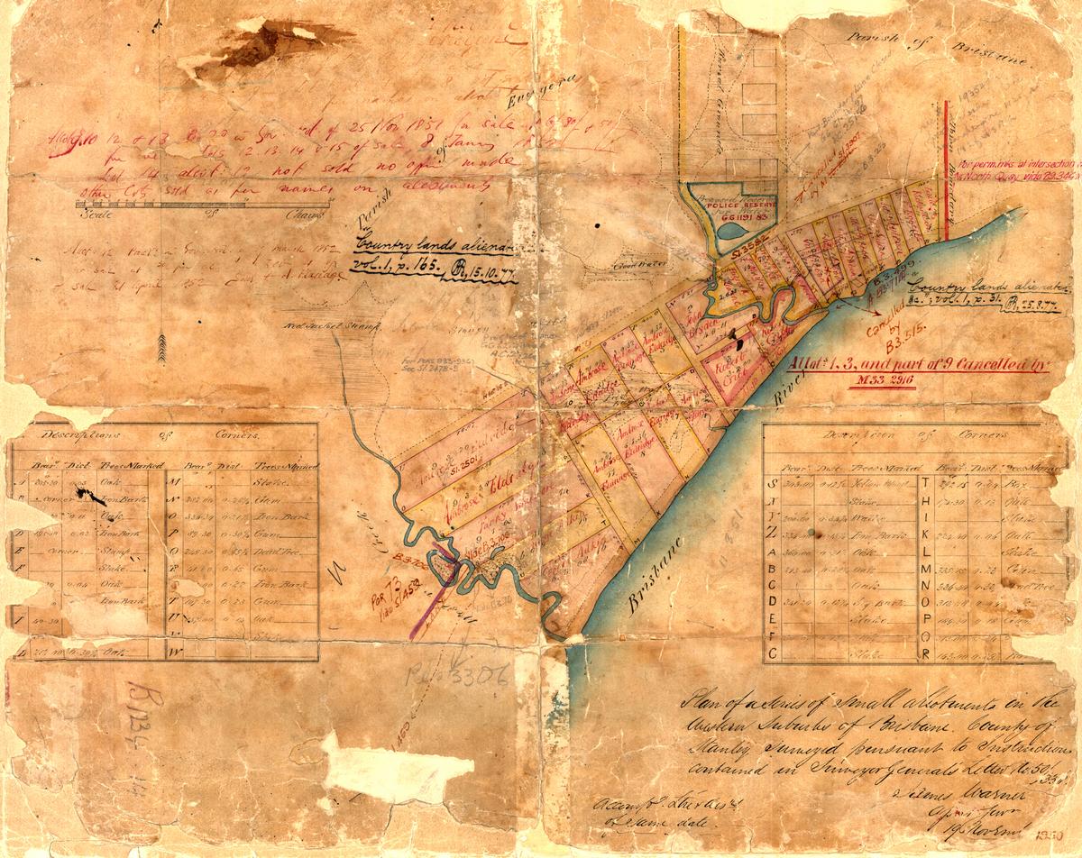
Figure 1. A survey plan of the Milton area in about 1850 (B.1234.14), held by Queensland’s Museum of Lands, Mapping and Surveying.

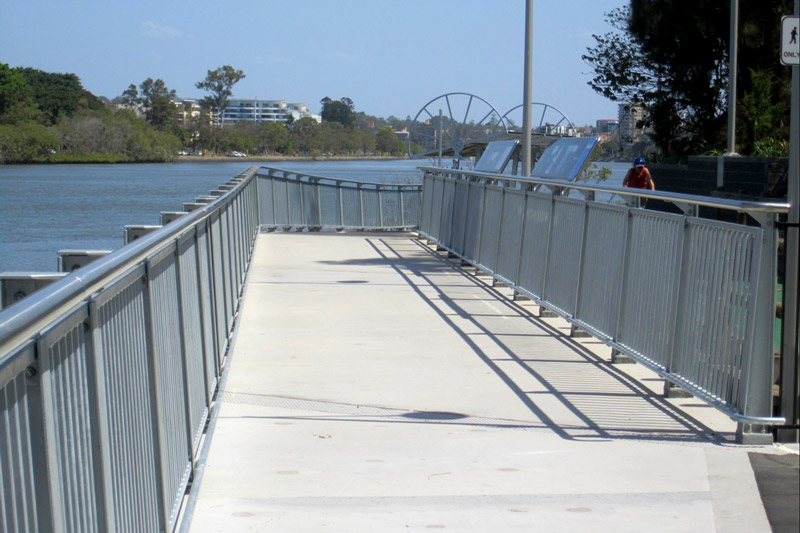
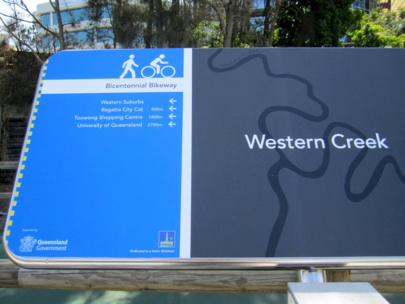
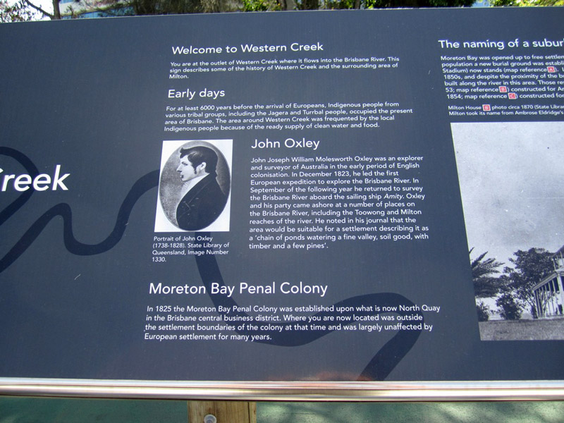
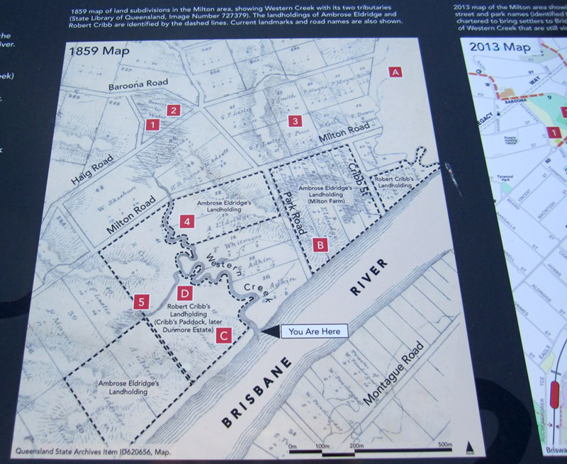
In an earlier post called The Waters of Milton, I explored a survey plan of Milton drawn in 1850 (Figure 1). Survey plans are valuable historical artifacts because they generally represent the first efforts to capture the landscape on paper. They reveal natural features that have long since vanished, such as creeks, swamps and even hills. They also provide insights into how the colonists saw the land, indicating its potential uses and specifying how it was to be divided up among its new owners.

Since writing that post, I have obtained several more digitised survey plans of the Milton Reach and Western Creek areas, thanks to the assistance of the Museum of Lands, Mapping and Surveying, which is part of the Queensland Department of Natural Resources and Mines. I look forward to featuring them all in articles in the future, but today I will explore just one of them. This particular plan carries the catalogue name of M.31.65. I have no idea what that means, but then there is a lot about these plans that I am still fuzzy about. Some of the surveying markings may as well be hieroglyphs to me, but thankfully there is much that can be gleaned even without specialist knowledge.

Unlike the Milton plan, this one depicts an area inland from the river. I’ll get to the precise area shortly, but first we need to dispense with some formalities.
Continue reading

Uncovering Langsville Creek, Part 3 – The Headwaters

This is the third in a series of posts about Langsville Creek, which was Western Creek’s upstream neighbour on the Toowong/Milton Reach. Before reading this, you may like to look at Part 1 and Part 2 of the series.

I started this series of articles about Langsville Creek as a distraction from my original mission of writing about Western Creek. My new interest soon produced another distraction when I stumbled across a dump of old bottles and cans while exploring Langsville Creek’s headwaters. When I finally finished writing about those bottles and cans a few months later, I took a holiday in Melbourne from which I returned with enough ideas about contrasting topographies to divert myself for several weeks more. Now, having gotten those ideas out of my system, I am resuming work on my first distraction so that some day in the near future I might return to my original goal.

This episode will be pick up the story in the same part of the creek as I got distracted in by those bottles and cans — its headwaters. Having mapped out Langsville Creek’s catchment in the last installment of the series, it is time now to trace where the water flows, and the logical place to start is where the water does: at the top.
Continue reading

Topography shock: Postcards from the south

There’s nothing like a change in surroundings to cast your normal environment — that familiar place you call ‘home’ — in a new light. The closer you are to something, the easier it is to forget what makes it special or distinctive.

For me, home has always been Brisbane’s western suburbs. I’ve lived in Bardon, The Gap, Toowong and, most recently, Roaslie (which nowadays is just a part of Paddington). But a few months ago I ventured outside my native habitat, moving across the river to the southside, landing in a sort of semi-rural-industrial outpost called Rocklea.

Like Rosalie, Rocklea is built on a floodplain, and to that extent probably should never have been built at all. But that’s about where the similarities end. It’s not just that you won’t see any cows or two-train semi-trailors in Rosalie, or that the local cuisine there gets more exotic than meat pies.1 For me, the most striking difference between my new environment and my old one is the topography. I’m used to living among hills. In Brisbane’s western suburbs — in Paddington, Bardon, Ashgrove and Toowong, for example — there are ridges that you can follow all the way up to Mount Coot-tha. In those parts of town, you live either on a hill or at the bottom of one.

Not so in Rocklea. If I look to the west from here, the first big hill I can see is the southern tip of the D’Aguilar Range. To the north-west it is Mount Coot-tha and the Taylor Range. The CBD lies nearly 8km to the north, but from here you can generally get city views by climbing a tree.2 To the east it’s easy riding until you hit Toohey Mountain and then Mount Gravatt. To the south, on a clear day you can see just about forever, and leading you most of the way there is the great floodplain of Oxley Creek.
Continue reading

Notes:

  1. Actually I’m being unfair. Although you wouldn’t suspect it, the pie shop at Rocklea does a good Vietnamese pork roll.
  2. If you draw a straight line from the Brisbane Markets to the CBD, you cross the river five times. Unless you cross Highgate Hill, it’s floodplain all the way.

Western Creek on display

A few months ago I moved out of Rosalie and the catchment of Western Creek. I didn’t want to leave, but such is the plight of a renter. I now am a citizen of Oxley Creek, which runs through my new neighbourhood of Rocklea.

So these days I am writing about Western Creek from a bit of a distance. I no longer get to notice the day-to-day changes that happen in the area, like the height of the pond at Norman Buchan Park, the movement of the heaps of dirt in Frew Park, and the state of the new footbridge being built along the bikeway at the mouth of Western Creek.

The new footbridge alongside the bikeway over the mouth of Western Creek (photo by Steven Cowley).

The new footbridge alongside the bikeway over the mouth of Western Creek (photo by Steven Cowley).

Luckily there are locals still keeping an eye out for me. A few days ago I learned from Steven Cowley that the footbridge has been completed. To our delight and surprise, the new bridge includes two large educational signs dedicated to the history of Western Creek and its surrounds. The first inhabitants, John Oxley’s arrival, the development of Milton, and the three creeks and bridges of the Milton Reach, are all covered. Accompanying the text are several large photographs from the State Library’s collection, and some maps illustrating the location of past and present landmarks, including Western Creek and Red Jacket Swamp.

It is rather beautifully done, and I am quite touched to see the effort that the council (and/or the state government) has made to promote the history of Western Creek and the Milton Reach. I hope that we will see more of these sorts of signs in Brisbane in the future.

(photo by Steven Cowley)

One of the signs on the new footbridge (photo by Steven Cowley)

(photo by Steven Cowley)

Welcome to Western Creek (photo by Steven Cowley)


(photo by Steven Cowley)

A map on one of the signs, showing past and present landmarks (photo by Steven Cowley)

(photo by Steven Cowley)

One of the two educational signs on the new footbridge (photo by Steven Cowley)

Bottles and cans: an adventure in suburban archaeology

Suburban secrets

Since I started chasing lost creeks, I have been drawn to spaces that most people would tend to ignore or avoid. For example, I often find myself peering into drains, which in many urbanised areas are the only waterways left. I’m sometimes tempted to venture inside them, but I rarely do.1 Out in the suburbs I’ll look twice at any gully or ditch that has not been covered over. These watercourses sometimes run through scenic parks, but more often they are tucked away in roadside scrub or remnant bush.

The bushland between Mount Coot-tha Road and Birdwood Terrace, where I stumbled upon a gully full of bottles, cans and other rubbish. View Larger Map

Exploring suburban gullies is hardly a taboo like venturing into drains, but neither is it a popular pursuit. For all of the prickles and scratches you are likely to endure, you can hardly expect to see nature at its finest.

Yet to me, there’s a certain appeal about being in a space that in all likelihood has not been looked at for many days, walked through for many weeks, or cleaned up for several years or decades. Such places remind you that there are still things to discover in an otherwise predictable suburban environment. If you keep your eyes peeled in a place like this, you never know what you might find.

I recently found myself in just such a place while exploring the headwaters of Langsville Creek. This creek exists only in fragments now, but it once flowed all the way from the Mount Coot-tha Quarry to the Brisbane River at Auchenflower. Its catchment neighbours that of Western Creek, the forgotten waterway that is the main focus of this website.

My exploration of Langsville Creek had taken me to a patch of bushland between Mount Coot-tha Road and Birdwood Terrace. I followed the Old Mount Coot-tha Road from near the entrance to the botanical gardens, and walked downhill through a clearing not far from Walter Street. Before I knew it, I was at the bottom of a damp and weedy gully.

Continue reading

Notes:

  1. Kids used to explore drains all the time, but these days it is something of a taboo — and for good reasons. Thankfully, there are still a few underground explorers around to remind us what remarkable spaces drains are. (For more examples of drain photography, see subduedmidnight.com and longexposure.net.)