
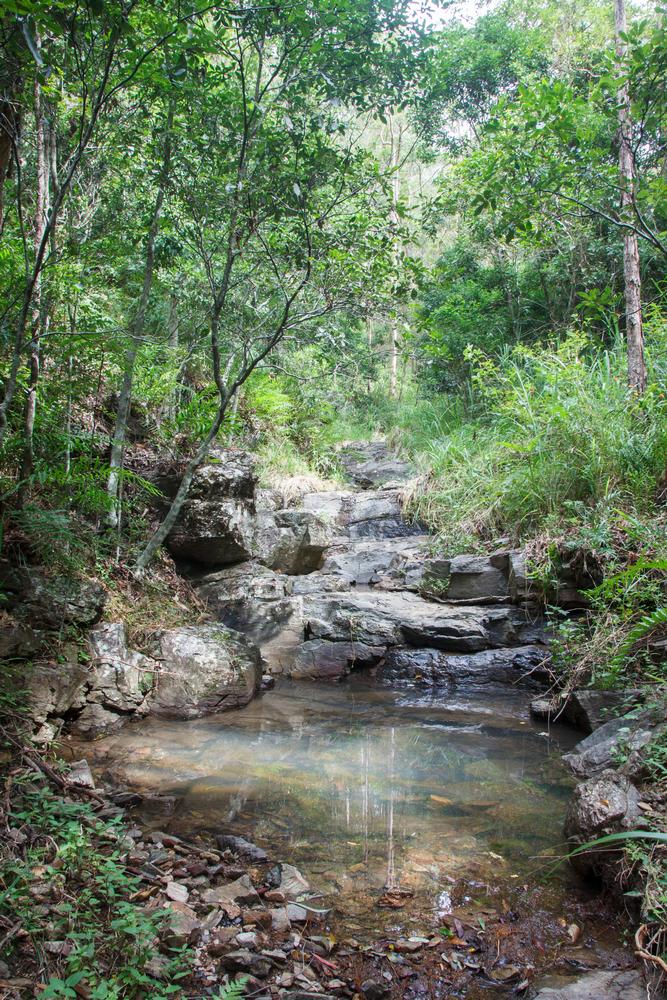
A pond in a tributary of Ithaca Creek, Mount Coot-tha. (February 2013)
This is just a quick plug for a side-project of mine that has mostly sat on the back-burner since this website was conceived. Before I started mapping out Western Creek in my imagination, I had started to map out Ithaca Creek (a real creek!) photographically. My plan was (and still is) to photograph Ithaca creek from one end to the other, documenting its journey from the headwaters in Mount Coot-tha Forest through to the much more suburban surrounds of Red Hill where it joins its bigger brother, Enoggera Creek.
Ithaca Creek is a neighbour of Western Creek, sharing a catchment boundary along the ridge of Stuartholme Road, Simpson’s Road, Macgregor Terrace and much of Latrobe Terrace.
To see the Ithaca Creek photo-map, click here and then click on the small banner at the top of the page to go to the Picasa Web Album (Google appears to be phasing out Web Albums in favour of the happy-snap functionality of Google+, so I don’t know how long this will remain functional). Beneath the small map on the right-hand side of the album there is a link which takes you to a proper map view of the album.
As well as celebrating the creek for its own sake, I’d like to think that the project is useful to anyone wanting to better understand Ithaca Creek and to track how it changes, not only along its length but also over time. Over the years, many suburban reaches of the creek have been rehabilitated, and this process is continuing through the efforts of the community-based group Save Our Waterways Now (SOWN). SOWN’s Ithaca Intact initiative aims to restore the entire seven-kilometre length of Ithaca Creek. What better companion piece than a seven-kilometre-long photo album?
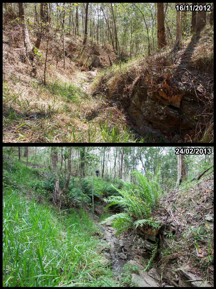
Contrasting conditions at the same location along a tributary in the headwaters of Ithaca Creek, in Mount Coot-tha forest.
Why am I talking about this now? Because I have just updated the album with some photos that I took up at the very top of the catchment near the summit of Mount Coot-tha. The photos show just one of the places where Ithaca Creek begins: a humble, dry gully that slowly but surely deepens and dampens as it descends, converging with similar gullies until it becomes a stream. This particular tributary flows into the ‘eastern’ branch of Ithaca Creek, which runs through the Slaughter Falls picnic area and past the old Freers Chip factory before joining the main stream of Ithaca Creek at the intersection of Carwoola Street and Simpsons Road.
I visited this tributary twice — first in November 2012, and again in February 2013. Without actually meaning to, I took several photos from almost the same location on each occasion, which allowed for some interesting comparisons of the stream and surrounding landscape during a wet and dry time (you can see an example on the left).
You’ll notice that there are still several large gaps in my photomap. Hopefully, this will be the year in which I plug them! But of course, the journey of Ithaca Creek will never be complete. The creek will continue to change, so there will be many more comparisons to make in the future.
Pingback: The catchments of the Crescent Reach | There once was a creek . . .
Thanks for your work on Ithaca Creek and the other catchment. I’ve been doing a little exploring of Bribane’s catchments myself, and through the Queensland Naturalists’ Club.