
I’ve expressed previously my enthusiasm for old maps. The older they are, the more they tend to reveal about the original landscape.
Until recently, the oldest map that I had found of the Milton area dated back to 1859. That map (‘Plan of Portions 203 to 257 in the Environs of Brisbane, Parish of Enoggera, County of Stanley, New South Wales) covers the area between Boundary Creek (which flowed between Cribb Street and Boomerang Street) and Toowong Creek. It depicts several features I had not seen on other maps, such as Red Jacket Swamp spilling over into Frew Park (later maps just show it covering Gregory Park) and a large lagoon between Cribb Street and Park Road.
But now I have an even older one, courtesy of Magnus, who writes the blog ‘A House in Auchenflower‘. Magnus went digging in the Queensland Museum of Lands, Mapping and Surveying and struck gold in the form of the map you see below.
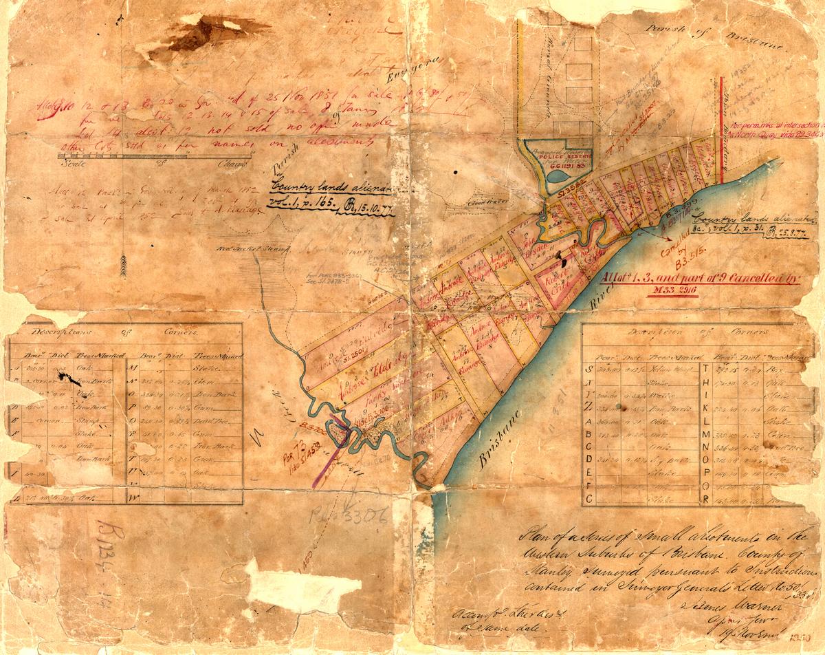
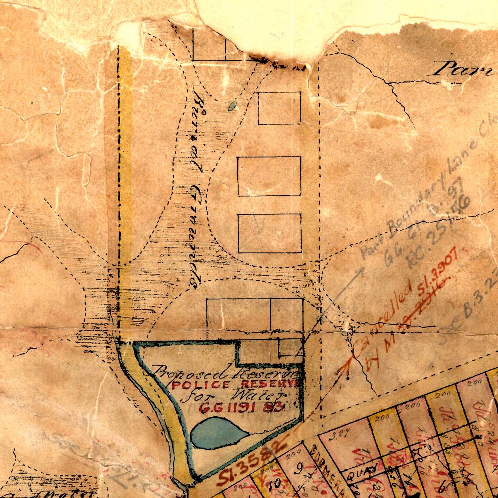
Surveyor James Warner’s plan of the Milton area in 1850, held by the Queensland Museum of Lands, Mapping and Surveying (B1234 14).
This map looks old enough to have fallen off a pirate ship. The various annotations on it show that it has been used and re-used for various purposes, and at different times, but the original drawing appears to date from 1850, when the assistant surveyor-general, James Warner, surveyed the area. Warner’s description of the map appears at the bottom-right corner:
Plan of a series of small allotments in the western suburbs of Brisbane, County of Stanley, Surveyed pursuant to instructions contained in Surveyor-General’s letter No. 50/33.
James Warner. (??), 19 November.
The original map’s edges are torn and frayed, and the corner where Warner would have written the year is missing. Thankfully, someone (perhaps an archivist, or a later user of the map) has re-written it on the underlying paper, which appears to be all that is holding the original map together. This is probably the oldest surviving map of the Milton area, and possibly the earliest that was ever drawn.
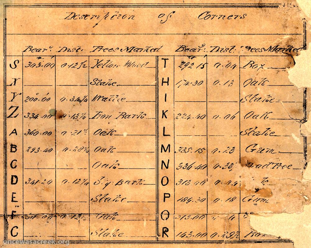
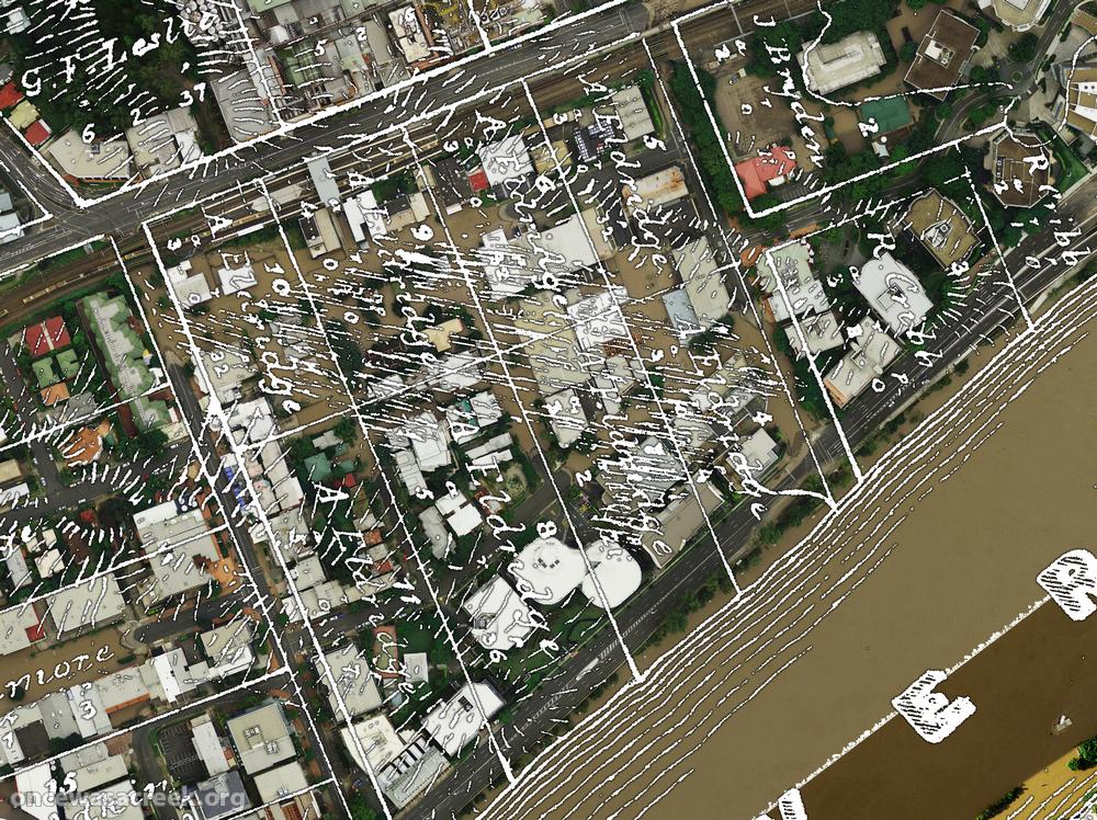
Table describing the corners of lots on a map of Milton from 1850. (Image enhanced to show text more clearly.)
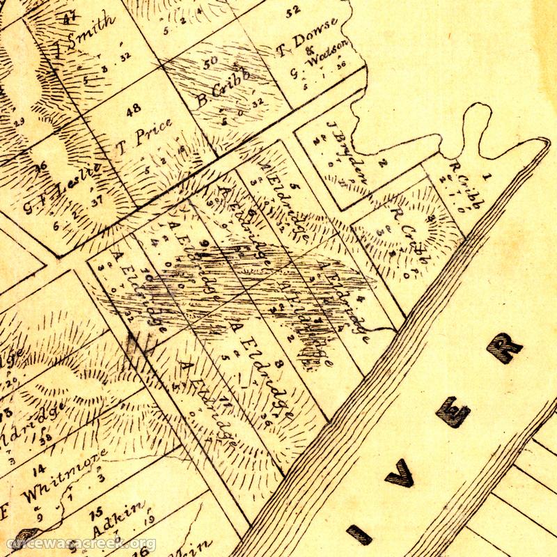
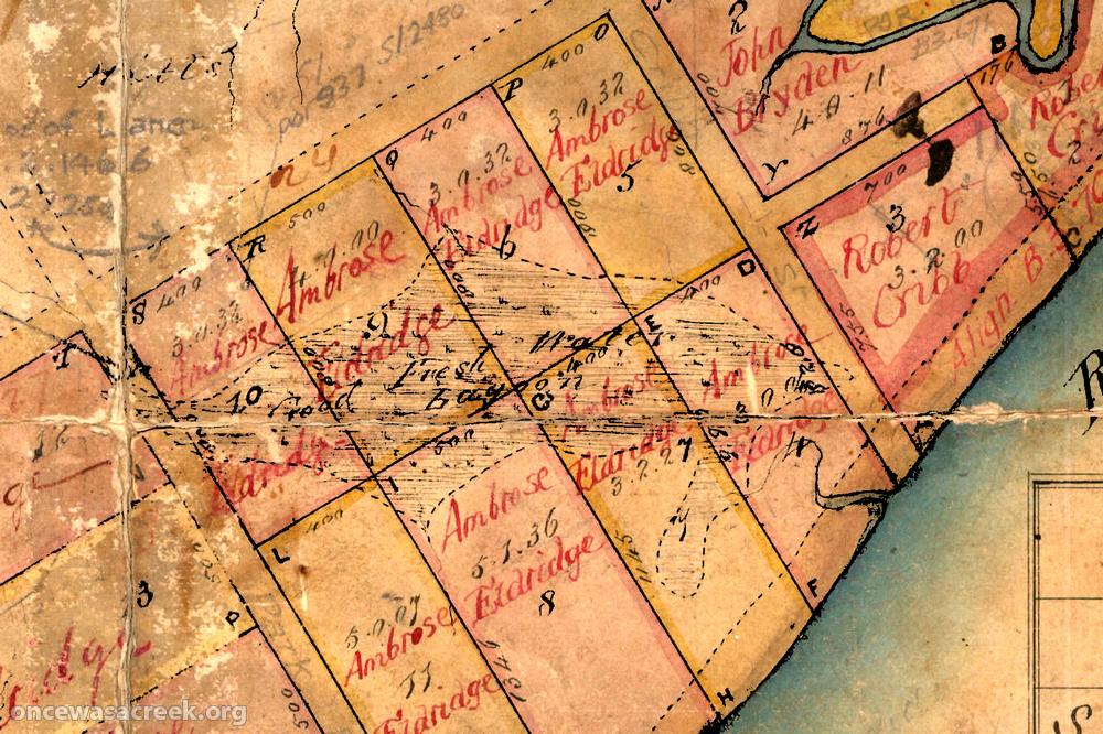
There are some fascinating things on this map. Take the way the corners of the lots are described, for example. Each corner is coded with a letter, which is associated via two tables with a bearing, distance, and the type of tree marked by the surveyor. At the corner of Park Road and Milton Road was an iron bark. At the corner of Cribb and Little Cribb Streets, a wattle. Numerous annotations to the original map, some faded beyond legibility, show allotments being cancelled or changing hands. Among the owners of the allotments are some familiar names, like Robert Cribb (an English migrant brought to the Colony by John Dunmore Lang) and Ambrose Eldridge (the first owner of Milton Farm and Milton House).
But what I find most exciting about this map is what it reveals about the creeks and water bodies in the area. These features are shown in more detail here than I have seen anywhere else, presumably because they were still intact when the map was made, and because knowledge about them would have been important to prospective buyers and users of the land. The two creeks on the map are Boundary Creek and Western Creek. Both of these creeks can be seen on later maps (see here and here for examples), but not in the level of detail that we find here.
The Cemetery Swamp
The swampy area of Boundary Creek, Milton, as depicted in 1850. The area was first used as a cemetery, and is now Suncorp Stadium.
Let’s start with the Boundary Creek system. Its meandering path between the river and Milton Road is familiar from several other maps, but this map also shows the extent of the burial grounds swamp, which ran through what is now Suncorp Stadium. The rectangles adjacent to the swamp mark out the various denominational sections of the cemetery. Running from bottom to top on the picture to the right are the Anglican, Presbyterian, Roman Catholic, Jewish, and (half-torn at the edge of the page) Congregationalist and Wesleyan sections. Just beyond the limits of the map was the Baptist section.1 The relative size of these plots presumably says something about the composition of Brisbane’s population at the time, and/or the relative influence of the different churches.
The burial ground swamp (now Suncorp Stadium) flowing into Boundary Creek, as depicted on a map from 1850.
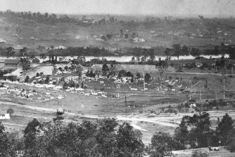
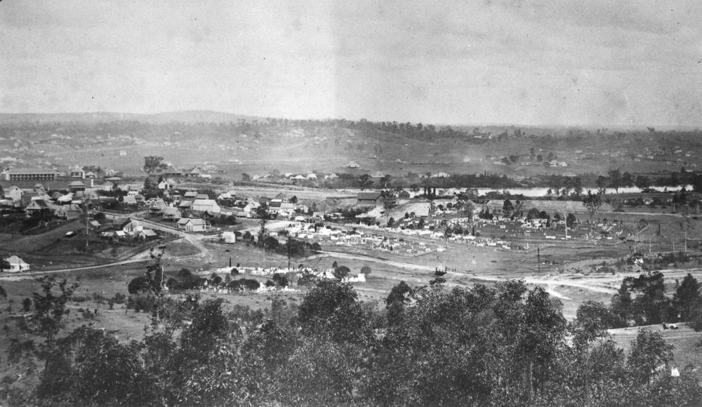
The sections of the cemetery can be seen in the photograph below, which was taken in 1870.2 Although the landscape is hardly recognisable compared to the one we know today, there are a few identifying features. At the far left of the photo is the Victoria Barracks, and the road running from right to left Must be Given Terrace going into Caxton Street. A small bridge can be seen where the road crosses the swamp — or what was left of it by that time. If you look really hard you can see part of the swamp (really more of a boggy paddock and a few dead trees) to the right of the bridge.
The North Brisbane Burial Grounds, Milton, 1870.
If you think a swamp is a silly place for a cemetery, you’d be right. By the 1860s, the population of Petrie Terrace and Milton was burgeoning, and there was a push to close the burial grounds on account of the hazards posed by over-crowded and waterlogged graves. New cemeteries were established in Brisbane in the 1870s, and the Milton burial grounds were formally closed in 1875.3
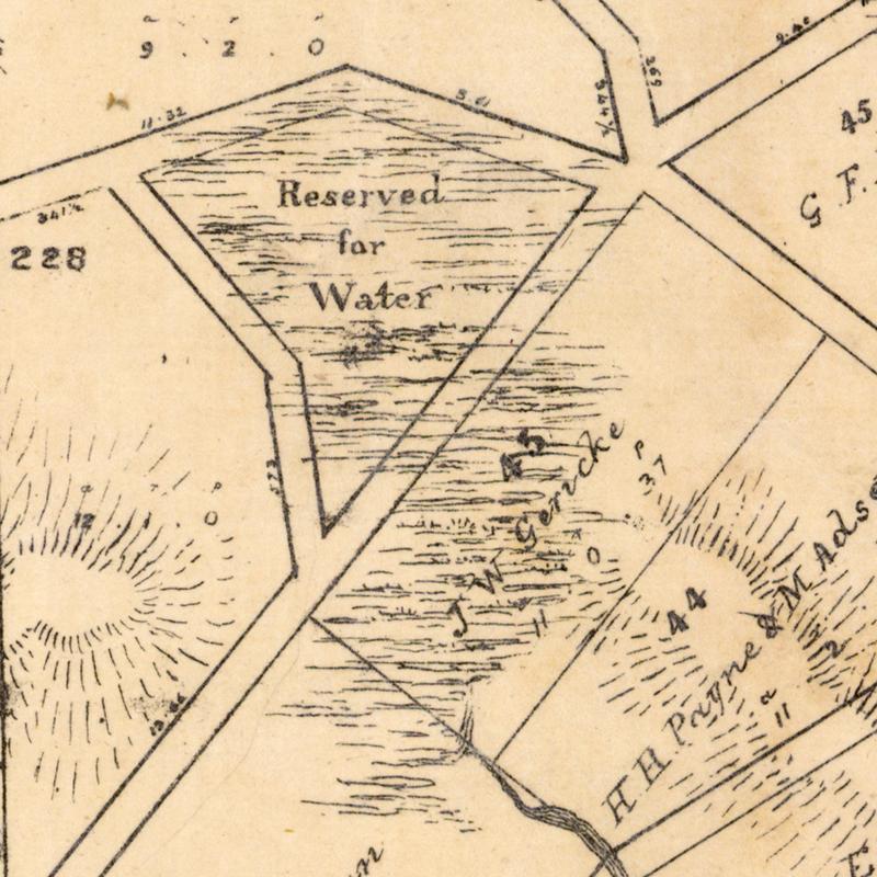
The Milton Water Reserve
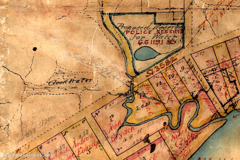
Boundary Creek (Milton), as depicted in 1850.
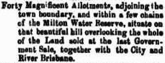
As if building a cemetery in a swamp in a future residential area is not bad enough, the map shows something just downstream that calls the ‘urban planning’ (or lack thereof) of the day into question even further. Between the cemetery and Milton Road is a block marked “Proposed Reserve for Water”, and in this block is a large round pond. I’ve seen references in old real estate advertisements to a ‘Milton Water Reserve’, but until now have not seen any other clear evidence of one existing (though the outline of the same pond is also visible on at least one other map). Surely, this must be it.
The pond appears to be built along a tributary of Boundary Creek that was dammed just before it reached the main stream. I don’t know for how long the reserve was used, but if it was still intact in 1870 then it should be visible in the photograph above. I may be letting my imagination get carried away here, but if you look closely at the far right of the picture, you can just see an oval-shaped outline that could be the rim of a raised section of earth (the ‘dam wall’ of the reserve). In the centre of the oval is a dark patch that could be the dried-up bottom of the reserve (and given how dry the rest of the swamp/creek looks, it may well have been a dry period). By my reckoning, it’s in about the right spot to be the water reserve, though I wouldn’t put any money on it without some more conclusive evidence.
Clipping from The Courier, 17 October 1862, page 3.
An annotation on the original map shows that this block was later designated as a police reserve. McKellar’s 1895 map shows this spot as a reserve for ‘Riding School, Defence Force”. Presumably, this land served for a time as an extension of the nearby Victoria Barracks after the water reserve was abandoned.
The XXXX Creek and the Officeworks Swamp
Just across Milton Road, the stream flowing from the cemetery meets up with a stream that begins in the slopes of what is now the carpark of the XXXX brewery. This stream fans out into a large swamp or waterhole covering much of what is now Officeworks, Kennards Self Storage and Black Street. The swamp is labelled as ‘Good Water’. Given the small and steep area that the XXXX Creek drained, I don’t think it would have flowed very reliably. The ‘good water’ in the Officeworks Pond was therefore most likely an expression of the underground water-table — or in other words, a spring.
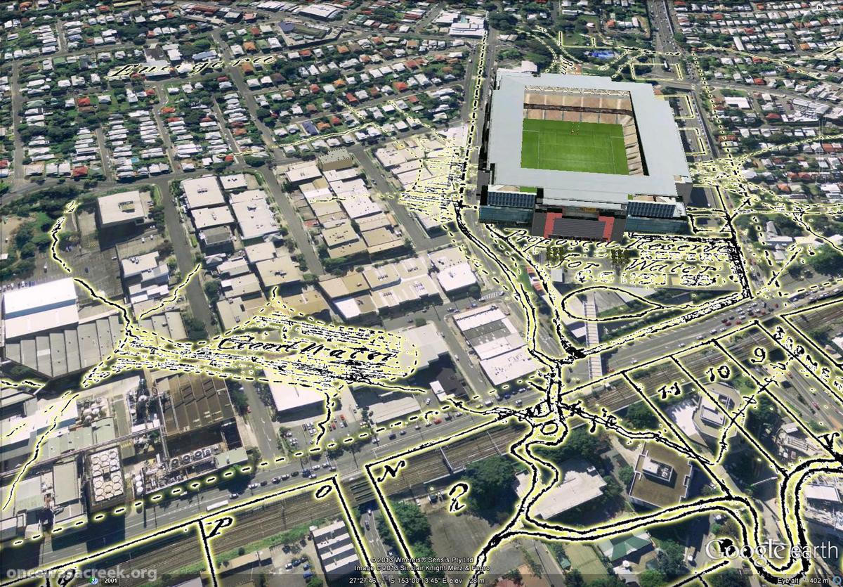
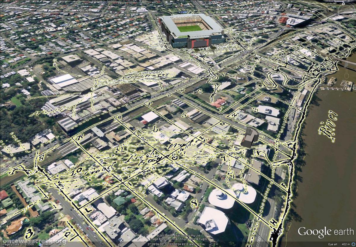
The area around Suncorp Stadium, Milton, as depicted on a map from 1850.
I’ve come across other references to springs in this area. For example, in 1864 Johann Heussler (the first owner of Fernberg, or Government House) wrote to the Lands Department asking that a water reserve be made at a spring located at what is now the intersection of Fernberg Road and Ellena Street. Augustus Charles Gregory, who was at that time the Queensland Surveyor-General, wrote in his reply that there was already a spring that could be made available somewhere in the vicinity of what is now Caxton Street. Might he have been referring to the Officeworks Swamp?
The Cribb Street Lagoon
A lagoon between Cribb Street and Park Road, Mitlon, as depicted in 1850.
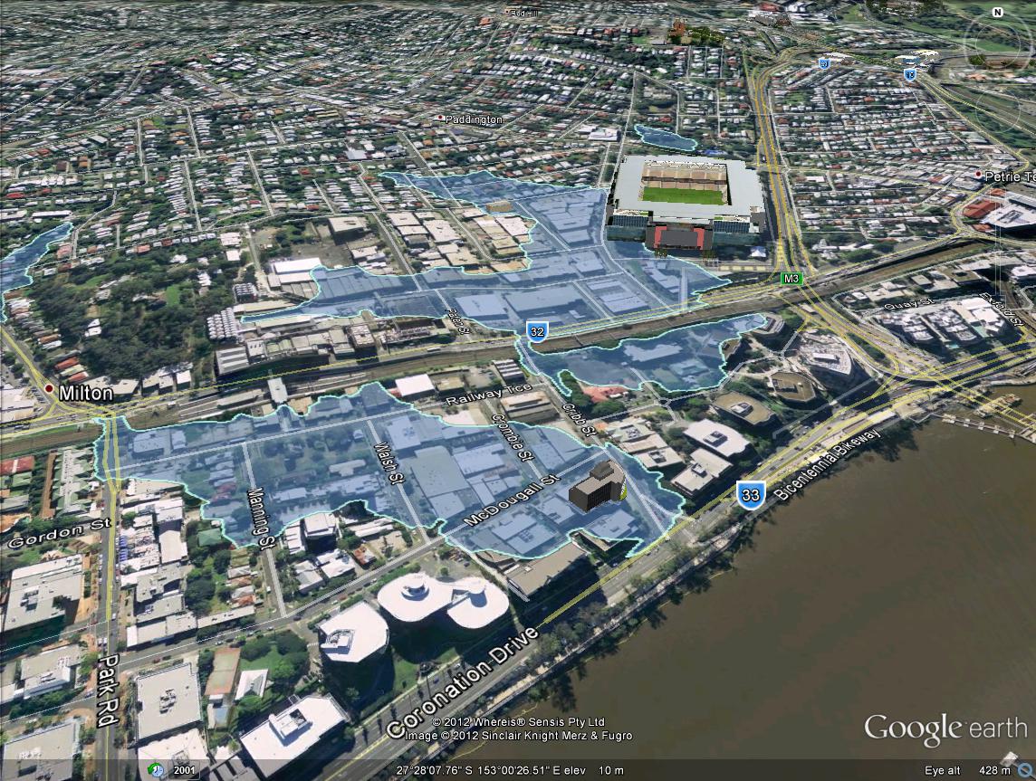
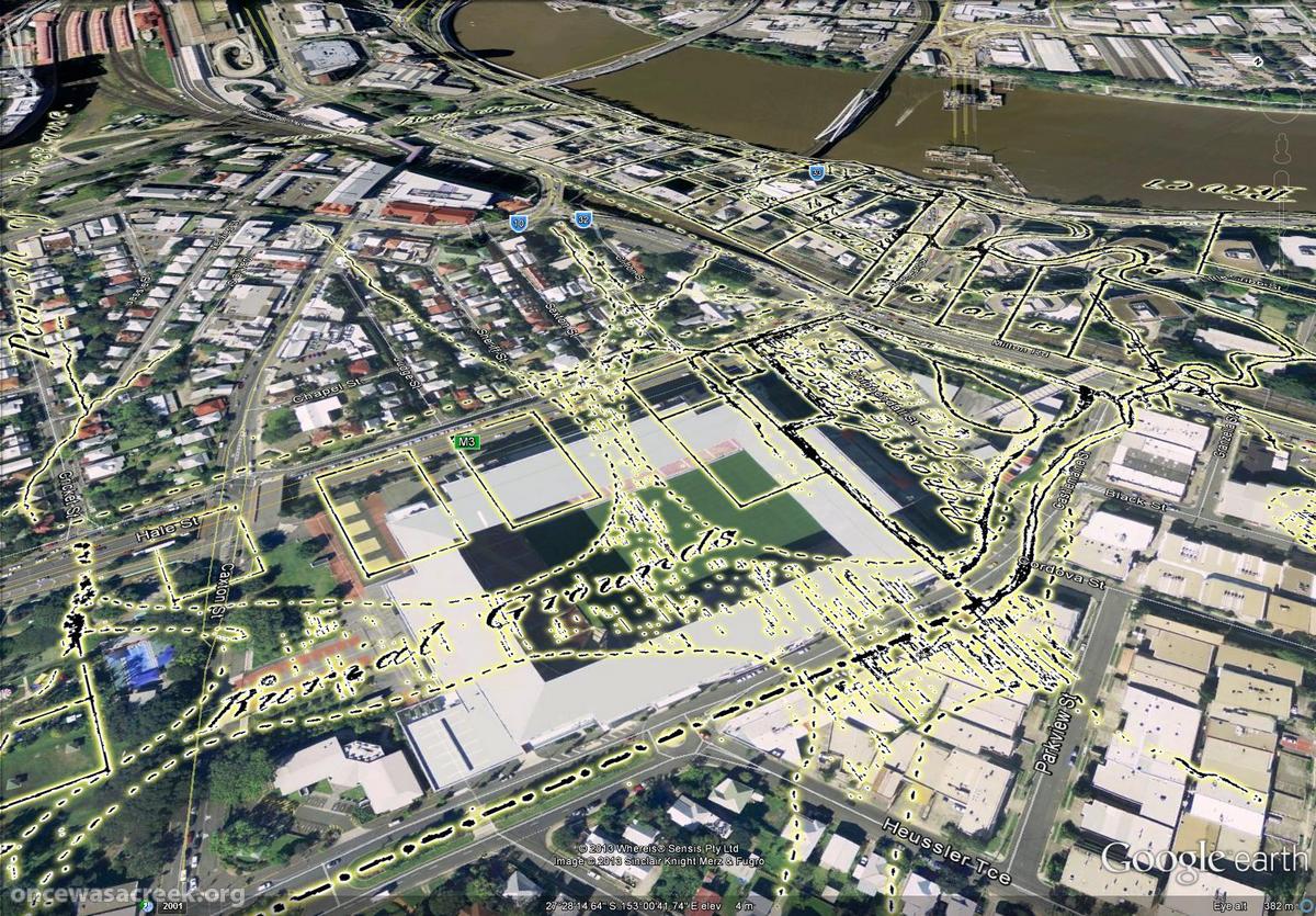
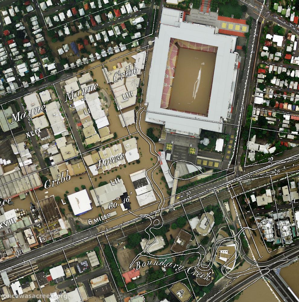
The 2011 floodline over the drainage systems of Cribb Street (foreground) and Castlemaine Street (Boundary Creek, near the stadium).
Between the Boundary Creek and Western Creek catchments, there is one other small drainage system. It falls within the block bounded by Cribb Street, Milton Road, Park Road and the river. The 2011 floodline (see above) marks out this system pretty well. (You may also notice how closely the floodline overlaps with Boundary Creek and the Officeworks Swamp.)
On the 1850 map, almost the exact same area is marked as a ‘Good Fresh Water Lagoon’. This lagoon is depicted on one other map that I know of, and is also mentioned in an account of the area from 1872, which describes “a fine lagoon running diagonally across the property”, adding that “frequently black swans and an odd pelican or two made it a place of call”.4
The lagoon that once stretched between Cribb Street and Park road, as depicted on a map from 1850.
The fact that the water in this lagoon was fresh is interesting. The lagoon was joined so closely to the river that its water must have been of a similar quality. If this lagoon existed today, the water would be brackish due to the tidal influence of the river. But in 1850, before the river was dredged and the bar at its mouth removed, the tides did not reach as far upstream as they do today. How far they reached, and how they affected the quality of the river at the Milton Reach, are questions that I still have not managed to answer. Until now, I had assumed that this lagoon would have always been brackish rather than fresh, but obviously that assumption was wrong.
There is a rather funny story behind the demise of this lagoon. It is revealed in correspondence from the Toowong Shire Council to the Central Board of Health published in the pages of The Brisbane Courier in June 1894. Responding to the board’s complaint about poor drainage in the Milton Estate, the council advised:
. . . the portion of the Milton Estate in which the nuisance is stated to exist was originally a lagoon, but during an exceptionally dry summer in 1886 was subdivided and sold in small allotments without any regard to arrangements for drainage, such subdivision and sale being a matter beyond the control of the shire council. As a necessary result as soon as wet weather set in the allotments were flooded.5
And thus another flood-prone block of land was developed. Are we learning yet?
The Western frontier
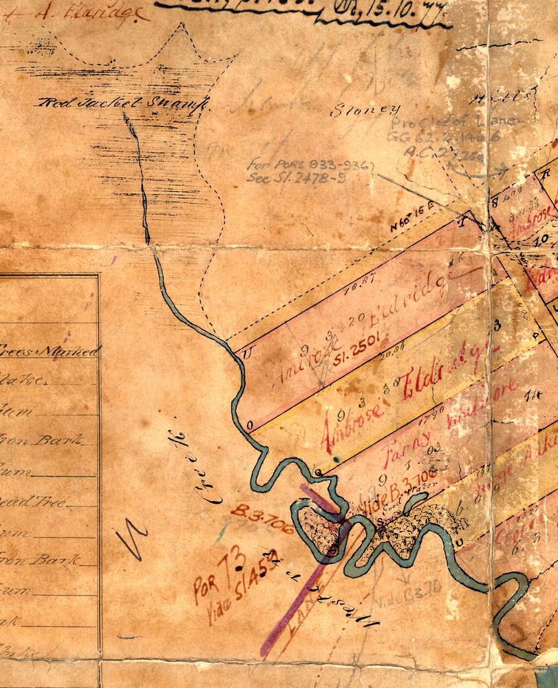
Western Creek and Red Jacket Swamp, as depicted in 1850.
Western Creek marks out the limits of this map, except for the annotation of an unnamed lane where Kilroe Street is today. The shape of the stream is more or less how it appears on later maps, but it is adorned with some interesting details.
As per usual, Red Jacket Swamp is as far upstream as the creek is depicted, but here it is drawn with more shape and definition than I have seen anywhere else. Unlike in later maps where the hard edges of roads and allotments distort its natural shape, here it stands alone, with its curved outline revealing the original contours of the landscape. This is as close as we are likely to get to a depiction of the original Red Jacket Swamp.
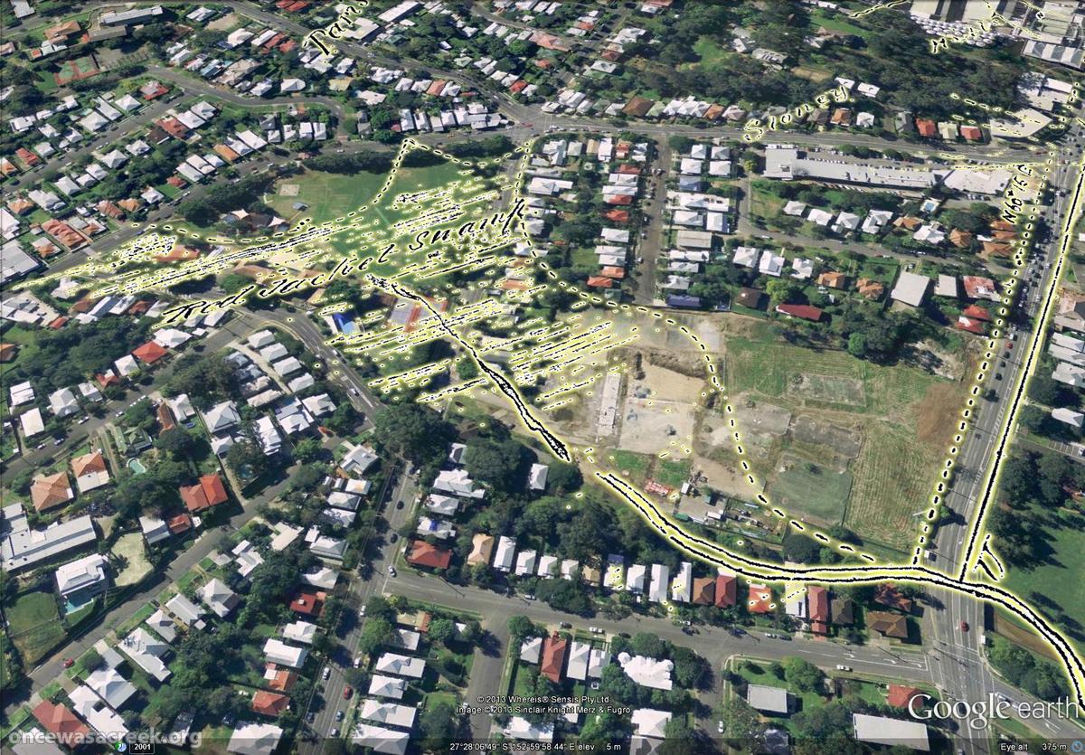
Red Jacket Swamp (now Gregory Park and Frew Park), as depicted in 1850.
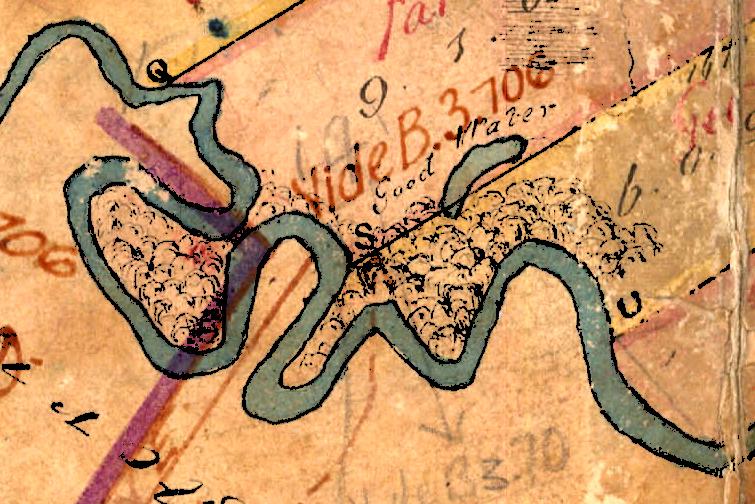
Part of Western Creek near Kilroe Street, Milton, as depicted in 1850.
Further downstream, in what is now the commercial part of Milton, there are markings indicating that this part of the creek was swampy as well. It’s hard to picture, but the dusty car yard of the repair shop on Kilroe Street must have once been marshlands teeming with life.
Close by, there is a small pond that appears to be an orphaned part of the main stream. Like the other water bodies on the map, it is marked ‘Good Water’. As with the Cribb Street Lagoon, I had long assumed that this part of the river, and thus the lower part of the creek, must have been unfit for drinking even before we started modifying the river. Why else would John Oxley have been excited about finding finding fresh water here in 1824? Clearly, there are nuances to that story, and to this landscape, that I am yet to appreciate. All in good time!
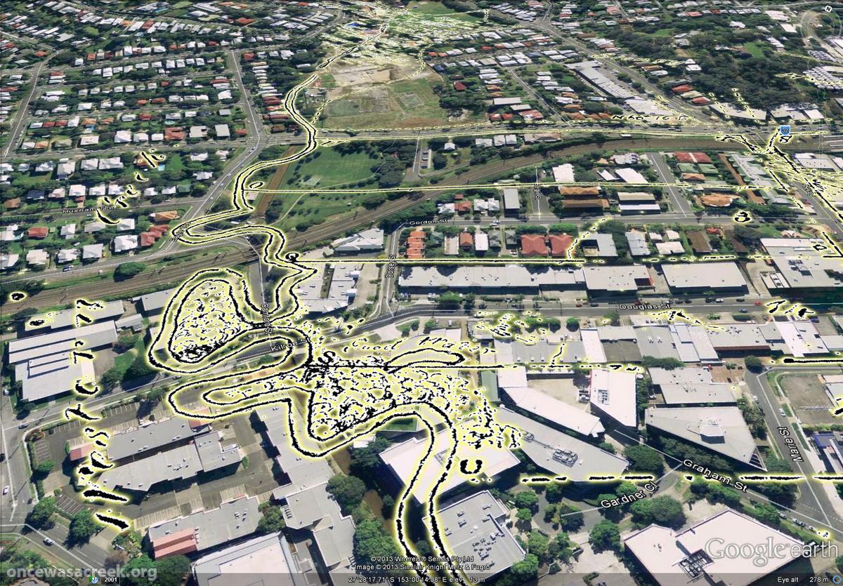
Western Creek as depicted on a map from 1850. In the foreground is a pond marked ‘good water’, and in the distance is Red Jacket Swamp.
Notes:
- Kevin Rains and Jonathan Pragnell (2002), ‘Background to the University of Queensland Archaeological Services Unit’s Lang Park Salvage Excavations: History, Significance Assessment and Methods’, Queensland Archaeological Research, vol 13, pp 21-30. Accessed online, 16 February 2013. Thanks to Steven Cowley for pointing me to this article. ↩
- I’ve taken this photo from the article cited above by Kevin Rains and Jonathan Pragnell. It is attributed to the John Oxley Library, but I believe this to be an error because the John Oxley Library does not appear to have it. Any information about the source of this photo would be greatly appreciated! ↩
- Ibid. ↩
- John O Neill Brenan (1972), “A few rough remeniscences of Early Toowong, etc.”, cited in John Pearn (1997), Auchenflower – the suburb and the name: A history of Auchenflower, Brisbane, Australia, Amphion Press: Herston, Qld, p52. ↩
- The Brisbane Courier, 14 June 1894, p2. ↩
Plan of a series of small allotments …… But I can’t read the other missing bit … Assis? Surveyor? (abbreviated?)
Fantastic Angus – your research is brilliant.
‘series’ — that works. ‘Assis Surveyor’ was my first thought too, but could that second letter really be an ‘s’?
Pingback: The broken lands of Toowong | There once was a creek . . .
great work. My great great grandfather Henry Edward (Capt) Ellice 19th Hussars is interred at the old cemetery and as far as we know is still there. He was not moved to Toowong and his name is on the cemetery records. His son my g grandfather immigrated to Perth from England and presumable had no idea where his father was buried. I’ve always wondered where his grave maybe and particularly whether it is under the current playing surface, your overlay map gives the best indication I have seen and indeed there is a good chance he is under the playing surface. I’m assuming he was in the Anglican section but who really knows.
Hi Angus – I’ve been working on the Toowong Council Minutes 1879-1825 and came across Bennett’s bridge (aka Milton bridge) and found that in 1886 it was dismantled to make room for culverts. Mr Bennett lived along the Boundary street (Boomerang street) in his home “Cadbury” which was later demolished to make room for the Tramways workshop.
In March 1881 Council had a large clean out of the creek as it was cited as a major health hazard. They also had to get the Chinese gardeners to clean out their area. Thanks for all your hard work on this matter