Today’s lesson: always go back to the source.
One of the intriguing leads that I came across when I started my research was a letter to the Department of Land and Works from J.C. Heussler, the first owner of Fernberg (Government House). Well, actually I didn’t come across the letter. Rather, I found a quotation of it in Allan Miles’ History of Rosalie1. Miles had found it in the State Archives, probably after many hours spent patiently perusing the correspondence files of various old departments. As Miles explained, the letter accompanied a petition from local land owners, residents and farmers, requesting the improvement of a road (what is now Caxton Street and Given Terrace) through the cemetery reserve (the swamp where Suncorp Stadium is today), and the formation of a water reserve “at the Red Jacket Swamp . . . where there is a spring of the purest water upon which the inhabitants (some hundreds, and daily increasing) have been entirely dependent during the late drought”.

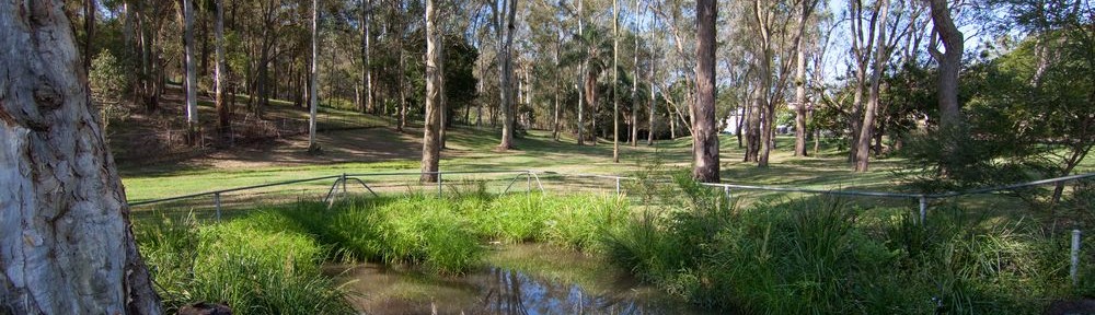
The pond on the Fernberg grounds (Governor’s House), October 2011
Miles remarked that “some of the details referred to on the map are not legible”, which I took to mean that the location of the proposed water reserve probably was no longer visible. I always intended to check it out for myself, but life, and the rest of the website, moved on. Given that Heussler was the author of the letter, and the fact that even today there is a permanent pond where Western Creek once crossed the Fernberg grounds, I surmised that the spring in question might have been on the same property, perhaps even the very same pond. I even based a substantial part of my essay about John Oxley and the chain of ponds on this assumption.
Today, I finally got out to the State Archives to see the letter, and the accompanying petition and map, for myself. With a little bit of help, I found actually it. The marking of the road described in the petition was, as Miles suggested, no longer legible. But the marking of the proposed water reserve was still there, clear as day. It is the small, dark square adjoining the road in the middle-left of the page.

Map accompanying a petition sent in 1864 to the Department of Lands and Works (Queensland State Archives Item ID22054, Corresponcence – inwards)
The creek at the bottom-right of the map is Boundary Creek, and the block marked “General Cemetery” takes in what is now Suncorp Stadium and Neal Macrossan Park. To get a better feel for how the features on this map lined up with the current landscape, I superimposed it on a screenshot from Google Maps:

The map accompanying the 1864 petition overlaid with Google Maps. The proposed water reserve can be seen on Fernberg Road, in the middle-left of the picture.
The proposed water reserve is marked on the property of W. Moore at what is now the intersection of Fernberg Road and Ellena Street. This location is not even close to the pond at Fernberg, which lies about half a kilometre to the south-west. It is, however, very close to the approximate route of the main stream of Western Creek, which is the thick blue line on the map. And it also aligns exactly with one of the tributary streams.
So, the pond is not the spring. But the pond could still be a spring. And the presence of a spring on Fernberg Road is wholly consistent with my hunch that the ‘chain of ponds’ that John Oxley found when he explored this area in 1824 was somewhere between Gregory Park and Norman Buchan Park. This spring could have fed ponds all the way along the creek between Fernberg Road and Gregory Park. And who’s to say there weren’t other springs as well? Indeed, this possibility is hinted at in the reply to Heussler’s letter, written by none other than Augustus Charles Gregory, who was at that time the Queensland Surveyor-General. Gregory also happened to be living just across the valley from Heussler, having taken up residence in Rainworth House on what is now Barton Street. In raising the question whether Mr Moore might seek compensation for the use of the spring on his land, Gregory stated:
I cannot however recommend that any large sum should be paid for the land as there is a spring within the limits of the road which might be cleared and made available if requisite.
I have the honor to be, Sir, Your obedient servant.
A.C. Gregory
And thus the letter ends. Which spring and which road Gregory is referring to is unclear. Could it have been another of the links in Oxley’s chain of ponds? Or was it perhaps somewhere in the Boundary Creek catchment? Either way, it reinforces the picture of Milton and Rosalie in pre-European times as a watery wonderland of streams, swamps and waterholes.
Of course, this newfound knowledge also means that I have to update some of my previous writings about Red Jacket Swamp and John Oxley’s chain of ponds. Remember: always go back to the source!
Notes:
- Allan Miles (1978), A History of Rosalie, Eastwood, NSW ↩
Impressive sleuthing Sherlock. How did you manage the overlay – just crig it to fit based on the boundaries and roads?
Photoshop! I basically put one layer on top of the other and stretched it in various directions until (most of) the roads etc lined up.
Pingback: Let’s talk about the weather | There once was a creek . . .
As a child of the fifties growing up on Baroona Road opposite Gregory Park, my brothers, lots of other local kids and I roamed up and down these waterways from Rainworth through to the Brisbane River. We were small enough to be able to transverse the storm water drain pipes from the back of Government house all the way down to Gregory Park. This involved keeping an eye on council works when they would have a two to three man team clearing the build up of gravel in the larger pipes under Gregory Park.
They employed one man on a windlass over a manhole with two working below filling buckets and attaching them to a lowered rope. This work could go on for a couple of weeks and they would often leave everything in place and the manhole open. Must mention here that the accumulated gravel was a godsend for most of the dads keen on doing some cementing around the house and kids and dads could be seen all weekend helping themselves to this free building material using whatever method of removing it, wheelbarrows, trailers and utes most common. My brothers and I must have moved a few cubic metres with just a small homemade trolly originally made for moving mowing grass clippings. Anyhow the open manhole was way too inviting after school hours and on weekends for adventurous boys. With a few candles, the odd torch, matches and newspaper, we would set off exploring up and down these tunnels/drainpipes and try to make it out to the other end either upstream or downstream. Running out of light was a big risk and often it was down to everyone of the gang looking in the direction we were heading with eyes adjusting to the dark and a kid at the back lighting a match so we could all see ahead and just feeling our way along when the match ran out until we would regroup and repeat the process, everyone said they would bring more matches, candles or torches but we almost always ended up in the dark. I didn’t mention the bats but that is another tale.