
A few months ago I moved out of Rosalie and the catchment of Western Creek. I didn’t want to leave, but such is the plight of a renter. I now am a citizen of Oxley Creek, which runs through my new neighbourhood of Rocklea.
So these days I am writing about Western Creek from a bit of a distance. I no longer get to notice the day-to-day changes that happen in the area, like the height of the pond at Norman Buchan Park, the movement of the heaps of dirt in Frew Park, and the state of the new footbridge being built along the bikeway at the mouth of Western Creek.
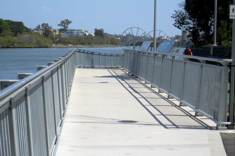
The new footbridge alongside the bikeway over the mouth of Western Creek (photo by Steven Cowley).
Luckily there are locals still keeping an eye out for me. A few days ago I learned from Steven Cowley that the footbridge has been completed. To our delight and surprise, the new bridge includes two large educational signs dedicated to the history of Western Creek and its surrounds. The first inhabitants, John Oxley’s arrival, the development of Milton, and the three creeks and bridges of the Milton Reach, are all covered. Accompanying the text are several large photographs from the State Library’s collection, and some maps illustrating the location of past and present landmarks, including Western Creek and Red Jacket Swamp.
It is rather beautifully done, and I am quite touched to see the effort that the council (and/or the state government) has made to promote the history of Western Creek and the Milton Reach. I hope that we will see more of these sorts of signs in Brisbane in the future.
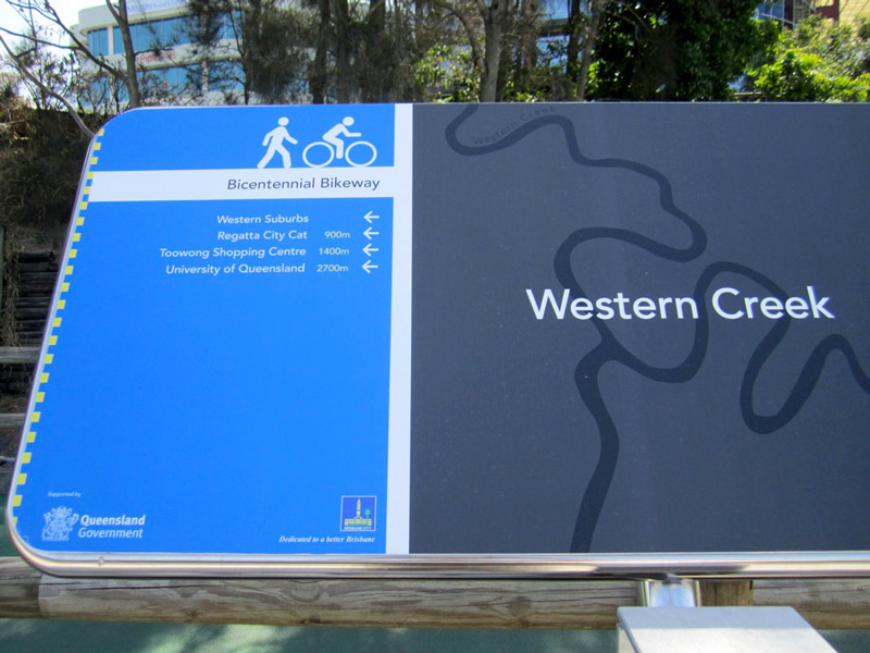
One of the signs on the new footbridge (photo by Steven Cowley)
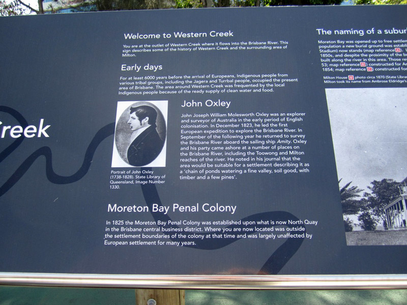
Welcome to Western Creek (photo by Steven Cowley)
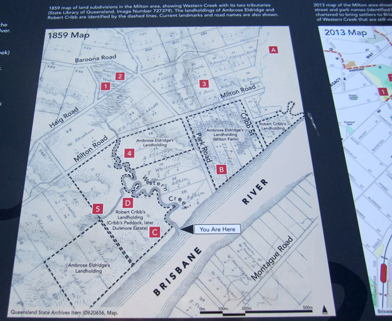
A map on one of the signs, showing past and present landmarks (photo by Steven Cowley)
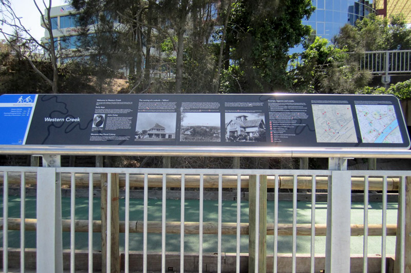
One of the two educational signs on the new footbridge (photo by Steven Cowley)
Hi Angus
That’s great to see the BCC on the job there. I would not be surprised to learn that this was inspired by your superb work (and that they used your site for research). Has the Lord Mayor ‘liked’ your site recently?
Regards Peter
If my work has influenced the council’s efforts here then that would be very satisfying. But I’m also happy to note that the signs include information that I have not yet researched. They have made a proper fist of it, even though nobody probably would have noticed if they’d done nothing at all.
And no, I haven’t heard from the Lord Mayor recently!
Thanks for sharing your wonderful information …it is so interesting to look at this area in such detail. Maps are so precious as the contours and land use keep changing. Hard to get ones head around but your research has really helped
I too was thrilled by the historical markers on he bike way….great job BCC (even a photo of my great great grandfathers Dunmore House- quite touching)
Pingback: A floodgate for Western Creek | There once was a creek . . .