
Plan of Brisbane Waterworks (1864)
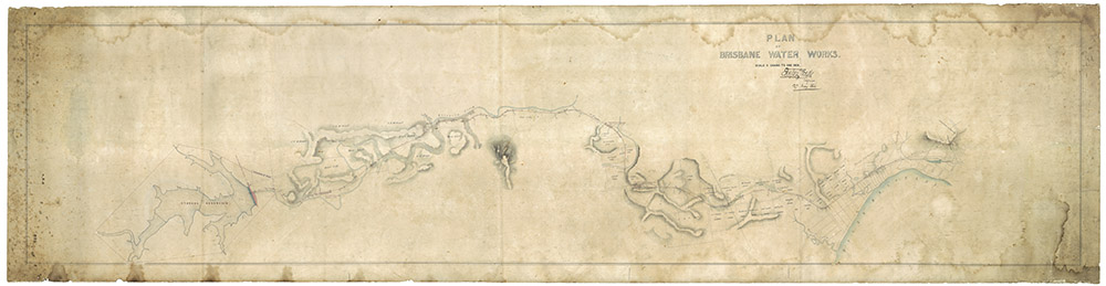
A map from 1864 showing the route of the water pipeline Enoggera Reservoir to Brisbane City. The original is held by the Brisbane City Archives.
This map shows the water supply pipeline route from Enoggera Reservoir and Brisbane City, and is available from the Brisbane City Council Archives. I’m not sure if this was the final route or the route that was planned before difficulties were encountered when building the tunnel across the boundary of the Ithaca Creek and Western Creek catchments.
It is the only map that I have found that depicts the path of Western Creek through what is now Norman Buchan Park, the Governor’s grounds and Rosalie Village. I’ve used this map previously in The lost creeks rise again and John Oxley and the chain of ponds.
Google Earth portal
You can explore a specially prepared version of this map in the Google Earth window below. (You may need to zoom in a bit first to see the map clearly.)
Google Earth data
You can explore this map in the standalone version of Google Earth by opening (or downloading and then opening) this file.
Last modified: April 13, 2013
Hi Angus — these Council Minutes from 1863 also describe the proposed route (and other matters) — however, I don’t know if they ultimately followed it
http://trove.nla.gov.au/ndp/del/article/3161146
Regards
Peter
d1ez3a
d17orb
lmy02j
gw8818
wm1q78
7c6bpz
1wt7kf
218f58
bfgxua
hx6p6k